

Strong Storms Continue Across Central Alabama
SCATTERED STRONG STORMS: Radar shows scattered, strong thunderstorms across Alabama this afternoon… the more numerous ones are south of I-20, and are producing strong gusty winds and lots of lightning as they move southeast. Away from the storms, we have a mix of sun and clouds with temperatures in the upper 80s and low 90s.
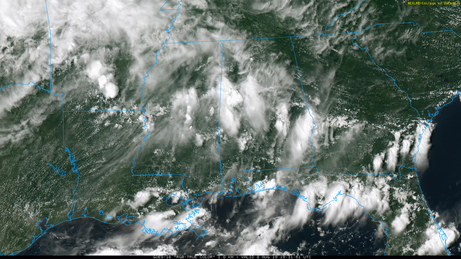
The scattered thunderstorms will end later tonight after sunset, and as the air becomes more stable.
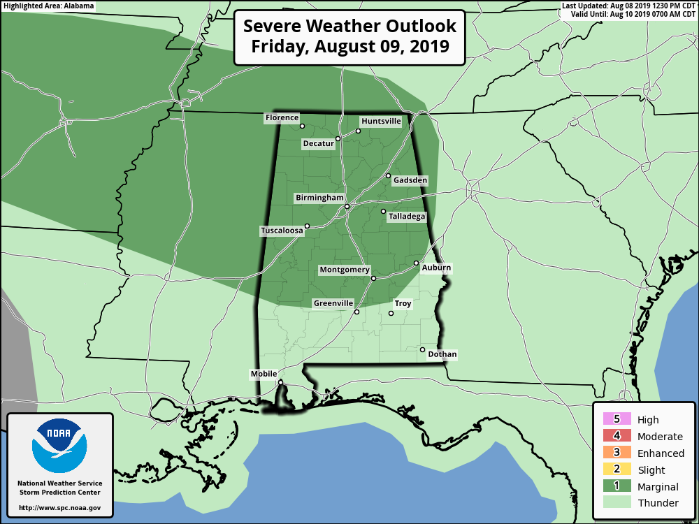
TOMORROW: Not much change in the overall weather situation. Partly sunny, hot, humid weather continues with more scattered thunderstorms, mostly between 12:00 noon and 10:00 p.m. SPC has introduce a “marginal risk” (level 1/5) of severe storms for North and Central Alabama… like today the heavier storms tomorrow could produce pockets of strong straight line winds.
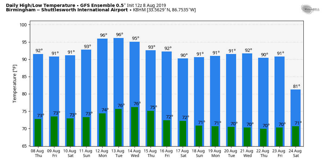
The high tomorrow will be at or just over 90 degrees for most communities.
THE WEEKEND AND BEYOND: We will keep a persistence forecast going. Look for partly sunny, hot, humid days with “scattered, mostly afternoon and evening showers and thunderstorms”. Again, most (but not necessarily all) of the storms will come from 12:00 noon until 10:00 p.m. Chance of any one spot getting wet will be 50/60 percent Saturday, and 40/50 percent Sunday through much of next week.
Highs over the weekend will be in the low 90s, followed by mid 90s Monday and Tuesday as the ridge west of the state tries to nose in here. See the Weather Xtreme video for maps, graphics, and more details.
TROPICS: The Atlantic basin is very quiet, and tropical storm formation is not expected through the weekend.
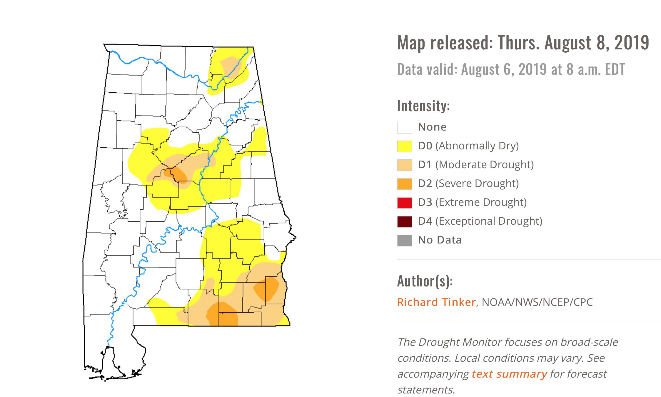
DROUGHT MONITOR: The new drought monitor released this morning shows pockets of dry conditions across Alabama… mainly over the southeast corner of the state, just south of Birmingham, and over Jackson County (far Northeast Alabama).
ON THIS DATE IN 2007: A tornado bounces across Staten Island and Brooklyn, New York, ripping off roofs and damaging dozens of buildings. The EF-2 twister hop-scotched through Brooklyn’s Bay Ridge and Sunset Park neighborhoods around 6:30 am.
BEACH FORECAST: Click here to see the AlabamaWx Beach Forecast Center page.
WEATHER BRAINS: Don’t forget you can listen to our weekly 90 minute show anytime on your favorite podcast app. This is the show all about weather featuring many familiar voices, including our meteorologists here at ABC 33/40.
CONNECT: You can find me on all of the major social networks…
Facebook
Twitter
Instagram
Pinterest
Snapchat: spannwx
Look for the next Weather Xtreme video here by 7:00 a.m. tomorrow…
Category: Alabama's Weather, ALL POSTS, Weather Xtreme Videos
About the Author (Author Profile)
James Spann is one of the most recognized and trusted television meteorologists in the industry. He holds the AMS CCM designation and television seals from the AMS and NWA. He is a past winner of the Broadcast Meteorologist of the Year from both professional organizations.Subscribe
If you enjoyed this article, subscribe to receive more just like it.


