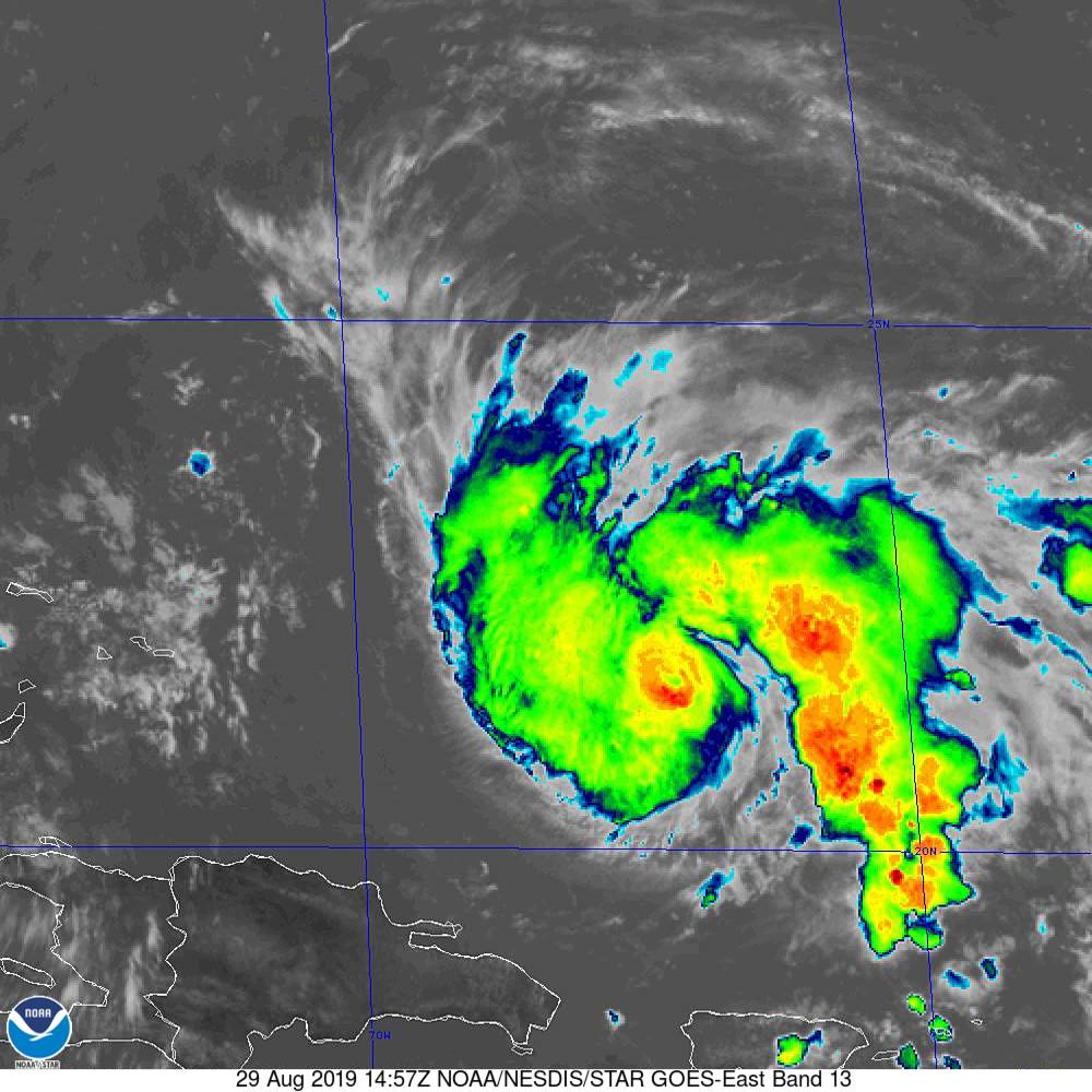
Hurricane Dorian Continues to the Northwest
NOAA/NESDIS/STAR GOES ABI BAND 13 OR_ABI-L1b-RadM2-M6C13_G16_s20192411457541_e20192411458010_c20192411458058.nc
Hurricane Dorian continues to the northwest this morning. Top winds are still 85 pmh.
FAST FACTS AT 10 AM
———————————————–
LOCATION…21.4N 67.2W
ABOUT 220 MI…355 KM NNW OF SAN JUAN PUERTO RICO
ABOUT 370 MI…600 KM E OF THE SOUTHEASTERN BAHAMAS
MAXIMUM SUSTAINED WINDS…85 MPH…140 KM/H
PRESENT MOVEMENT…NW OR 325 DEGREES AT 13 MPH…20 KM/H
MINIMUM CENTRAL PRESSURE…986 MB…29.12 INCHES
The hurricane entrained some dry air last night which slowed down the intensification process. It should remain steady-state or slowly strengthen today and should intensify more rapidly tomorrow. An upper low to the southwest is producing some shear that is also impacting the storm. This will lessen as the hurricane continues northwest while the upper low moves southwest.
The track is basically unchanged. The key to the track is the upper ridge to the north. It may be strong enough to drive the storm further to the south, but it is expected to weaken enough for it to turn north over Florida or southern Georgia. Everything depends on that ridge though. The hurricane could actually strengthen the ridge and push it into the Gulf. Still lots to watch on this one.
About the Author (Author Profile)
Bill Murray is the President of The Weather Factory. He is the site's official weather historian and a weekend forecaster. He also anchors the site's severe weather coverage. Bill Murray is the proud holder of National Weather Association Digital Seal #0001 @wxhistorianSubscribe
If you enjoyed this article, subscribe to receive more just like it.


