A 6 p.m. Look at Hurricane Dorian
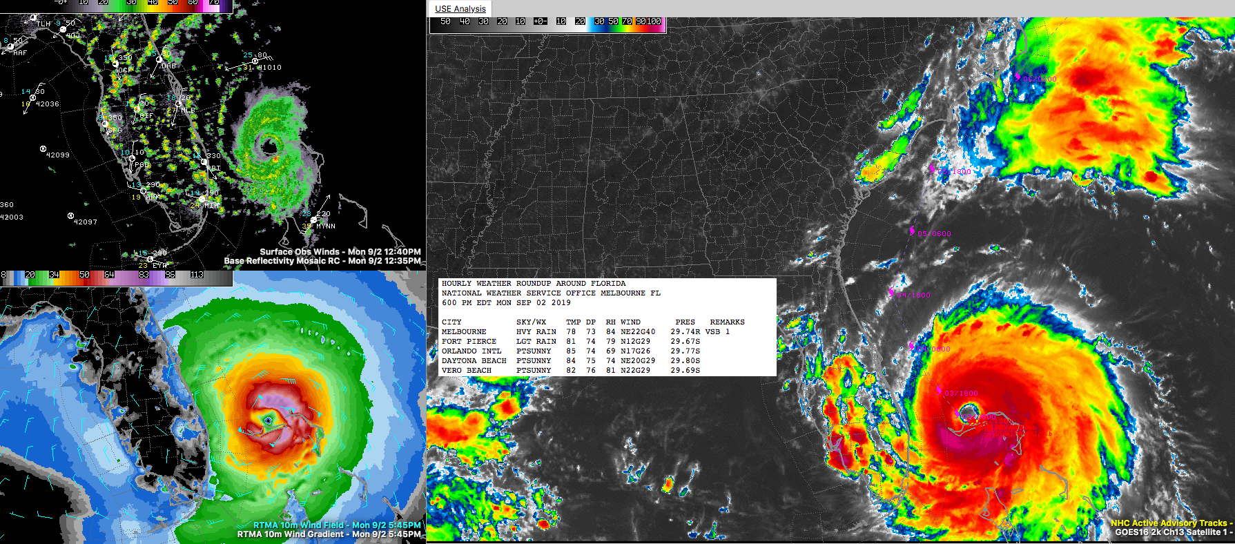
At 6 pm Dorian was stationary 30 mi northeast of Freeport, Grand Bahama Island or 105 mi east of West Palm Beach FL with max sustained winds of 145 mph, a central pressure of 940 mb/27.76.
The hurricane is still pounding Grand Bahama Island:
* The path should of the center should follow the Florida coastline, but not make landfall.
* The storm remains a threat to the coastlines of Georgia, South Carolina, and North Carolina.
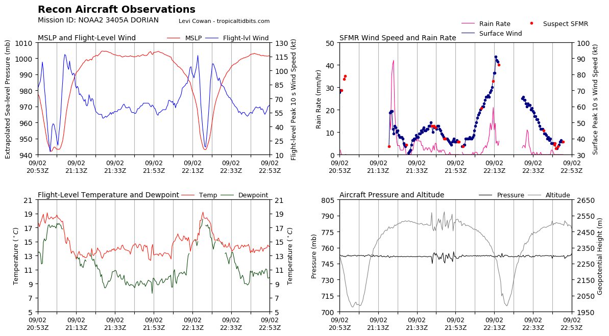
The storm is in the process of broadening out its circulation, which will mean an expanded wind field. The hurricane seems to have leveled off around 940 millibars. The secondary eyewall seems to be forming.
Here is the latest recon:
Even though Hurricane Dorian is stationary, impacts are already being felt across Florida. Wind gusts of 50 mph accompany some of those mini squalls moving across Florida. Conditions will continue to deteriorate tonight, especially across the Treasure Coast. All preparations should now be complete now on the central part of the Florida East Coast in the warning area.
Hurricane watches have been extended northward to include the entire Georgia coast and the Lowcountry of South Carolina.
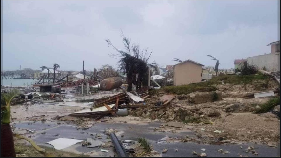
The damage in the Abacos is extreme. From @JohnMoralesNBC6 Miami:
About the Author (Author Profile)
Bill Murray is the President of The Weather Factory. He is the site's official weather historian and a weekend forecaster. He also anchors the site's severe weather coverage. Bill Murray is the proud holder of National Weather Association Digital Seal #0001 @wxhistorianSubscribe
If you enjoyed this article, subscribe to receive more just like it.


