A Brief Look At Hurricane Dorian At 4:00 PM
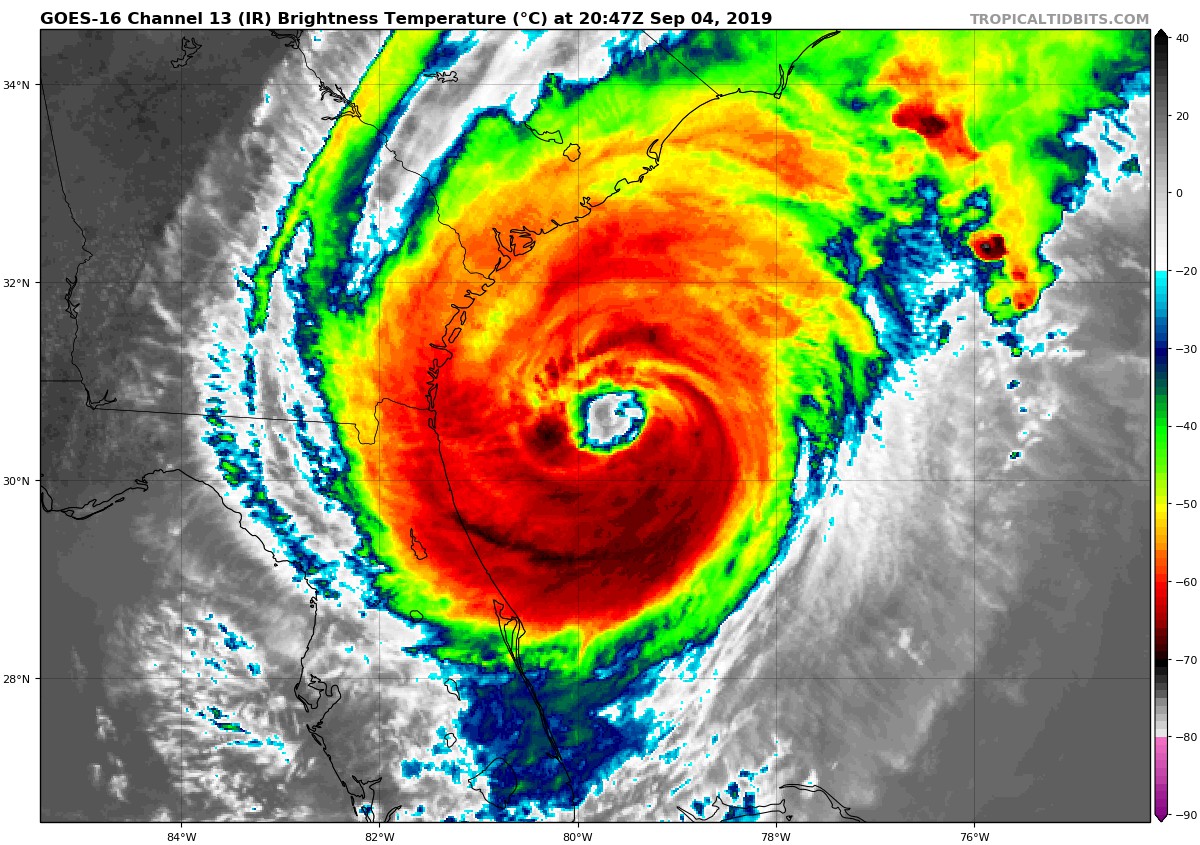
Hurricane Dorian remains at category 2 intensity this afternoon but has a slight uptick in maximum sustained winds to 110 mph with a pressure dropping down to 961 MB. Movement is to the north-northwest at 8 mph. While the radius of the tropical-storm-force winds has remained the same at 175 miles out, the hurricane-force wind radius has increased to 70 miles out.
There is currently a Hurricane Hunter recon aircraft flying through Dorian to give us a better understanding of the structure and what is happening inside the storm.
Dorian is expected to make landfall late tomorrow on the coast of South Carolina and then the Outer Banks of North Carolina by Friday morning. A Tropical Storm Warning and Hurricane Watch are in effect from just south of Daytona Beach, Florida up to the Georgia and South Carolina border. A Hurricane Warning is in effect from Tybee Island, Georgia up to the North Carolina and Virginia border. The highest storm surge is expected to be from Isle of Palms to Myrtle Beach, South Carolina with 5 to 8 ft.
Again, the intensity of Dorian does not take into account the storm surge, rainfall, or flooding potential. All of the southeastern US Atlantic coast will be impacted with the Carolinas receiving the greatest impact. Strong rip currents will be a big hazard and although coastal counties are under evacuation orders, some may choose to stay in their homes. However, it is best to stay off the beach. Waves, wind gusts, flooding, and coastal erosion are all capable of producing deadly consequences.
About the Author (Author Profile)
Bill Murray is the President of The Weather Factory. He is the site's official weather historian and a weekend forecaster. He also anchors the site's severe weather coverage. Bill Murray is the proud holder of National Weather Association Digital Seal #0001 @wxhistorianSubscribe
If you enjoyed this article, subscribe to receive more just like it.


