

Hurricane Dorian Heading Out to the Northeast After Crossing the Outer Banks
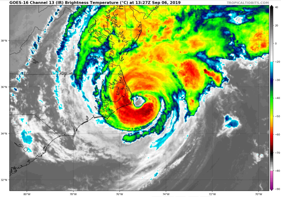
Hurricane Dorian made landfall near Hatteras, North Carolina around 7:35 a.m. CDT this morning. The hurricane’s center has since moved out over the open Atlantic to the northeast.
A sustained wind of 77 mph was measured on Hatteras at the High School. Mitchell Field in Hatteras is currently reporting ESE winds at 48 gusting to 66 mph. There was light rain and fog. The pressure read 960.7 millibars or 28.37 inches.
Top winds are still 90 mph. The central pressure is 957 mb. Dorian will get to rank in the top ten of North Carolina hurricanes by central pressure after all.
The hurricane will transition quickly to an extratropical low that will deal a swiping blow to New England. Tropical storm warnings are in effect for the Cape of eastern Massachusetts. Then it will hit Nova Scotia hard Saturday and Saturday night into Sunday.
Impacts in the Carolinas have mostly been flooding and downed trees and powerlines. Power outages are widespread, but nothing compares to the destruction in the Bahamas. Our hearts and wallets need to be open right now to helping that devastated nation’s people.

Hurricane Dorian is bringing drier air into Alabama which will reinforce our hot weather for the next several days.
About the Author (Author Profile)
Bill Murray is the President of The Weather Factory. He is the site's official weather historian and a weekend forecaster. He also anchors the site's severe weather coverage. Bill Murray is the proud holder of National Weather Association Digital Seal #0001 @wxhistorianSubscribe
If you enjoyed this article, subscribe to receive more just like it.


