Another Hot and Dry Afternoon in Progress
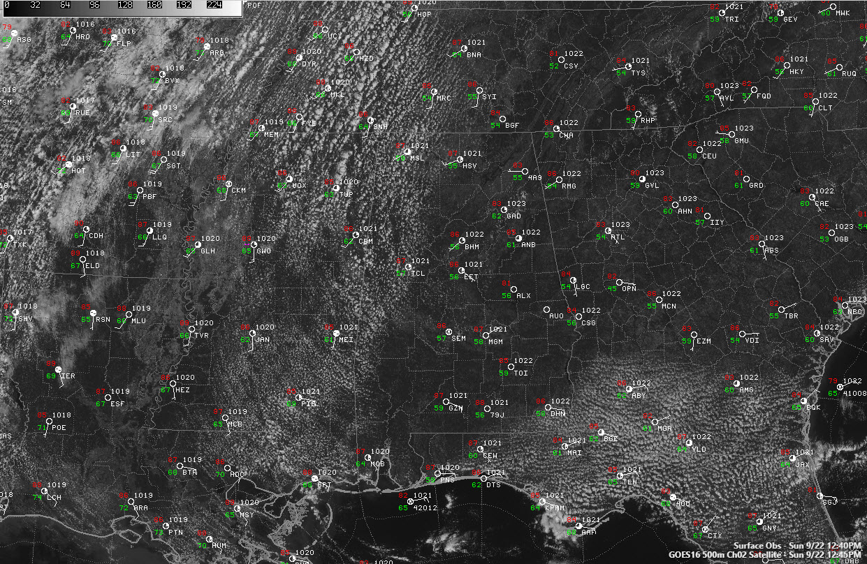
Temperatures are warming this afternoon across Alabama as another hot September day rolls on. Noon temperatures included in 86F at Birmingham and Calera, 87F at Tuscaloosa, and 85F at Anniston.
Dewpoints are still in the middle and upper 50s for the most part, making it feel not as humid as it might with higher dewpoints.
Regional radars are quiet and are expected to remain quiet today.
A cold front is passing St. Louis this afternoon and it will be approaching North Alabama by tomorrow afternoon. There is a chance that it might trigger a few showers and storms tomorrow afternoon over northern Mississippi and western Tennessee. Some of them will edge into northwestern Alabama late tomorrow afternoon and evening.
The front will work down to around I-20 on Tuesday, allowing some dry air to work into the northern third of the state. It will be a brief respite as moisture will start moving back into the area on Wednesday. Another front will approach late on Wednesday or Thursday, and this may trigger a few more isolated showers or storms late Wednesday. Otherwise, things will be dry through Thursday.
High pressure will build in for the weekend limiting rain chances and allow temperatures to edge upwards into the middle and upper 90s. No significant rain chances are seen on the horizon until around the start of the month. We will be watching what happens with Tropical Storm Karen in about 10 days to see if it can help bring some relief to an increasingly dry Alabama.
Category: Alabama's Weather, ALL POSTS
About the Author (Author Profile)
Bill Murray is the President of The Weather Factory. He is the site's official weather historian and a weekend forecaster. He also anchors the site's severe weather coverage. Bill Murray is the proud holder of National Weather Association Digital Seal #0001 @wxhistorianSubscribe
If you enjoyed this article, subscribe to receive more just like it.


