

Cloudy, Cool, Wet for Some
Nestor lost its tropical characteristics this morning and become post tropical, but still continues to impact many areas across the Southeast. The system will continue moving inland and across northern Florida and southern Georgia the rest of today and tonight, and by tomorrow morning it should be over in South Carolina.
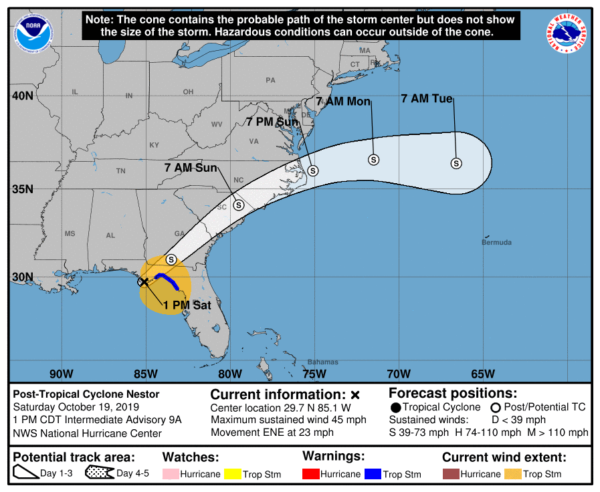
For us in Alabama, the rest of our Saturday will continue to feature a cloudy sky and cool temps with 50s and 60s where the rain is falling, while other locations are in the 70s, especially across western and southwestern portions of the state.
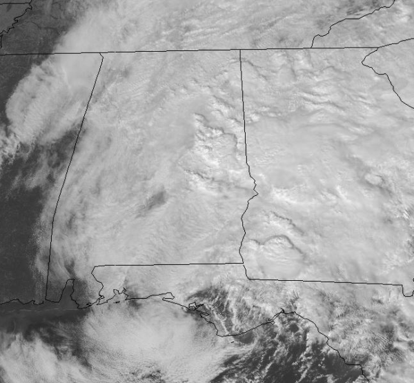
Along the 65 corridor, we are seeing scattered showers, west of 65 not much is falling, but East Alabama, we are seeing more widespread areas of light to moderate rain.
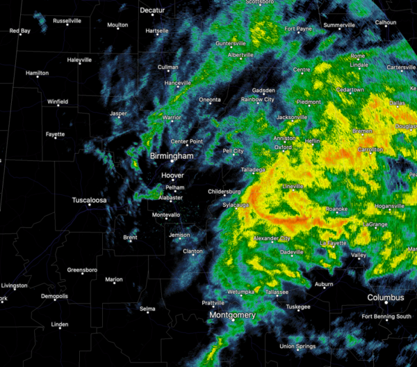
We expected the heavier to be over eastern portions of the state and that forecast is certainly verifying. Through the evening hours, the rain should gradually taper off across the area as the center of Nestor moves to the east and we should most of the rain ending by midnight. The sky should stay mainly to partly cloudy overnight and lows should settle into the 50s in many locations.
FOOTBALL WEATHER: UAB is hosting Old Dominion this afternoon at Legion Field in Birmingham (3:00p CT kickoff)… the sky remains cloudy with some light rain lingering during the game. Temperature are generally in the lower 60s.
Jacksonville State hosts Southeast Missouri State today (3:00p CT kickoff)… the sky is cloudy with rain ongoing. Temperatures are in the 50s with the rain falling.
Alabama hosts Tennessee tonight at Bryant-Denny Stadium in Tuscaloosa (8:00p CT kickoff)… the weather will be dry in Tuscaloosa with a partly cloudy sky, with temps falling from the 60s into the 50s by final whistle.
MORE SUN FOR SUNDAY: Tomorrow will be dry statewide and we should see more sun than clouds. It will be a very warm fall day of weather for Alabama as highs will be in the upper 70s to lower 80s.
MONDAY STORMS: Monday should be another very mild day with highs close to 80° with increasing clouds. A cold front will be approaching the state late in the day and it will bring a round of showers and storms to Alabama late Monday and Monday night. The SPC has areas of western and northwestern Alabama in a “slight risk” for severe weather, while most of the rest of the state is in a “marginal risk”.
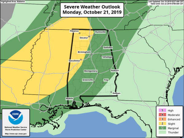
The main timeframe for the storms looks to be Monday afternoon through early Tuesday morning. Storms may begin affecting northwestern counties around 3 PM Monday and should exit the southeastern counties as late as 3 AM Tuesday. The main threats from these storms should be isolated damaging winds and perhaps a brief tornado or two.
BEACH FORECAST CENTER: Get the latest weather and rip current forecasts for the beaches from Fort Morgan to Panama City on our Beach Forecast Center page. There, you can select the forecast of the region that you are interested in visiting.
WORLD TEMPERATURE EXTREMES: Over the last 24 hours, the highest observation outside the U.S. was 109.8F at Failakah Island, Kuwait. The lowest observation was -79.1F at Dome C, Antarctica.
CONTIGUOUS TEMPERATURE EXTREMES: Over the last 24 hours, the highest observation was 99F at Rio Grande Village, TX. The lowest observation was 7F at Copper Basin, ID.
WEATHER ON THIS DATE IN 1984: Thunderstorms deluged the town of Odem, TX (located 15 miles northwest of Corpus Christi) with 25 inches of rain in just three and a half hours. Most businesses in Odem were flooded, as were 1000 homes in nearby Sinton.
Category: Alabama's Weather, ALL POSTS
About the Author (Author Profile)
Macon, Georgia Television Chief Meteorologist, Birmingham native, and long time Contributor on AlabamaWX. Stormchaser. I did not choose Weather, it chose Me. College Football Fanatic. @Ryan_StinnetSubscribe
If you enjoyed this article, subscribe to receive more just like it.


