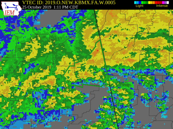
Areal Flood Warning For Parts Of Cherokee & Etowah Counties Until 3:45 PM

The National Weather Service in Birmingham has issued a
* Flood Warning for…
Eastern Etowah County in northeastern Alabama…
Cherokee County in northeastern Alabama…
* Until 345 PM CDT.
* At 1248 PM CDT, Doppler radar indicated thunderstorms producing
heavy rain which will cause flooding. Up to three inches of rain
have already fallen.
* Some locations that will experience flooding include…
Gadsden, Piedmont, Hokes Bluff, Centre, Cedar Bluff, Little River
Canyon National Preserve, Forney, Centre Municipal Airport,
Glencoe, Leesburg, Sand Rock, Gaylesville, Tennala, Tabor Road,
Cherokee Rock Village, Pleasant Gap, Cornwall Furnace Park,
Blanche, Eastern Weiss Lake and Ballplay.
Additional rainfall amounts of up to two inches are possible in the
warned area.
PRECAUTIONARY/PREPAREDNESS ACTIONS…
Turn around, don’t drown when encountering flooded roads. Most flood
deaths occur in vehicles.
In hilly terrain there are hundreds of low water crossings which are
potentially dangerous in heavy rain. Do not attempt to cross flooded
roads. Find an alternate route.
Category: Alabama's Weather, ALL POSTS, Severe Weather


