Showers Return To Alabama Later Today And Tonight
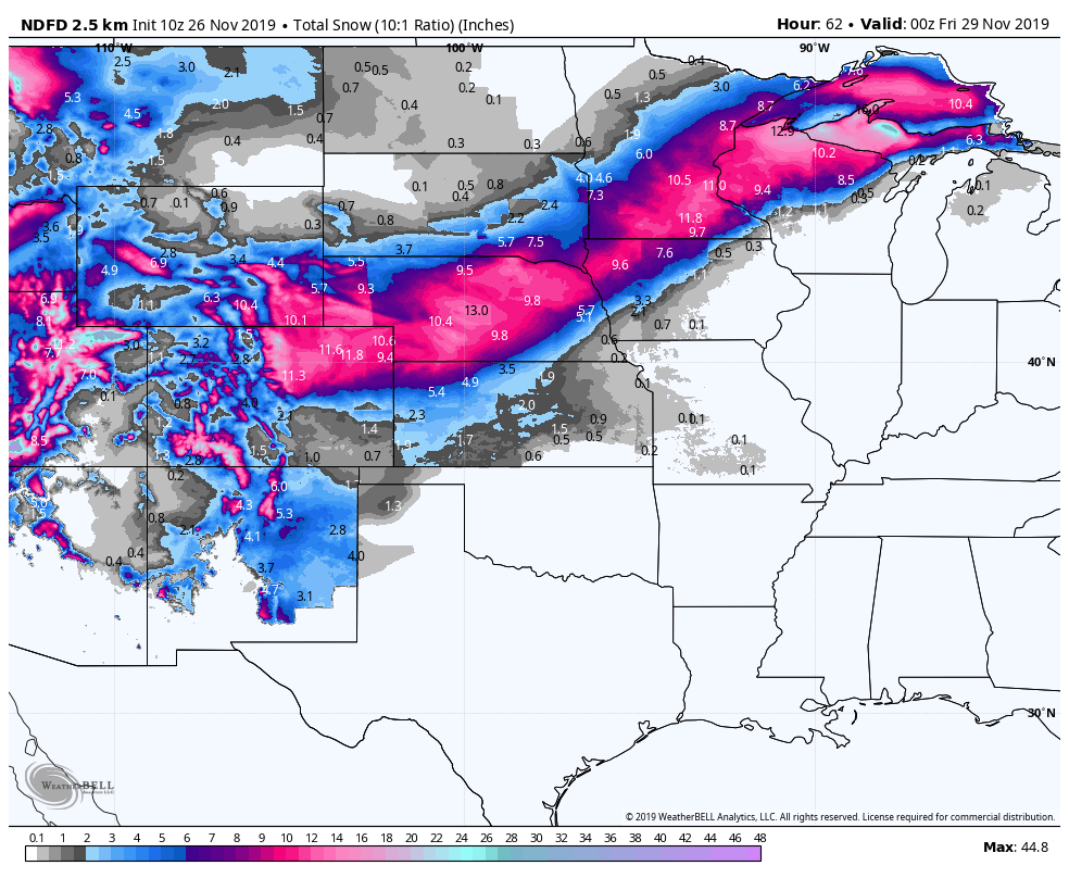
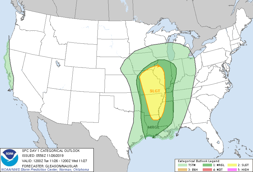
RAIN ON THE WAY: Clouds will increase across Alabama today ahead of a major pre-Thanksgiving storm system developing over the Central U.S. This system will bring heavy snow from Colorado and Wyoming out across the High Plains and the northern Great Lakes over the next 48 hours; winter storm warnings are in effect there, and major travel issues are likely. In the warm sector of the system, severe thunderstorms are possible later today and tonight from Louisiana and Mississippi north into Missouri and parts of Illinois.
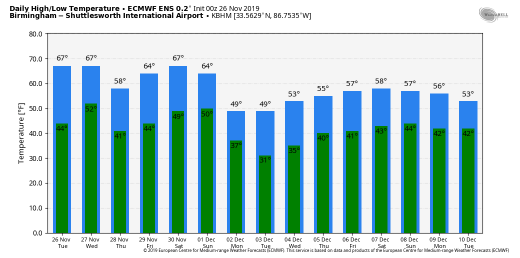
Our high today will be in the mid 60s, and a few showers could break out over the northwest counties this afternoon. But, the main threat of showers and storms will come tonight and early tomorrow morning. A strong storm can’t be ruled out, but the risk of severe thunderstorms in Alabama tonight is low with hardly any surface based instability. Rain amounts should be generally around 1/2 inch, and by tomorrow afternoon all of the showers will shift into South Alabama.
THANKSGIVING/BLACK FRIDAY: Dry weather is the story for Alabama Thursday and Friday. With sunshine in full supply, the high Thursday will be in the 57-62 degree range. Friday will feature a partly to mostly sunny sky with a high in the mid 60s.
REST OF THE HOLIDAY WEEKEND: Another major storm system will bring changes to Alabama over the weekend. Clouds will increase Saturday, and showers and thunderstorms are likely Saturday night into early Sunday morning. This will be another system will very impressive dynamic support, but marginal thermodynamics… but it would produce a few strong to severe storms. We will be able to evaluate the threat in a more detailed fashion later in the week. Saturday will be mild with a high from 68-72, then Sunday will be cooler with a daytime high in the 50s.
NEXT WEEK: For now most of next week looks cool and dry with seasonal temperatures; some rain could return by the end of the week on Friday (December 6)… See the Weather Xtreme video for maps, graphics, and more details.
IRON BOWL: For the biggest game of the year in Alabama (2:30p CT kickoff Saturday at Jordan-Hare Stadium), the sky will be mostly cloudy with a kickoff temperature near 70 degrees. For now, we believe the rain arrives after the game is over, generally after 7 p.m. But, of course, the game is still several days away and things could change. We will keep you posted.
ON THIS DATE IN 2007: Lightning and heavy rain delay the start of the Monday Night Football game at Pittsburgh’s Heinz Field between the Miami Dolphins and the Pittsburgh Steelers by 25 minutes. The muddy field conditions contribute to one of the lowest scoring NFL games won by the Steelers, 3-0. The teams combined 375 yards, and the winning field goal occurred with 17 seconds left in the game.
BEACH FORECAST: Click here to see the AlabamaWx Beach Forecast Center page.
WEATHER BRAINS: Don’t forget you can listen to our weekly 90 minute show anytime on your favorite podcast app. This is the show all about weather featuring many familiar voices, including our meteorologists here at ABC 33/40.
CONNECT: You can find me on all of the major social networks…
Facebook
Twitter
Instagram
Pinterest
Snapchat: spannwx
Look for the next Weather Xtreme video here by 4:00 this afternoon… enjoy the day!
Category: Alabama's Weather, ALL POSTS, Weather Xtreme Videos
About the Author (Author Profile)
James Spann is one of the most recognized and trusted television meteorologists in the industry. He holds the AMS CCM designation and television seals from the AMS and NWA. He is a past winner of the Broadcast Meteorologist of the Year from both professional organizations.Subscribe
If you enjoyed this article, subscribe to receive more just like it.


