New Day One Severe Weather Outlook Issued by SPC; New Tornado Watch Issued for Parts of Mississippi/Tennessee
The Storm Prediction Center has issued its new Day One severe weather outlook and I agree with their assessment based on evening model data.
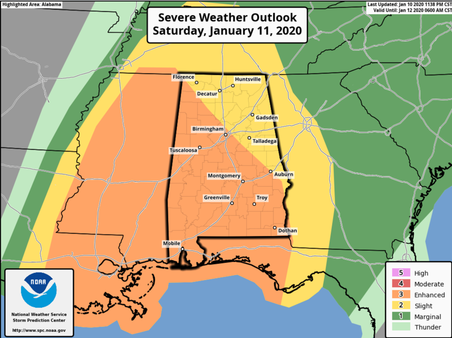
All of Alabama is in a slight risk outlook for today, and areas along and southwest of US-78/US-280 are in an enhanced risk area (one level above slight).
Our squall line has intensified and become better organized tonight to the west as the surface low between Longview, Texas and Shreveport strengthens.
There are three tornado warnings right now in Northeast Texas approaching the Shreveport area. There is also one in the Houston area.
There are several large severe thunderstorm warnings along the line in Arkansas and eastern Texas.
Tornado watches now extend from the Middle Texas Coast into Northwestern Louisiana and across much of Arkansas. A new tornado watch was just issued for western Tennessee, northwestern Mississippi and extreme southeastern Arkansas. Another new watch was just issued for portions of Louisiana and Southeast Texas.
You will want to stay alert today and pay attention to the weather. Know when the windows of time severe weather is expected at your location. Have a couple of reliable ways to receive warnings. Have a plan for what to do when a warning is issued for your location.
TIMING: Westernmost counties of Alabama, like Marion, Lamar, Pickens, Greene, and Sumter will experience the storms most likely beginning between 11 a.m. and 1 p.m. Locations from Decatur to Jasper/Cullman and Tuscaloosa will experience them starting between 1-3 p.m. They should reach the Birmingham-Selma areas between 2-4 p.m. and the Gadsden and Anniston areas between 3-5 p.m. The storms should exit Central Alabama between 6-8 p.m. Your times may vary, so check the latest updates until the storms are past your area.
Category: Alabama's Weather, ALL POSTS, Severe Weather
About the Author (Author Profile)
Bill Murray is the President of The Weather Factory. He is the site's official weather historian and a weekend forecaster. He also anchors the site's severe weather coverage. Bill Murray is the proud holder of National Weather Association Digital Seal #0001 @wxhistorianSubscribe
If you enjoyed this article, subscribe to receive more just like it.


