Rain Returns Tomorrow; Drier By The Weekend
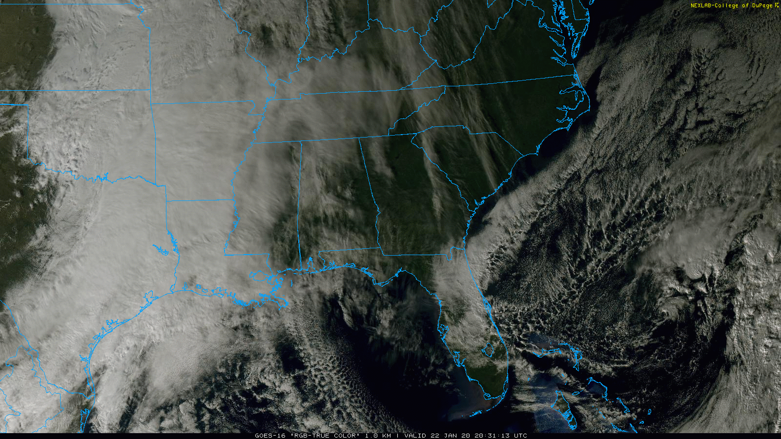
CLOUDS MOVING IN: Clouds have been increasing across Alabama today ahead of a weather system west of the state; temperatures are mostly in the 40s over North Alabama, with 50s to the south. Clouds will continue to thicken tonight, and some rain could reach West Alabama by tomorrow morning.
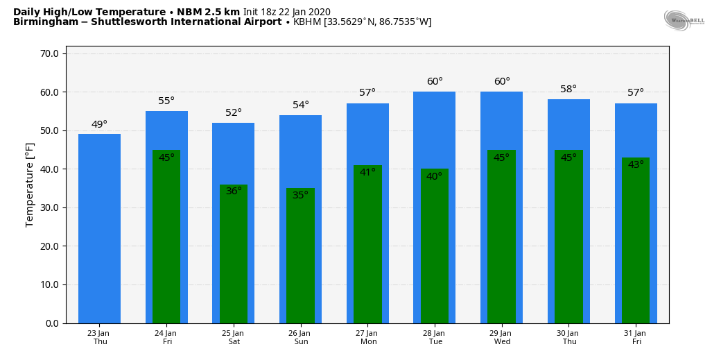
RAIN RETURNS: Tomorrow will be a cool, wet day across Alabama with periods of rain likely. The rain will be most widespread tomorrow afternoon and tomorrow night; temperatures will hold in the 40s so there won’t be any severe thunderstorm worries. Maybe some scattered thunder for the southern half of the state where there will be a touch of surface based instability. Rain amounts between 1/2 and 1 inch are likely.
The latest model data shows rain moving out of the state very early in the day Friday; most of the day will be dry, but clouds will linger. The high Friday afternoon will be in the low to mid 50s.
THE ALABAMA WEEKEND: The weekend looks cool and dry with partly sunny days and fair nights. Highs will be in the mid 50s Saturday and Sunday, with early morning lows in the low to mid 30s.
NEXT WEEK: Clouds will increase Tuesday, and the next rain event comes Tuesday night into Wednesday. Then, we trend drier toward the end of the week. Temperatures will be close to seasonal averages for late January with highs mostly in the upper 50s, although we could see low 60s on a day or two. See the Weather Xtreme video for maps, graphics, and more details.
THIS MORNING: Here are lows this morning across Alabama with our team of Skywatchers…
Heflin 18
Weaver 19
Cottondale 19
Carbon Hill 20
Millport 20
Hueytown 20
Alexander City 21
Arley 22
Coker 22
Remlap 23
Jemison 24
ON THIS DATE IN 1904: An estimated EF-4 tornado leveled the northern part of Moundville just after midnight, killing 37 people. The tornado reportedly had a phosphorescent glow. An engineer on a northbound Great Southern train saw the destruction right after it occurred, and backed his train 12 miles in reverse to the town of Akron, where he sent a telegram for help. An infant was snatched from its crib in the lower part of town and hurled through the air. It was airborne as it passed over the demolished stores. It was deposited uninjured in an old cotton field more than 100 yards away. Everything in the tornado path was swept aside including heavily laden freight cars standing on the tracks. The tornado sucked heavy timbers from the rain cars and scattered them nearby.
BEACH FORECAST: Click here to see the AlabamaWx Beach Forecast Center page.
WEATHER BRAINS: Don’t forget you can listen to our weekly 90 minute show anytime on your favorite podcast app. This is the show all about weather featuring many familiar voices, including our meteorologists here at ABC 33/40.
CONNECT: You can find me on all of the major social networks…
Facebook
Twitter
Instagram
Pinterest
Snapchat: spannwx
I enjoyed seeing the 6th graders today at Thorsby High School… be looking for them on the Pepsi KIDCAM today at 5:00 on ABC 33/40 News! The next Weather Xtreme video will be posted here by 7:00 a.m. tomorrow…
Category: Alabama's Weather, ALL POSTS, Weather Xtreme Videos
About the Author (Author Profile)
James Spann is one of the most recognized and trusted television meteorologists in the industry. He holds the AMS CCM designation and television seals from the AMS and NWA. He is a past winner of the Broadcast Meteorologist of the Year from both professional organizations.Subscribe
If you enjoyed this article, subscribe to receive more just like it.


