A Good Explanation From The WPC On The Excessive Rainfall Across North/Central Alabama
The National Weather Service’s Weather Prediction Center has put out a great pictorial description of what is causing the excessive rainfall that we are seeing over North/Central Alabama and the rest of the lower Mississippi Valley. Here is that information…
From the WPC: Flash flooding over the Lower MS Valley developed from elements often seen when heavy rain occurs here. The jet stream transports moisture from the Pacific, as low-level winds transport moisture from the Gulf. Storms train along fronts in the moisture plume, causing flash flooding.
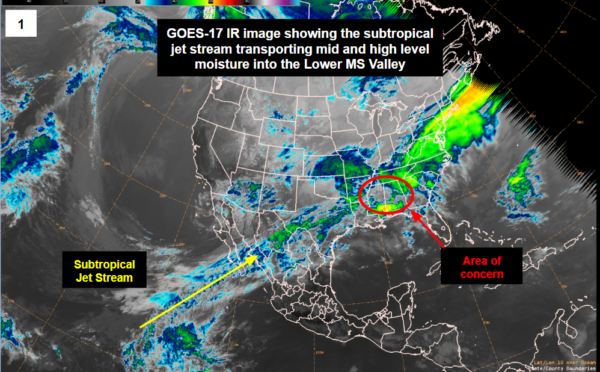
This is the GOES-17 infrared image showing the subtropical jet stream transporting mid and high-level moisture into the lower Mississippi Valley.
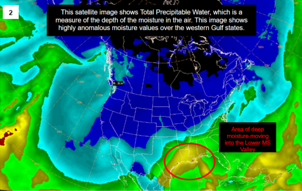
This satellite image shows Total Precipitable Water, which is a measure of the depth of the moisture in the air. This image shows highly anomalous moisture values over the western Gulf states. Also, notice the deep moisture moving into the lower Mississippi Valley.
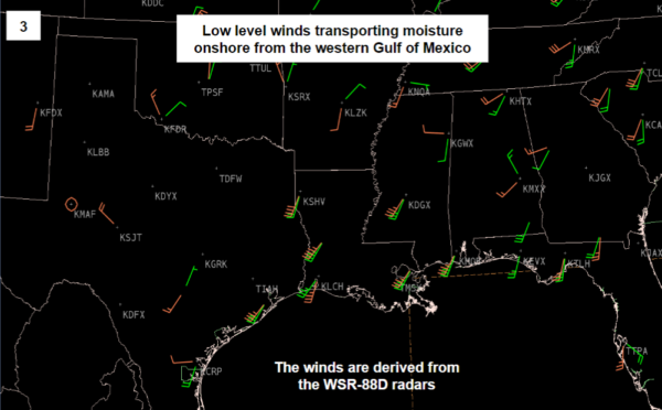
This image shows that the low-level winds are transporting moisture onshore from the western Gulf of Mexico.
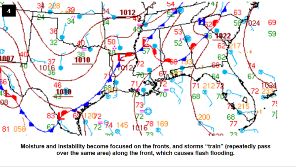
This image explains that moisture and instability become focused on the fronts, and storms train along the front, which causes flash flooding.
Category: Alabama's Weather, ALL POSTS
About the Author (Author Profile)
Scott Martin is an operational meteorologist, professional graphic artist, musician, husband, and father. Not only is Scott a member of the National Weather Association, but he is also the Central Alabama Chapter of the NWA president. Scott is also the co-founder of Racecast Weather, which provides forecasts for many racing series across the USA. He also supplies forecasts for the BassMaster Elite Series events including the BassMaster Classic.Subscribe
If you enjoyed this article, subscribe to receive more just like it.


