Drier Tomorrow; More Rain Thursday
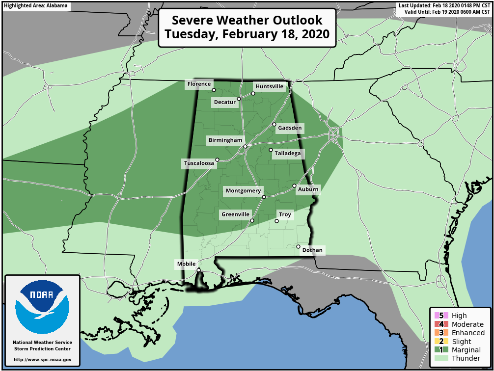
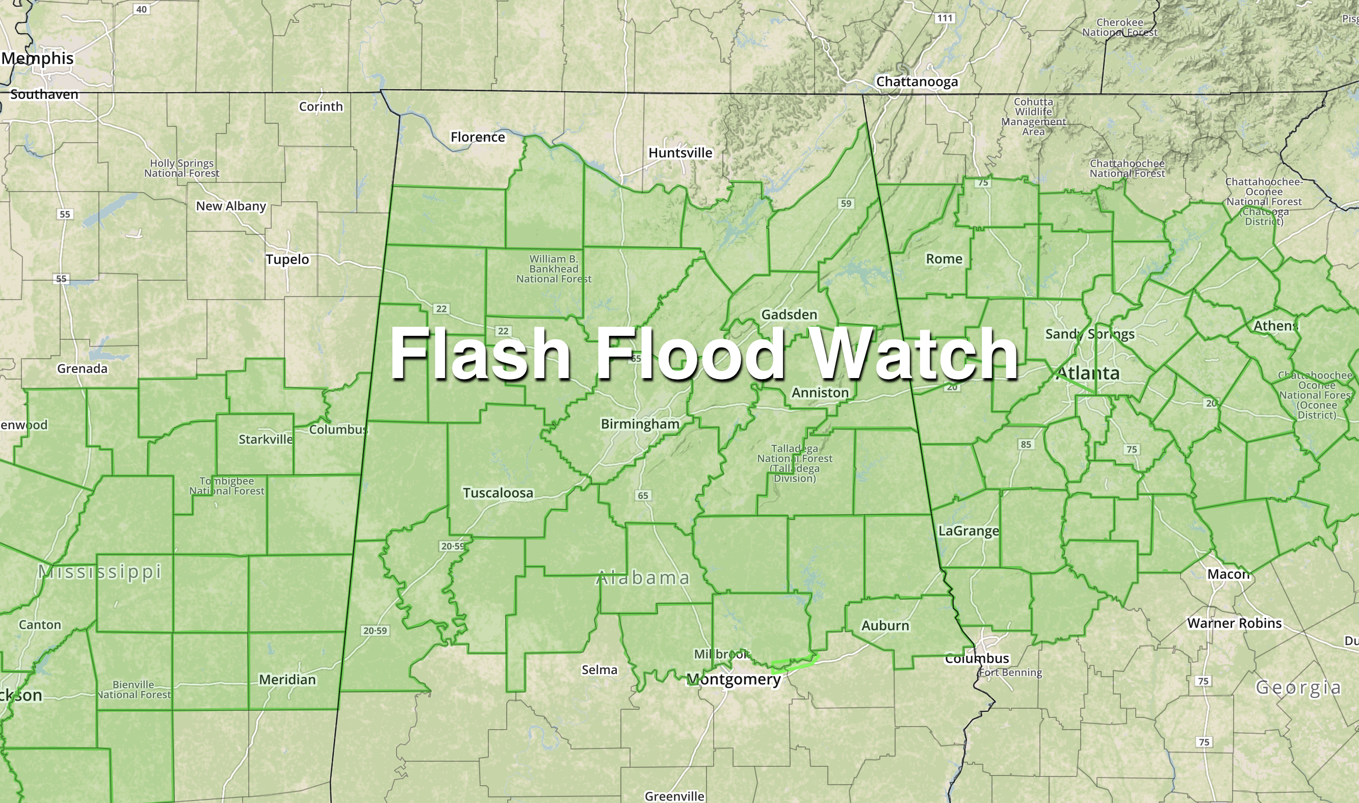
WET IS THE WORD: Rain is widespread over the northern half of Alabama this afternoon; a flash flood watch is in effect for many counties due to the saturated soil conditions. There are a few embedded thunderstorms within the large rain mass, and SPC maintains a low end, “marginal risk” (level 1/5) of severe storms for much of the state through this evening.
Some of the heavier storms could produce small hail and gusty winds this evening. The chance of a brief tornado is very low, but not zero. Periods of rain will continue through the night, before tapering off early tomorrow morning.
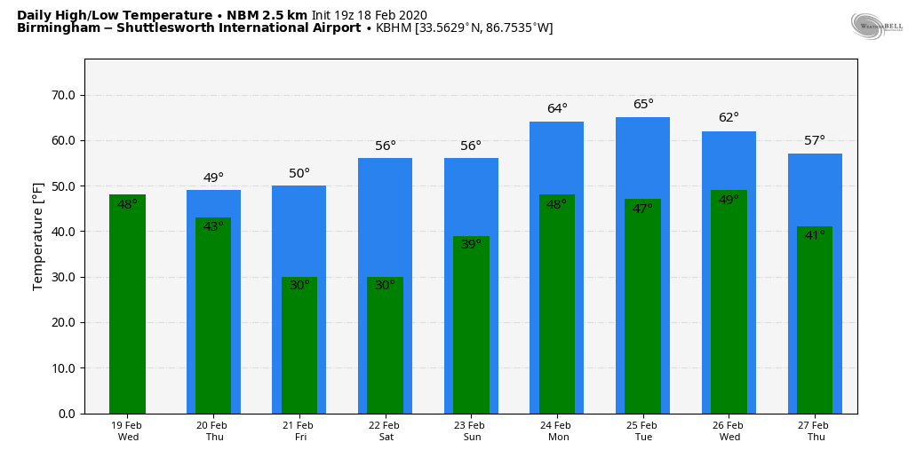
Tomorrow will be mostly cloudy and cooler with a high in the mid 50s; some patchy light rain is possible, but the rain won’t be as heavy or as widespread as today as a surface front settles into South Alabama and stalls.
A wave of low pressure forms on the front, and will spread a cold rain over Alabama late tomorrow night and on Thursday. Temperatures will be only in the 40-45 degree range as the rain falls over North Alabama Thursday, and a few patches of light snow or sleet are possible near the Tennessee border during the day. If we happen to see wintry precipitation over far North Alabama, we expect no impact as surface temperatures will be above freezing. The rain ends Thursday evening as a good push of dry air rolls into the state.
Additional rain amounts of 1-2 inches are likely between now and Thursday night, with isolated 3″ totals possible.
FRIDAY AND THE WEEKEND: Friday and Saturday will be dry with sunshine in full supply both days. Mornings will be cold; we project lows between 26 and 32 Saturday and Sunday morning… the high Friday will be near 50, followed by mid to upper 50s Saturday. Clouds will increase Sunday, and rain will likely move back into the state Sunday night.
NEXT WEEK: Rain ends during the day Monday, but another rain producing system is due in here Wednesday, followed by sharply colder air toward the end of the week. See the Weather Xtreme video for maps, graphics, and more details.
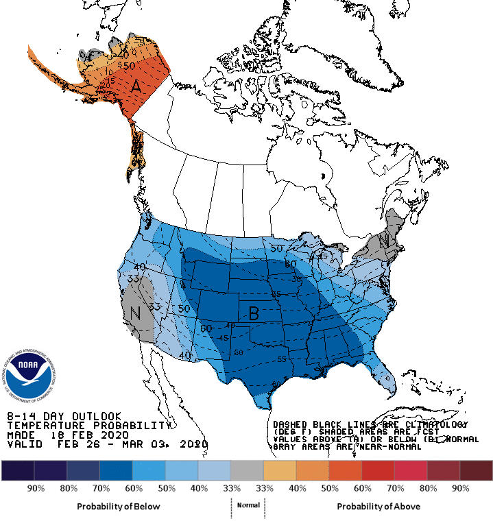
CPC OUTLOOK: The new 8-14 day outlook from the Climate Prediction Center shows below average temperatures likely for much of the contiguous United States for the period February 26-March 3.
ON THIS DATE IN 1992: A thunderstorm spawned an unusually strong F4 tornado for so far north for the time of the year in southern Van Wert County in Ohio. The tornado touched down just west of US Route 127 and traveled northeastward for about 3 miles. One house was completely leveled, and nine others experienced severe damage. Six people were injured.
BEACH FORECAST: Click here to see the AlabamaWx Beach Forecast Center page.
WEATHER BRAINS: Don’t forget you can listen to our weekly 90 minute show anytime on your favorite podcast app. This is the show all about weather featuring many familiar voices, including our meteorologists here at ABC 33/40.
CONNECT: You can find me on all of the major social networks…
Facebook
Twitter
Instagram
Pinterest
Snapchat: spannwx
I enjoyed seeing the students today at Moon Lake Elementary in Mentone, and Alexandria Elementary in Calhoun County… be looking for them on the Pepsi KIDCAM today at 5:00 and 6:00 on ABC 33/40 News! The next Weather Xtreme video will be posted here by 7:00 a.m. tomorrow….
Category: Alabama's Weather, ALL POSTS, Weather Xtreme Videos
About the Author (Author Profile)
James Spann is one of the most recognized and trusted television meteorologists in the industry. He holds the AMS CCM designation and television seals from the AMS and NWA. He is a past winner of the Broadcast Meteorologist of the Year from both professional organizations.Subscribe
If you enjoyed this article, subscribe to receive more just like it.


