Soaking Rain Tomorrow; Dry Air Returns Friday
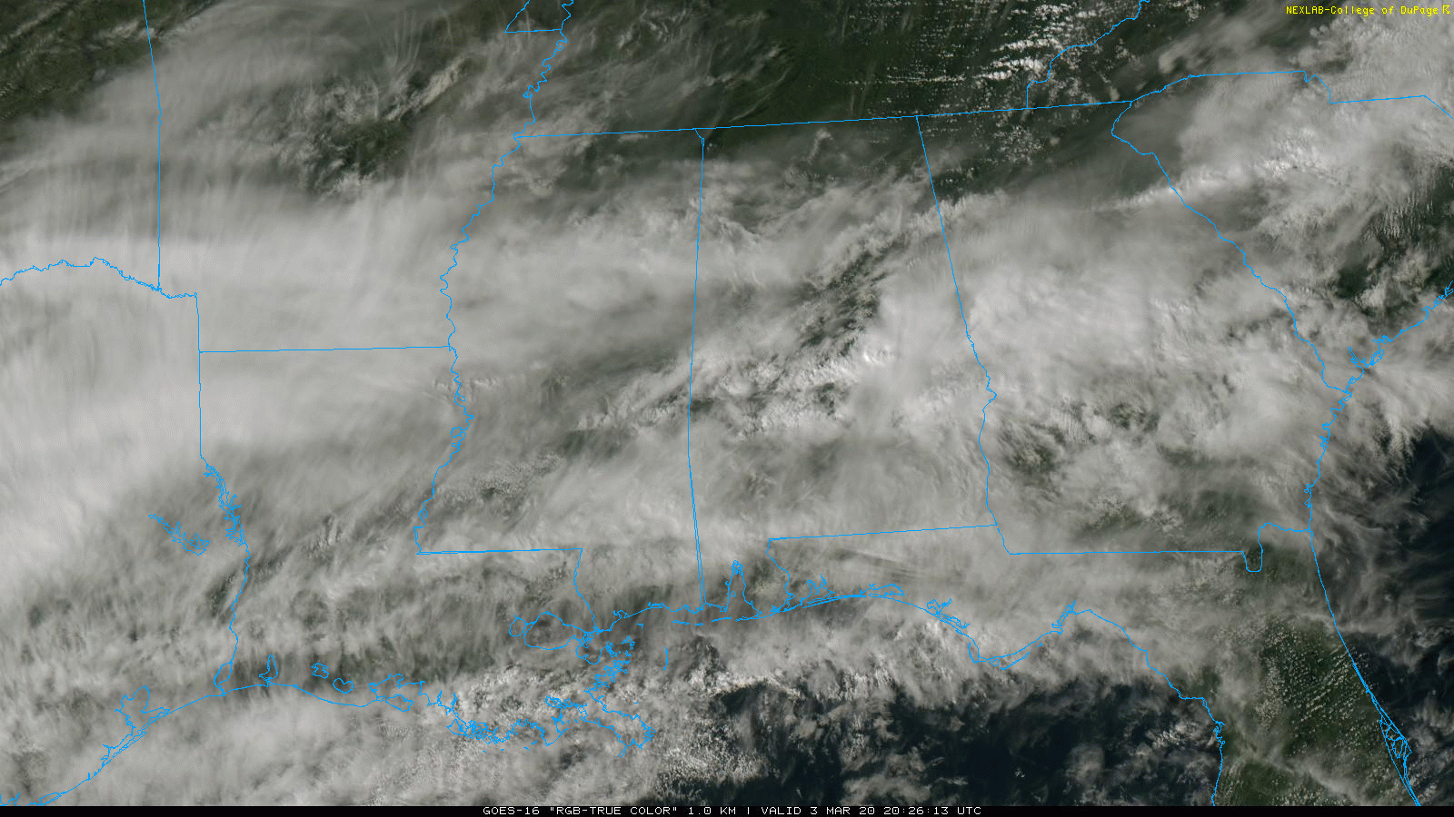
MILD AFTERNOON: Temperatures are generally in the low 70s across Alabama this afternoon… the average high for Birmingham on March 3 is 63. Most of North Alabama is dry, but showers continue over the southern half of the state.
MORE RAIN: A surface front will drift down to near the Gulf Coast late tonight, and a wave of low pressure forms along the front tomorrow morning. This will spread widespread rain into Alabama tomorrow. The rain could be heavy at times, and a flash flood watch is in effect for the southern 2/3 of the state through midday Thursday.
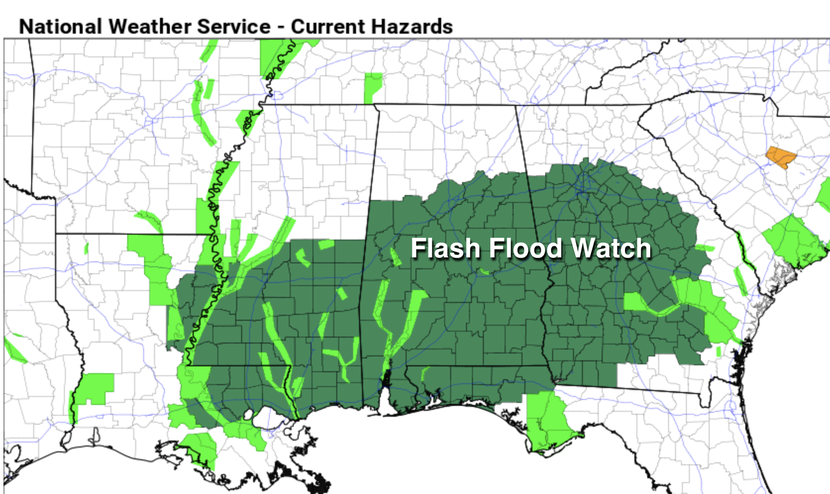
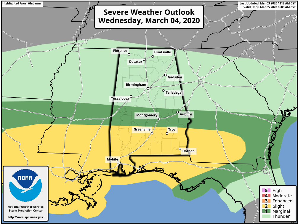
Additional rain amounts of 1 to 3 inches are likely. Also, SPC maintains the standard “slight risk” (level 2/5) for South Alabama… generally south of a line from Sweetwater to Fort Deposit to Eufaula. Unstable air is forecast to move up into the southern part of the state by mid to late afternoon, and a few storms over South Alabama could produce hail, strong winds, and a few tornadoes.
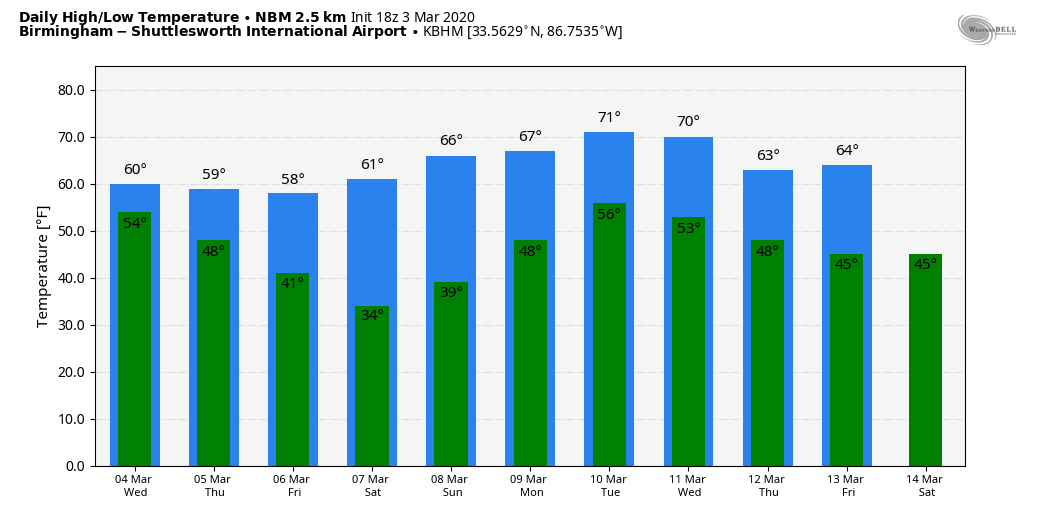
The air over North Alabama will remain stable tomorrow with temperatures in the 50s… flooding is the concern there. Then, on Thursday, rain will end from west to east during the day as drier air begins to move into the state. The sky becomes clear late Thursday night. Thursday’s high will be in the 57-60 degree range.
FRIDAY AND THE WEEKEND: The weather will be dry Friday through the weekend with sunny days and fair nights. The high Friday and Saturday will be close to 60, followed by mid to upper 60s Sunday. Coldest morning will come early Saturday with a low in the 28-32 degree range.
NEXT WEEK: Moisture returns early in the week, and showers are possible Monday and Tuesday. A cold front will bring showers and storms Wednesday, followed by drier air Thursday and Friday. See the Weather Xtreme video for maps, graphics, and more details.
ON THIS DATE ONE YEAR AGO: A strong late-winter/early-spring storm system moved through the southeastern United States. As the conditions deteriorated, dozens of tornadoes touched down across East Alabama, the panhandle of Florida, and western Georgia causing widespread damage. The deadliest was an EF-4 in Lee County between the towns of Beauregard and Smiths Station, south of Auburn and Opelika. The twister touched down around 2 p.m., and stayed on the ground for 26 miles. It leveled homes and buildings in its path, killing 23 people in the town of Beauregard. It was the deadliest tornado since 2013, and the first EF-4 tornado in the United States in almost two years. Most of those that died were in mobile homes.
BEACH FORECAST: Click here to see the AlabamaWx Beach Forecast Center page.
WEATHER BRAINS: Don’t forget you can listen to our weekly 90 minute show anytime on your favorite podcast app. This is the show all about weather featuring many familiar voices, including our meteorologists here at ABC 33/40.
CONNECT: You can find me on all of the major social networks…
Facebook
Twitter
Instagram
Pinterest
Snapchat: spannwx
Look for the next Weather Xtreme video here by 7:00 a.m. tomorrow…
Category: Alabama's Weather, ALL POSTS, Weather Xtreme Videos
About the Author (Author Profile)
James Spann is one of the most recognized and trusted television meteorologists in the industry. He holds the AMS CCM designation and television seals from the AMS and NWA. He is a past winner of the Broadcast Meteorologist of the Year from both professional organizations.Subscribe
If you enjoyed this article, subscribe to receive more just like it.


