Mild With A Few Showers/Storms Daily Through Friday
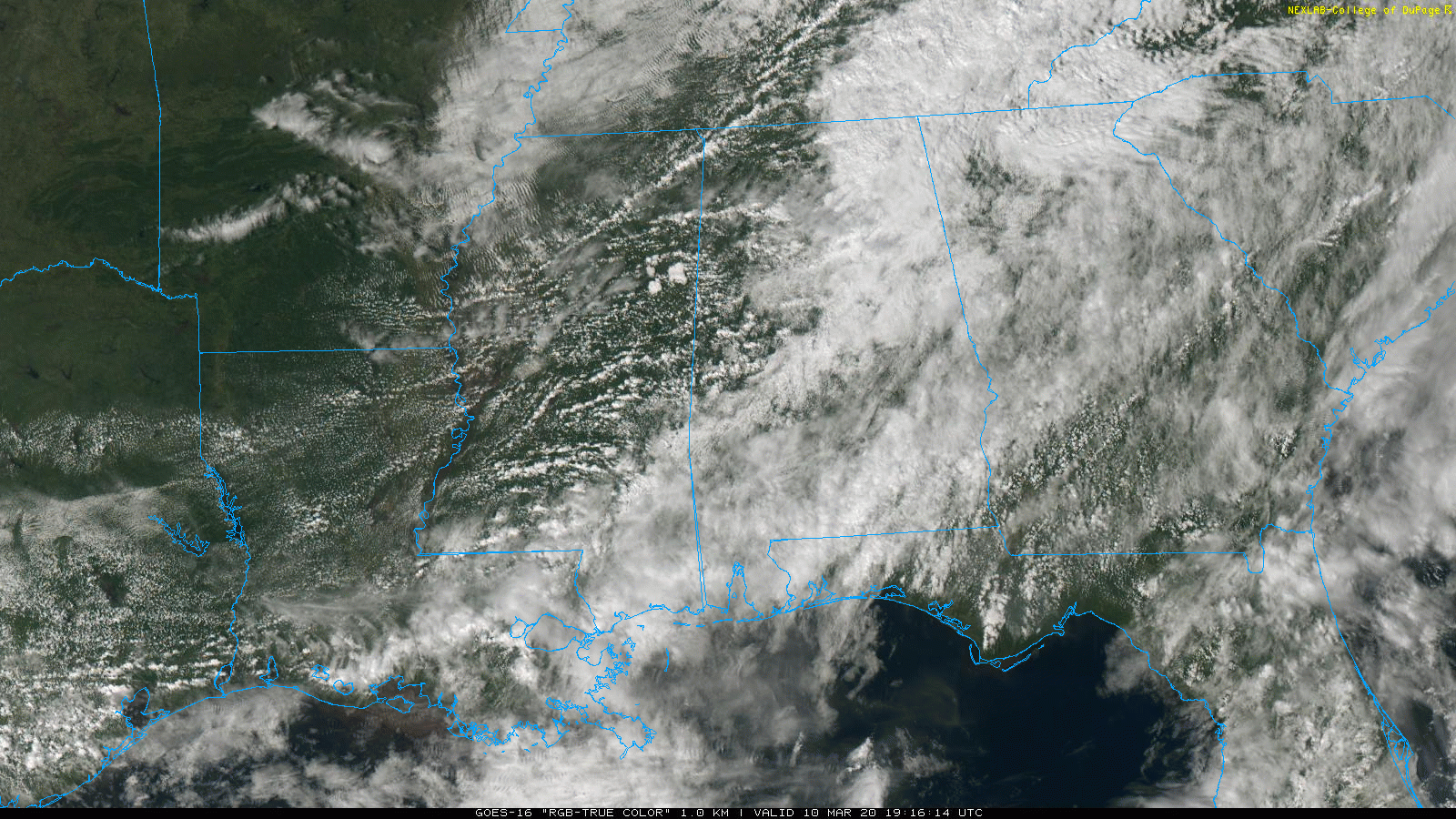
RADAR CHECK: After a large mass of rain this morning, the weather is fairly quiet across Alabama this afternoon. We have a few scattered showers on radar, but nothing widespread. And, there are breaks in the cloud cover over parts of West Alabama, where temperatures are in the 70s.
A few scattered showers will remain possible tonight, but nothing widespread.
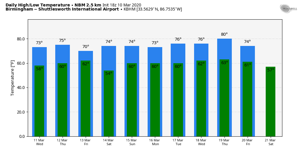
TOMORROW: The day will be mostly cloudy and mild with a high between 71 and 75 degrees. A decent part of the day will be dry, although a few scattered showers are possible. To the west, an MCS (Mesoscale Convective System) is expected to form over Arkansas tomorrow morning; it will roll through parts of West Tennessee and North Mississippi during the afternoon, and SPC has a “slight risk” (level 2/5) of severe storms identified for this region in their “Day 2” outlook for tomorrow and tomorrow night.
A “marginal risk” (level 1/5) extends into far West Alabama, but most of the good high resolution models suggest the MCS will dissipate as it moves into Alabama due to warmer air aloft.
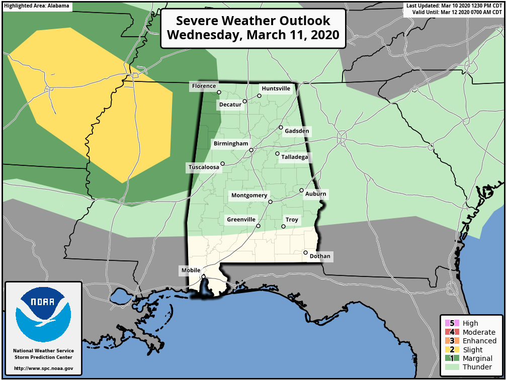
Keep in mind these thunderstorm areas can last longer than models show, so just be aware there could be a strong storm tomorrow evening over Northwest Alabama with potential for some hail and strong gusty winds. But, for the rest of the state, the overall threat is low.
THURSDAY/FRIDAY: Mild weather continues with highs exceeding 70 degrees for most places both days. The sky will feature more clouds than sun, and we will continue to mention a chance of showers both days. But again, no wash-out, and rain amounts won’t be too heavy. Rain amounts between now and Friday will be around 1 inch for much of North/Central Alabama… so no flooding problems are anticipated.
THE ALABAMA WEEKEND: Most of the day will be dry and mild Saturday with a high around 70. A few showers could form near the Tennessee state line, however, but even there rain won’t be widespread or heavy. Then, on Sunday, we will mention some risk of showers over the northern third of the state (mainly north of I-20), but the rest of the state should remain dry with high in the 70s.
NEXT WEEK: The pattern favors below average temperatures for the western half of the U.S… with above average temperatures for the eastern states, including Alabama. Highs will be in the 70s on most days, and scattered showers are possible, but an upper ridge should keep rain amounts fairly light and spotty. See the Weather Xtreme video for maps, graphics, and more details.
LAST FREEZE? No sign of any really cold weather for Alabama over the next 15 days, but a reminder we almost always have a late season freeze during. the first half of April. The latest freeze on record at Birmingham came on April 23, 1986, when the low was 30. The coldest April temperature on record at Birmingham is 26, measured on April 11, 1973. We should also mention Birmingham received 5 inches of snow on April 3, 1987.
ON THIS DATE IN 1986: Severe thunderstorms and tornadoes hit Indiana, Kentucky, and Ohio. A total of 19 tornadoes occurred. Three of the tornadoes in Indiana reached EF3 intensity. A densely populated subdivision of Southeast Lexington, Kentucky, was heavily damaged by a tornado. Twenty people were injured, and 900 homes were destroyed or demolished. A very strong thunderstorm downburst hit the Cincinnati area. At the Greater Cincinnati Airport, windows were blown out of the control tower, injuring the six controllers on duty. At Newport, Kentucky, 120 houses were destroyed from winds estimated from 100 to 140 mph.
BEACH FORECAST: Click here to see the AlabamaWx Beach Forecast Center page.
WEATHER BRAINS: Don’t forget you can listen to our weekly 90 minute show anytime on your favorite podcast app. This is the show all about weather featuring many familiar voices, including our meteorologists here at ABC 33/40.
CONNECT: You can find me on all of the major social networks…
Facebook
Twitter
Instagram
Pinterest
Snapchat: spannwx
I enjoyed seeing the third graders today at Cottondale Elementary… be looking for them on the Pepsi KIDCAM today at 5:00 on ABC 33/40 News! The next Weather Xtreme video will be posted here by 7:00 a.m. tomorrow…
Category: Alabama's Weather, ALL POSTS, Weather Xtreme Videos
About the Author (Author Profile)
James Spann is one of the most recognized and trusted television meteorologists in the industry. He holds the AMS CCM designation and television seals from the AMS and NWA. He is a past winner of the Broadcast Meteorologist of the Year from both professional organizations.Subscribe
If you enjoyed this article, subscribe to receive more just like it.


