Strong Storms Approaching The Northwestern Parts Of The Area
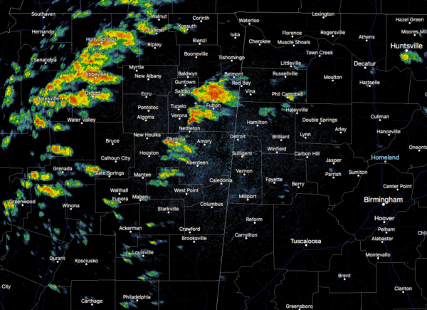
As of 3:45 pm, we have some stronger storms that are separating themselves from the rest of the activity over northern Mississippi that is about to move into the northwestern parts of the area. When they cross over the state line, they will be moving into a much more unstable environment. With the ingredients in place for severe storms, we will really need to watch these as they move into and across Franklin and Marion counties over the next 30-60 minutes. They are moving to the northwest at roughly 45 MPH.
Other than a few scattered showers and storms over the northeastern parts of the area, the rest of North and Central Alabama is quiet at this point.
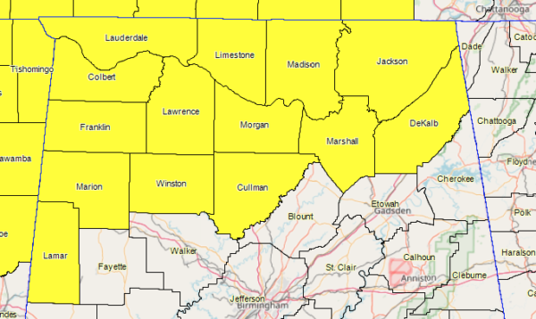
A TORNADO WATCH remains in effect for all of North Alabama and for Lamar, Marion, and Winston counties in Central Alabama through the rest of the daylight and into the evening hours and is set to expire at 10:00 pm.
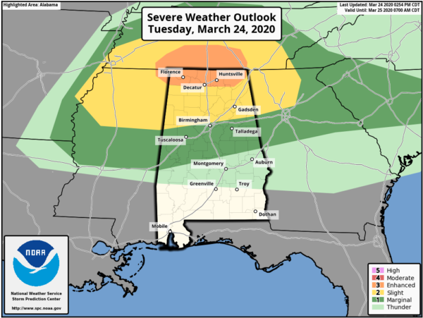
An ENHANCED RISK is up for locations along and north of a line from just south of Littleville (Colbert Co.) to New Hope (Madison Co.) to Section (Jackson Co.). A SLIGHT RISK continues for locations north of a line from just south of Macedonia (Pickens Co.) to Tarrant (Jefferson Co.) to just north of Fruithurst (Cleburne Co.). A MARGINAL RISK is up for locations north of a line from just south of Cuba (Sumter Co.) to just south of Billingsley (Autauga Co.) to Lanette (Chambers Co.).
The threat for a few tornadoes, large hail, and damaging winds will be focused this afternoon and evening across North Alabama and for the northern half of Central Alabama. One or two strong tornadoes may be possible in and around the Enhanced Risk locations.
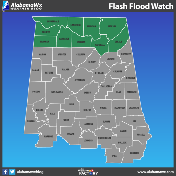
A FLASH FLOOD WATCH also remains in effect for nearly all of North Alabama with the exception of Cullman County until 1:00 am Wednesday.
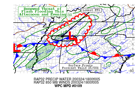
WPC is highlighting the locations under the flash flood watch for the possibility of more heavy rain falling over the same locations that received a good bit of rain earlier this morning. Rainfall rates with these stronger to severe thunderstorms could reach as high as 1.50 inches per hour.
Be sure you have a good way of hearing warnings if they are needed. And, if you typically go to a community shelter, check with our county EMA (Emergency Management Agency) to be sure it will be open. We are living in different times and you might need to adjust your normal severe weather plan when it comes to sheltering. But remember, you must protect yourself from a tornado FIRST if you are in a warning polygon… then do the best you can when it comes to “social distancing”.
Category: Alabama's Weather, ALL POSTS, Severe Weather
About the Author (Author Profile)
Scott Martin is an operational meteorologist, professional graphic artist, musician, husband, and father. Not only is Scott a member of the National Weather Association, but he is also the Central Alabama Chapter of the NWA president. Scott is also the co-founder of Racecast Weather, which provides forecasts for many racing series across the USA. He also supplies forecasts for the BassMaster Elite Series events including the BassMaster Classic.Subscribe
If you enjoyed this article, subscribe to receive more just like it.


