

Scattered Showers/Storms Remain Possible Through The Rest Of The Week
RADAR CHECK: An upper low will form over Tennessee over the next 24 hours, and will keep Alabama’s weather cooler than average for mid-May, and a bit unsettled. We have scattered showers and thunderstorms on radar this afternoon; they are very random, and moving the north. There isn’t much lightning, and some spots are seeing some sunshine. Temperatures are in the 75-82 degree range, but a few spots are only in the 60s because of clouds and rain.
We note SPC has defined a low end, “marginal risk” (level 1/5) of severe storms for Alabama communities near the Georgia border…
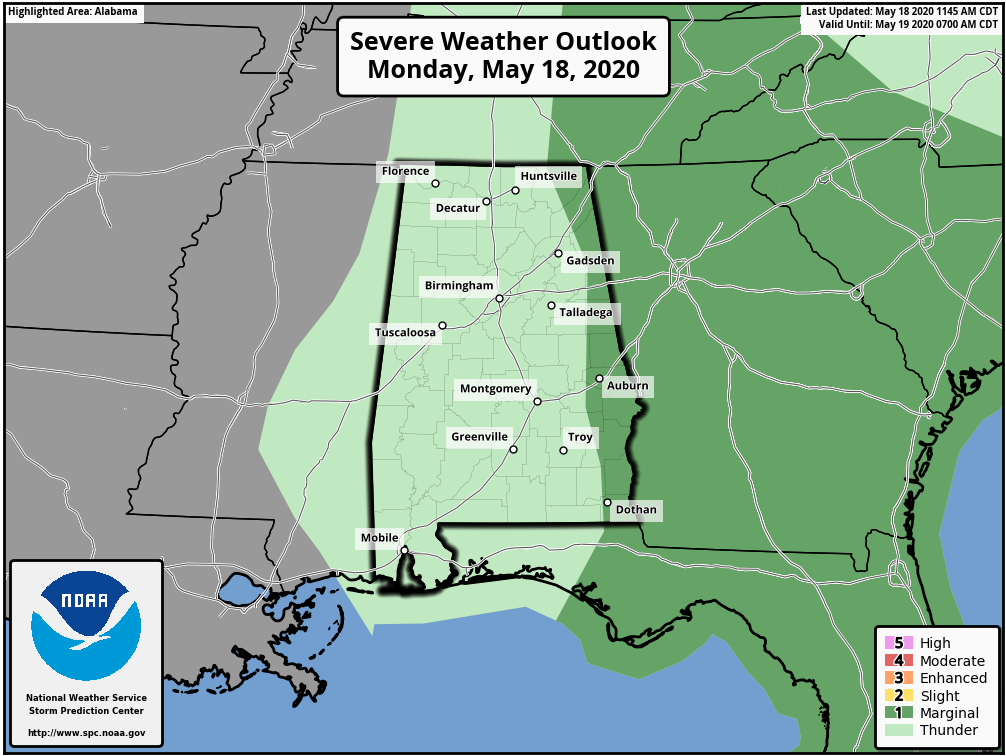
A few storms there could produce small hail and gusty winds through the evening hours. Scattered showers and storms will diminish late tonight.
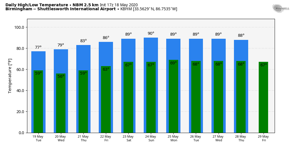
REST OF THE WEEK: We will have some risk of scattered showers and storms on a daily basis through Friday. The key word here is “scattered”… meaning some places will get wet, others won’t see a drop. While most of the showers will come during the afternoon and evening hours, we can’t rule out a few that linger into the late night hours. Highs will be in the mid to upper 70s tomorrow and Wednesday; then back into the low to mid 80s Thursday and Friday.
THE ALABAMA WEEKEND: Not much change. Partly sunny, warm days and mostly fair nights Saturday and Sunday with highs in the mid to upper 80s. A few spots will see a passing shower or storm both days, but they will be rather random, and mostly during the afternoon and evening hours.
NEXT WEEK: Not much change. The primary jet stream across North America will shift to the north, which you expect this time of the year, and we will have very warm, humid weather daily with highs well up in the 80s with some risk of “widely scattered, mostly afternoon and evening showers and thunderstorms” on a daily basis. See the Weather Xtreme video for maps, graphics, and more details.
EYES ON ARTHUR: Tropical Storm Arthur is packing sustains winds of 50 mph near the Outer Banks of North Carolina this afternoon… it will be moving out into the open Atlantic, away from land, tonight. The system is expected to become post-tropical by Wednesday, and loop around in the Atlantic well offshore later this week.
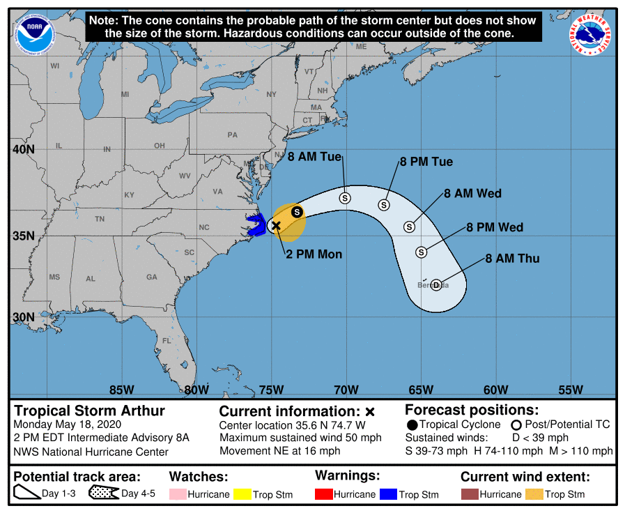
The rest of the Atlantic basin is quiet; the “official” start to the hurricane season comes on June 1.
ON THIS DAY IN 1980: Mount Saint Helens erupted, spewing ash and smoke sixty-three thousand feet into the air. Heavy ash covered the ground to the immediate northwest, and small particles were carried to the Atlantic coast.
BEACH FORECAST: Click here to see the AlabamaWx Beach Forecast Center page.
WEATHER BRAINS: Don’t forget you can listen to our weekly 90 minute show anytime on your favorite podcast app. This is the show all about weather featuring many familiar voices, including our meteorologists here at ABC 33/40.
CONNECT: You can find me on all of the major social networks…
Facebook
Twitter
Instagram
Pinterest
Snapchat: spannwx
Look for the next Weather Xtreme video here by 7:00 a.m. tomorrow…
Category: Alabama's Weather, ALL POSTS, Weather Xtreme Videos
About the Author (Author Profile)
James Spann is one of the most recognized and trusted television meteorologists in the industry. He holds the AMS CCM designation and television seals from the AMS and NWA. He is a past winner of the Broadcast Meteorologist of the Year from both professional organizations.Subscribe
If you enjoyed this article, subscribe to receive more just like it.


