Hot and Humid; Cristobal Continues North
THE REST OF TODAY: Much of North/Central Alabama is seeing a mix of sun and clouds today, while down south, more and more clouds are pushing north into Alabama as moisture levels continue to rise in all levels of the atmosphere as Cristobal moves closer.
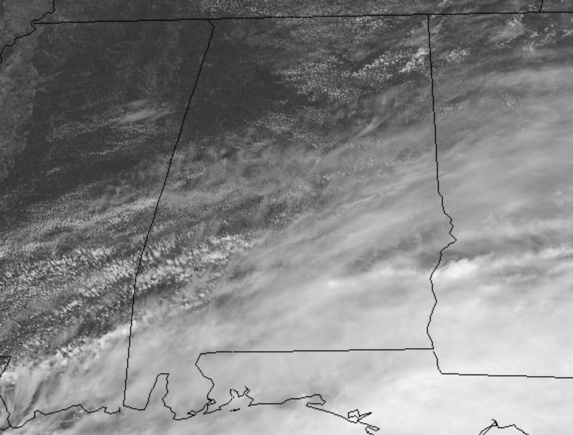
We will be seeing some scattered afternoon showers and storms across Central Alabama, but the better rain chances today are down to the south, where early this afternoon we are seeing some rain and storms.
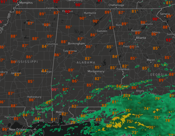
For the northern half of the state, it should remain mainly dry, and the northern half of the state will actually be hotter due to more sun. Highs this afternoon will be in the upper 80s and lower 90s, while to the south, many spots hold in the mid 80s. Tonight, isolated showers and storms will remain possible, but again, the best chance for these will be south of Interstate 20. Lows tonight will be in the lower 70s.
FOR TOMORROW: Again it will be another very muggy day, with a mix of sun and clouds, and highs on wither side of 90s. Rain chances will be hit or miss for the northern half of the state, while the southern half to the state will be dealing with occasional showers and storms, and breezier conditions as the impacts of Cristobal are felt.
LATEST ON CRISTOBAL: WEATHER CONDITIONS SHOULD DETERIORATE ALONG THE NORTHERN GULF COAST TONIGHT…
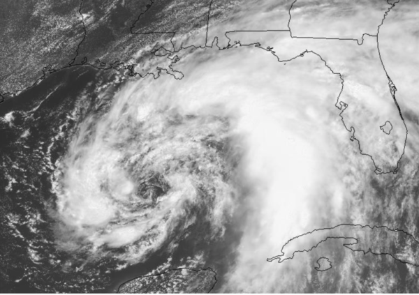
As of the 1PM update, Cristobal continues its northward journey through the Gulf where it will be making landfall along the southeast Louisiana Coast tomorrow night. The center of Tropical Storm Cristobal was located near latitude 24.7 North, longitude 90.2 West. Cristobal is moving toward the north near 12 mph, and this general motion is expected to continue, followed by a gradual turn toward the north-northwest. On the forecast track, the center of Cristobal will move northward over the central Gulf of Mexico today and tonight, and will be near the northern Gulf of Mexico coast on Sunday. Cristobal’s center is then forecast to move inland across Louisiana late Sunday through Monday morning, and northward across Arkansas and Missouri Monday afternoon into Tuesday.
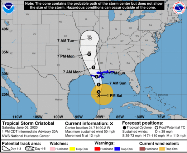
Maximum sustained winds are near 50 mph with higher gusts. Some slow strengthening is forecast
the northern Gulf coast. Weakening will begin once Cristobal moves inland late Sunday and Monday. Tropical-storm-force winds extend outward up to 240 miles from the center. The minimum central pressure estimated from Air Force Hurricane Hunter aircraft observations is 994 mb (29.36 inches).
IMPACT FORECAST ALONG THE NORTHERN GULF COAST:
STORM SURGE: The combination of a dangerous storm surge and the tide will cause normally dry areas near the coast to be flooded by rising waters moving inland from the shoreline. The water could reach the following heights above ground somewhere in the indicated areas if the peak surge occurs at the time of high tide…
Mouth of the Mississippi River to Ocean Springs MS including Lake Borgne…3-5 ft Morgan City LA to Mouth of the Mississippi River…2-4 ft Ocean Springs MS to Marco Island FL including Mobile Bay, Pensacola Bay, and Tampa Bay…1-3 ft
The deepest water will occur along the immediate coast in areas of onshore winds and will likely extend along the coast well to the east of the center. Surge-related flooding depends on the relative timing of the surge and the tidal cycle, and can vary greatly over short distances.
WIND: Tropical storm conditions are expected within the Tropical Storm Warning area along the northern Gulf Coast beginning late tonight or Sunday morning.
RAINFALL: Cristobal is expected to produce total rainfall accumulations of 4 to 8 inches across the eastern and central Gulf Coast into the Lower Mississippi Valley, with isolated amounts to 12 inches. Isolated significant river flooding is possible along the central Gulf Coast. Rainfall totals of 2 to 4 inches, with local amounts to 6 inches, are expected across the Mid-Mississippi Valley. This rainfall may lead to flash flooding and widespread flooding on smaller streams across the Lower to Mid-Mississippi Valley.
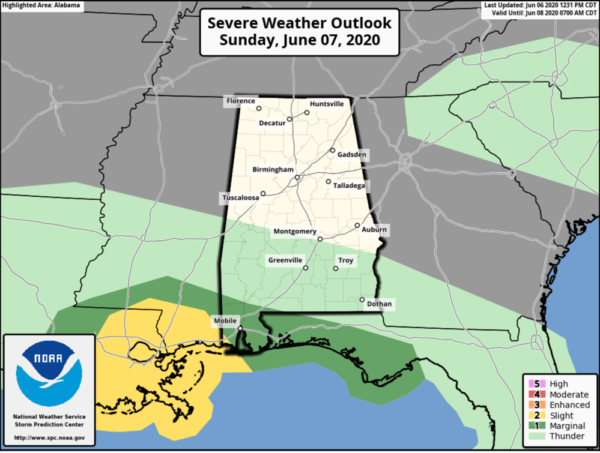
TORNADOES: A few tornadoes may occur on Sunday across southern Louisiana, southern Mississippi, southwest Alabama and the western Florida Panhandle.
SURF: Swells generated by Cristobal will affect portions of the northern and eastern Gulf coast during the next few days. These swells are likely to cause life-threatening surf and rip current conditions.
BEACH FORECAST CENTER: Get the latest weather and rip current forecasts for the beaches from Fort Morgan to Panama City on our Beach Forecast Center page. There, you can select the forecast of the region that you are interested in visiting.
WORLD TEMPERATURE EXTREMES: Over the last 24 hours, the highest observation outside the U.S. was 118.8F at Al Ain International Airport, United Arab Emirates. The lowest observation was -99.9F at University Dome, Antarctica.
CONTIGUOUS TEMPERATURE EXTREMES: Over the last 24 hours, the highest observation was 114F at Death Valley, CA. The lowest observation was 26F at Cabin Lake, OR.
WEATHER ON THIS DATE IN 1816: The temperature reached 92 degrees at Salem MA during an early heat wave, but then plunged 49 degrees in 24 hours to commence the famous year without a summer .
Category: Alabama's Weather, ALL POSTS
About the Author (Author Profile)
Macon, Georgia Television Chief Meteorologist, Birmingham native, and long time Contributor on AlabamaWX. Stormchaser. I did not choose Weather, it chose Me. College Football Fanatic. @Ryan_StinnetSubscribe
If you enjoyed this article, subscribe to receive more just like it.


