

Scattered Showers/Storms Though Wednesday, Then Much Drier Air Arrives
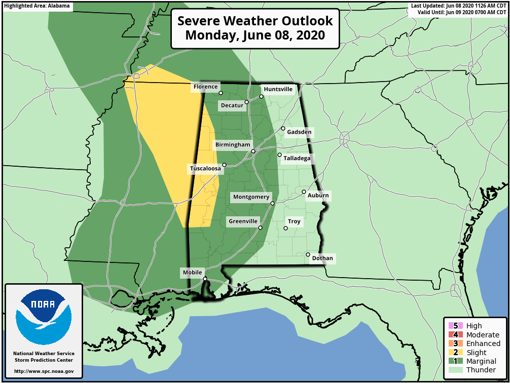
RADAR CHECK: Bands of showers along with a few thunderstorms continue to rotate through Alabama this afternoon, on the east side of the circulation of Tropical Storm Cristobal, which is now over southern Arkansas. Potential exists for a brief tornado or two over North Mississippi or Northwest Alabama through the evening hours, but it is a fairly low-end threat.
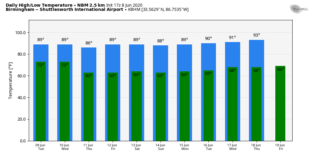
A very moist airmass will stay in place over the next few days; scattered showers and storms remain possible tomorrow. Otherwise, the day will be warm and very humid with a mix of sun and clouds along with a high in the mid to upper 80s.
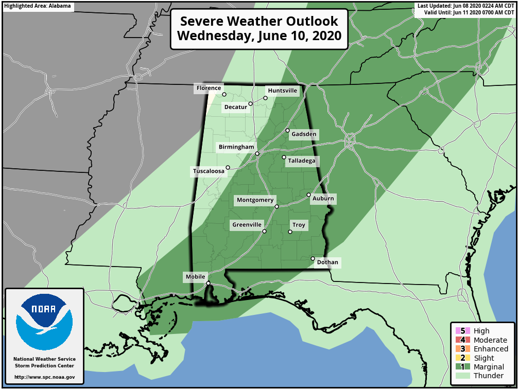
A rare June cold front will push into the state Wednesday, and a few storms ahead of the front could be strong with gusty winds. SPC has a decent part of the state in a low end, “marginal risk” (level 1/5) of severe thunderstorms for this potential.
THURSDAY THROUGH THE WEEKEND: A very dry air mass pushes into the state Wednesday night, and Thursday and Friday will be very pleasant days for June. Expect a good supply of sunshine, lower humidity, and cooler nights. Highs will hold in the 80s, but lows will be well down in the 60s and cooler spots will hit the upper 50s.
Not much change for the weekend as dry air hangs in here; the sky will be mostly sunny Saturday and Sunday with highs in the 80s and lows in the 58-62 degree range.
NEXT WEEK: Moist air begins to return early in the week, and we will bring back the chance of scattered showers and thunderstorms Monday, and keep it in the forecast on a daily basis through the end of the week. Highs will be in the upper 80s most days… See the Weather Xtreme video for maps, graphics, and more details.
TROPICS: Tropical Depression Cristobal is over Arkansas and continues to weaken; the rest of the Atlantic basin is quiet and tropical storm formation is not expected this week.
ON THIS DATE IN 2001: Tropical Storm Allison hits Houston, Texas, for the second time in three days. Louisiana and southern Texas were inundated with rain. Baton Rouge received 18 inches over just a couple of days. Some portions of Texas racked up 36 inches by June 11.
BEACH FORECAST: Click here to see the AlabamaWx Beach Forecast Center page.
WEATHER BRAINS: Don’t forget you can listen to our weekly 90 minute show anytime on your favorite podcast app. This is the show all about weather featuring many familiar voices, including our meteorologists here at ABC 33/40.
CONNECT: You can find me on all of the major social networks…
Facebook
Twitter
Instagram
Pinterest
Snapchat: spannwx
Look for the next Weather Xtreme video here by 7:00 a.m. tomorrow…
Category: Alabama's Weather, ALL POSTS, Weather Xtreme Videos
About the Author (Author Profile)
James Spann is one of the most recognized and trusted television meteorologists in the industry. He holds the AMS CCM designation and television seals from the AMS and NWA. He is a past winner of the Broadcast Meteorologist of the Year from both professional organizations.Subscribe
If you enjoyed this article, subscribe to receive more just like it.


