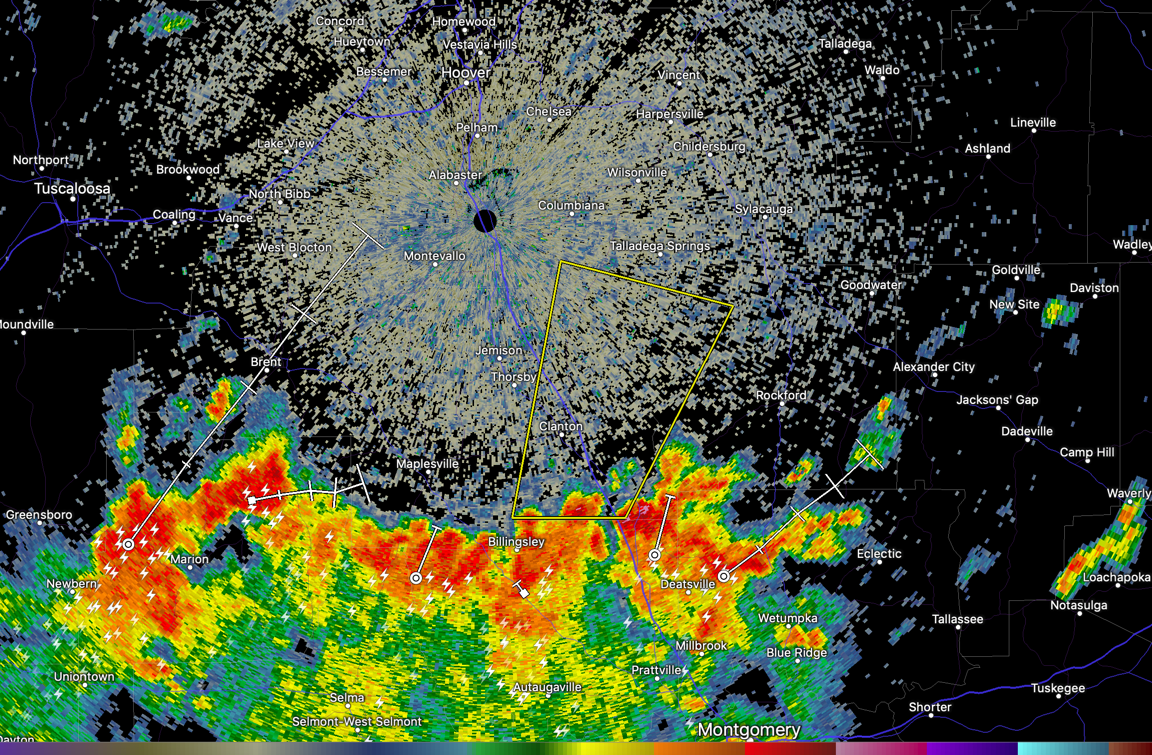
Severe Thunderstorm Warning for Parts of Chilton, Shelby, and Coosa Counties until 2 p.m.
The National Weather Service in Birmingham has issued a
* Severe Thunderstorm Warning for…
Eastern Chilton County in central Alabama…
South central Shelby County in central Alabama…
Northwestern Coosa County in east central Alabama…
* Until 200 PM CDT.
* At 119 PM CDT, a severe thunderstorm was located near Pooles
Crossroads, or 7 miles south of Clanton, moving north at 35 mph.
HAZARD…60 mph wind gusts.
SOURCE…Radar indicated.
IMPACT…Expect damage to roofs, siding, and trees.
* Locations impacted include…
Clanton, Mitchell Lake, Dollar, Gap Of The Mountain, Lay Lake Dam,
Unity, Marble Valley, Higgins Ferry Park, Verbena, Lay Lake, Lomax,
Waxahatchee Creek, Highway 145 and CR 46, Paint Creek, I 65 Rest
Area, Spring Creek and Cooper.
Category: Alabama's Weather, ALL POSTS, Severe Weather
About the Author (Author Profile)
Bill Murray is the President of The Weather Factory. He is the site's official weather historian and a weekend forecaster. He also anchors the site's severe weather coverage. Bill Murray is the proud holder of National Weather Association Digital Seal #0001 @wxhistorianSubscribe
If you enjoyed this article, subscribe to receive more just like it.


