Sun And Scattered Thunderstorms
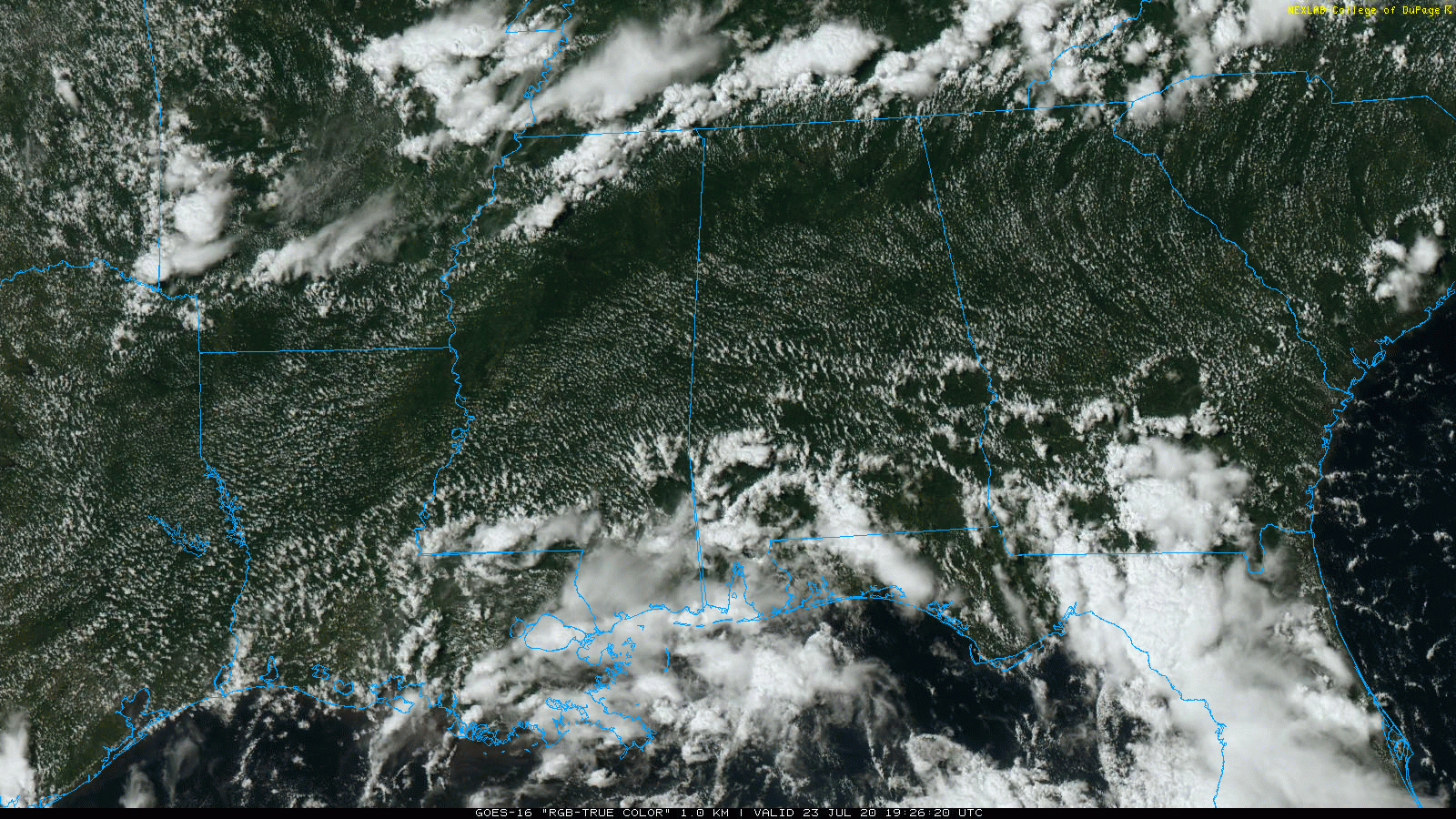
RADAR CHECK: So far today, most of the showers and storms across Alabama have been over the southern half of the state. North Alabama is mostly sunny with temperatures in the low 90s, right at seasonal averages for late July. Some of the showers over South Alabama will work their way northward this evening before dissipating.
A few storms with heavy rain have been moving along the Gulf Coast today, on the northern periphery of the tropical depression in the Gulf.
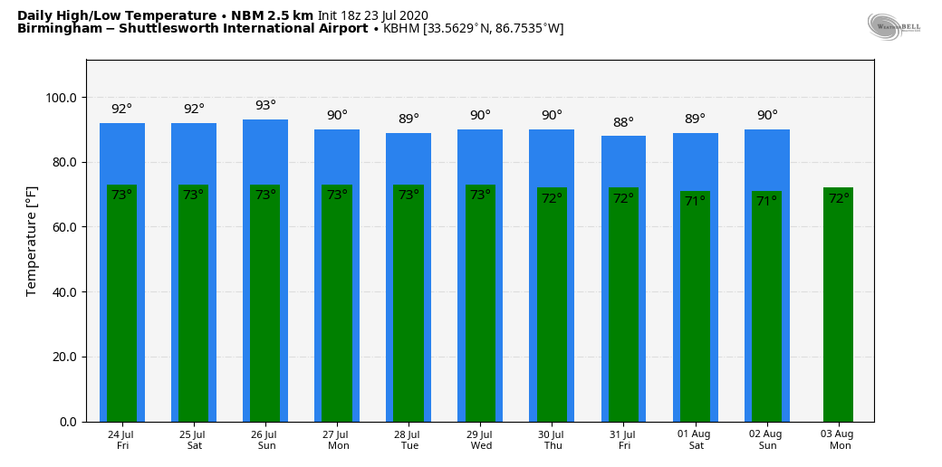
TOMORROW THROUGH THE WEEKEND: Not much weather change; partly sunny days with the risk of a few scattered, mostly afternoon and evening showers and thunderstorms on a daily basis. Odds of any one spot getting wet will be around 30 percent each day, and highs will be close to 90 degrees as heat levels back down a bit across the Deep South.
NEXT WEEK: Sure looks like showers and thunderstorms will become more numerous across Alabama through much of next week as colder air aloft makes the air more unstable. We expect scattered to numerous showers and thunderstorms each day with highs between 87 and 91 degrees. See the Weather Xtreme video for maps, graphics, and more details.
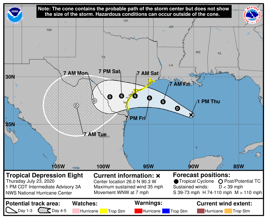
TROPICAL DEPRESSION EIGHT: The tropical depression continues to move westward across the Gulf of Mexico, and is expected to become Tropical Storm Hanna late tonight or tomorrow morning. Landfall comes Saturday morning along the Texas coast; the main impact will be potential for heavy rain and flooding over South Texas. The rip current danger along the Central Gulf Coast will ease by the weekend as the tropical system moves inland over Texas.
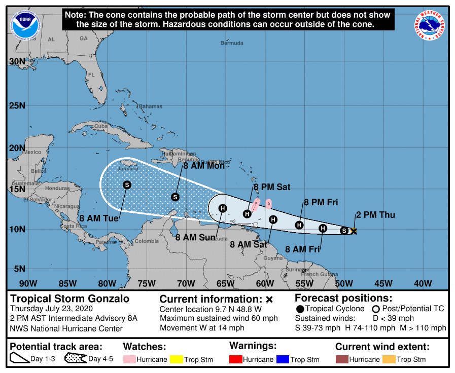
TROPICAL STORM GONZALO: This one is about 850 miles east of the Windward Islands in the open Atlantic with sustained winds of 60 mph. The compact system has looked rather disorganized on satellite images today, and it is fighting lots of dry air. NHC is currently forecasting it to move through the Windward Islands Saturday afternoon, and then into the open Caribbean. This is a very low confidence intensity forecast; the system could dissipate entirely, or it could hold together through the Caribbean as a tropical storm. Still way too early to know if this will impact the U.S.
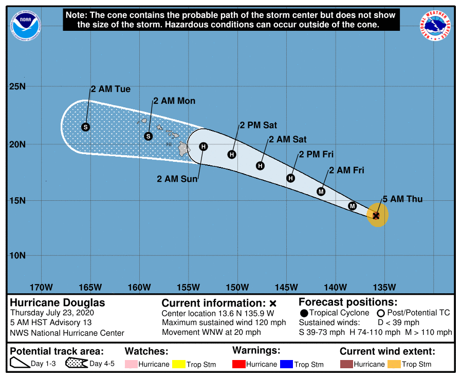
HURRICANE DOUGLAS: Over in the Pacific, Douglas is a major hurricane with winds of 120 mph; it will move over the Hawaiian Islands over the weekend as it weakens to a tropical storm. Still, the islands will see strong winds and heavy rain with potential for some flooding.
ON THIS DATE IN 1788: Called the George Washington’s Hurricane, this storm originated near Bermuda on the 19th before making landfall in Virginia. It passed directly over the Lower Chesapeake Bay and Mount Vernon, the home of George Washington. This track is very similar to the path of the Chesapeake-Potomac hurricane of 1933. At Norfolk, winds increased at 5 p.m. on the 23rd with the wind originating from the northeast. At 12:30 a.m., the wind suddenly shifted to the south and “blew a perfect hurricane, tearing down chimneys, fences”.
BEACH FORECAST: Click here to see the AlabamaWx Beach Forecast Center page.
WEATHER BRAINS: Don’t forget you can listen to our weekly 90 minute show anytime on your favorite podcast app. This is the show all about weather featuring many familiar voices, including our meteorologists here at ABC 33/40.
CONNECT: You can find me on all of the major social networks…
Facebook
Twitter
Instagram
Pinterest
Snapchat: spannwx
Look for the next Weather Xtreme video here by 7:00 a.m. tomorrow…
Category: Alabama's Weather, ALL POSTS, Weather Xtreme Videos
About the Author (Author Profile)
James Spann is one of the most recognized and trusted television meteorologists in the industry. He holds the AMS CCM designation and television seals from the AMS and NWA. He is a past winner of the Broadcast Meteorologist of the Year from both professional organizations.Subscribe
If you enjoyed this article, subscribe to receive more just like it.


