Sun And Scattered Storms Over The Weekend
CLASSIC SUMMER WEATHER CONTINUES: A very humid, tropical airmass lingers over Alabama today, and we have scattered showers and thunderstorms in progress. They are most numerous over the southern half of the state at mid-afternoon, but should increase over the northern counties through the evening hours in the unstable air. Temperatures are generally in the mid to upper 80s; the average high for Birmingham on July 24 is 91. Showers and storms will fade late tonight as the air cools and becomes more stable.
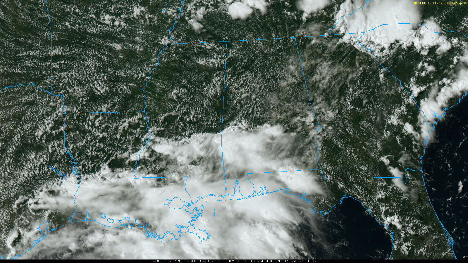
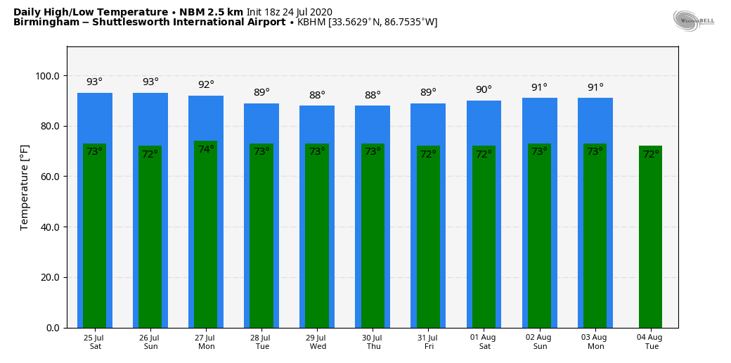
THE ALABAMA WEEKEND: Not much change. Partly sunny days, very humid, highs between 87 and 91, and “scattered, mostly afternoon and evening showers and thunderstorms”. Chance of any one place seeing rain both days around 30 percent, and most of the showers will come from about 1:00 until 9:00 p.m. No way of knowing in advance exactly when and where they form; you just have to watch radar trends.
NEXT WEEK: The upper ridge over the region weakens, and with colder air aloft the air will be more unstable, and we expect rather unsettled weather through the week with scattered to numerous showers and thunderstorms on a daily basis. Highs will remain below average, generally in the 86 to 90 degree range. See the Weather Xtreme video for maps, graphics, and more details.
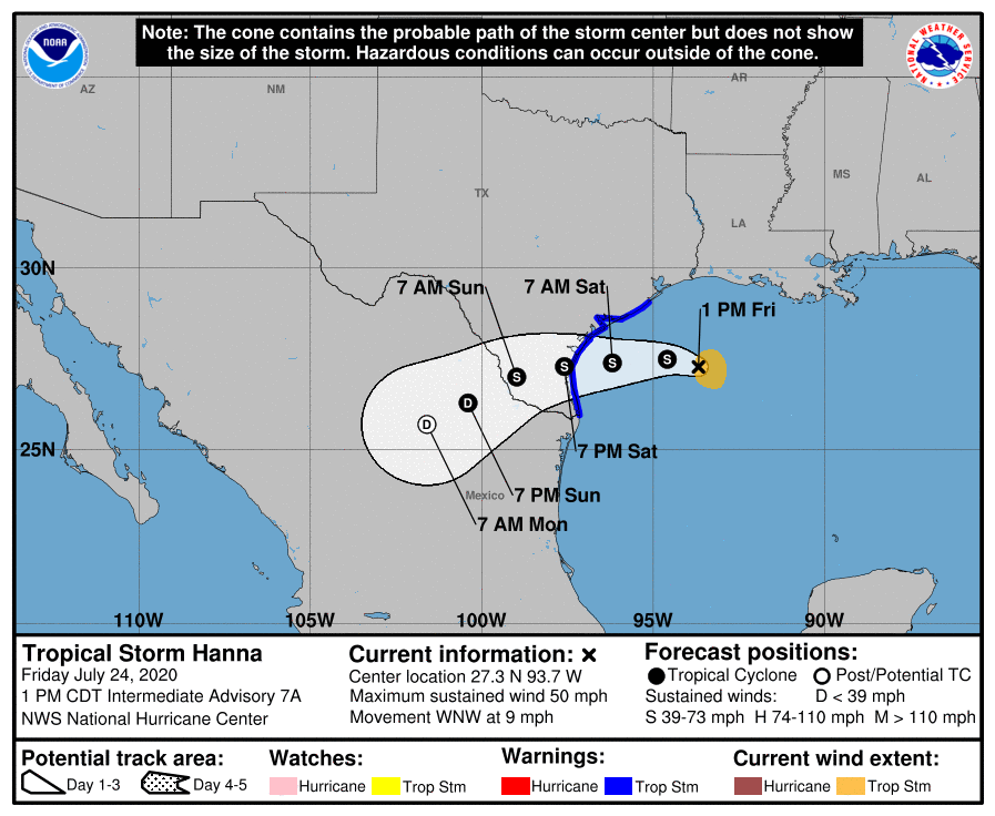
TROPICAL STORM HANNA: Hanna features sustained winds of 50 mph in the Gulf; the center is about 230 miles east of Corpus Christi. Landfall comes on the lower Texas coast tomorrow; the main inland impact will come from heavy rain and flooding; some spots could see amounts of 5-10 inches over the weekend. Hanna will dissipate early next week over northern Mexico.
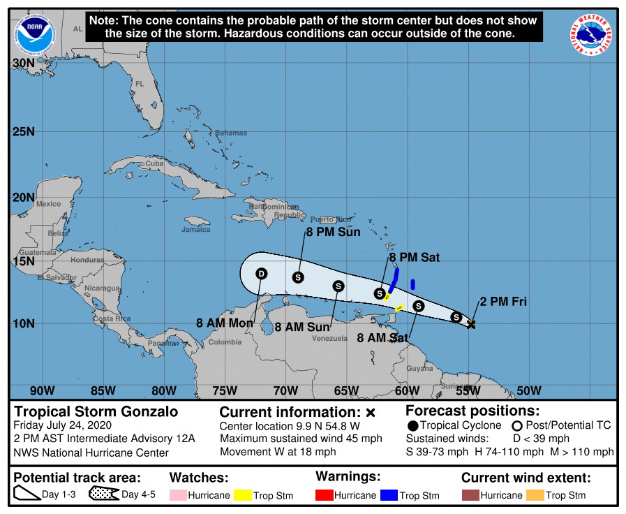
TROPICAL STORM GONZALO: This one, centered about 445 miles east of the Windward Islands in the Atlantic, is struggling due to it’s small size and dry air. Winds are down to 45 mph, and it is expected to dissipate by Monday morning over the Caribbean well before getting close to the Gulf of Mexico.
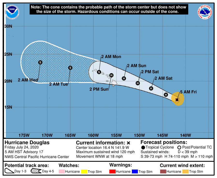
HURRICANE DOUGLAS: This hurricane in the Pacific has sustained winds of 120 mph, and will continue to weaken over the next few days. It moves over the Hawaiian Islands Sunday, and will bring strong winds and heavy rain.
INVEST 92L: And, Invest 92L is a well organized wave in the far eastern Atlantic. The disturbance is expected move westward across the tropical Atlantic during the next several days, and some gradual development of this system is possible by early next week when it reaches the western tropical Atlantic. A decent chance this becomes Tropical Storm “Isaias”. Just one to watch for now.
ON THIS DATE IN 1952: The temperature at Louisville, Georgia soared to 112 degrees to establish a state record. The temperature also hit 112 degrees in Greenville, Georgia on August 20, 1983.
BEACH FORECAST: Click here to see the AlabamaWx Beach Forecast Center page.
WEATHER BRAINS: Don’t forget you can listen to our weekly 90 minute show anytime on your favorite podcast app. This is the show all about weather featuring many familiar voices, including our meteorologists here at ABC 33/40.
CONNECT: You can find me on all of the major social networks…
Facebook
Twitter
Instagram
Pinterest
Snapchat: spannwx
Look for my next Weather Xtreme video here by 7:00 a.m. Monday… enjoy the weekend!
Category: Alabama's Weather, ALL POSTS, Weather Xtreme Videos
About the Author (Author Profile)
James Spann is one of the most recognized and trusted television meteorologists in the industry. He holds the AMS CCM designation and television seals from the AMS and NWA. He is a past winner of the Broadcast Meteorologist of the Year from both professional organizations.Subscribe
If you enjoyed this article, subscribe to receive more just like it.


