

Flooding, Severe Weather Threat Increasing Along the Coast
Here is the situation along the northern Gulf Coast as of 11;20 this morning:
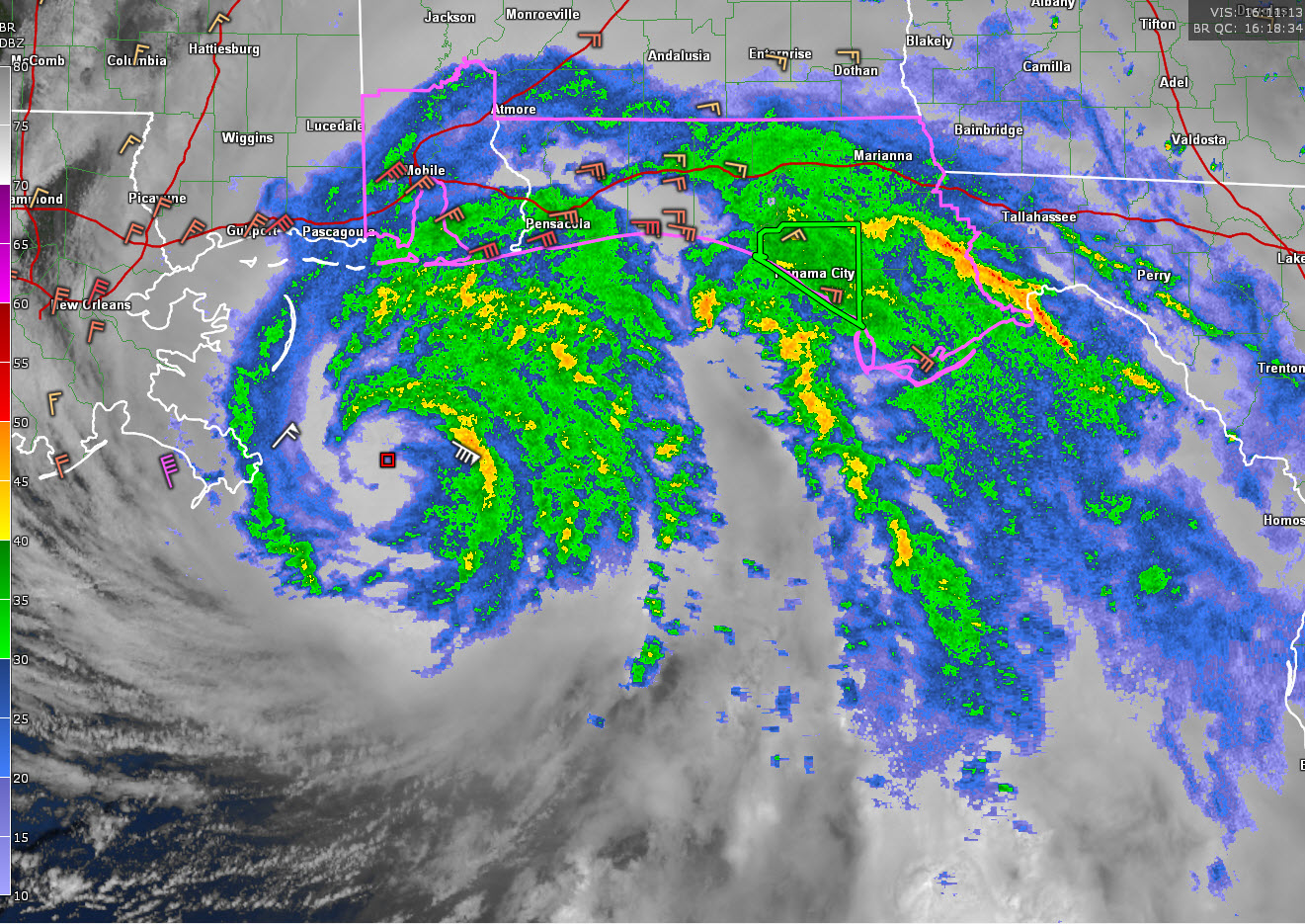
The outer rainbands associated with Hurricane Sally extend across Coastal Alabama and Northwest Florida now extending up into extreme South Alabama.
Enhanced moisture convergence along with strengthening shear and modest instability will allow for bands of low topped supercells to continue rotating northwestward through the morning hours. These storms will bring enhanced rainfall rates and an increased tornado threat.
A tornado watch is shown on the map outlined in pink.
The threat for flash flooding will also be on the increase. 2-3 inches of rain has already fallen and rainfall amounts in the feeder band are approaching 1-2 inches per hour. A flash flood warning has just been issued for Bay County, including Panama City.
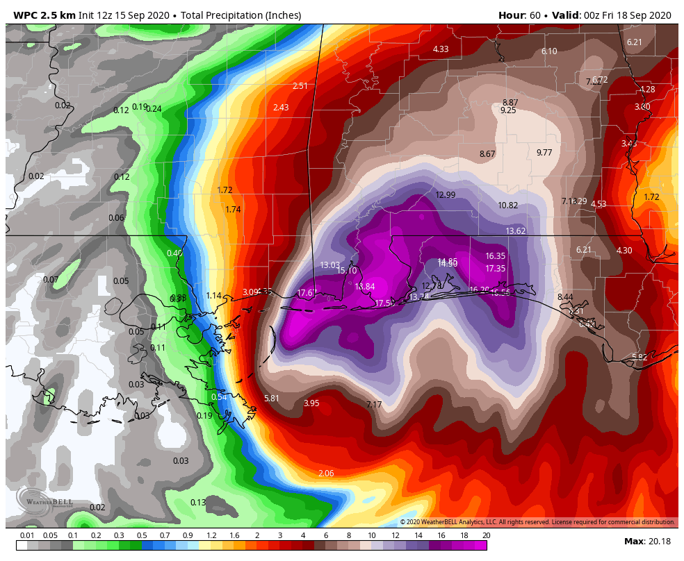
Here are expected rainfall amounts across Coastal Alabama and Northwest Florida from the Weather Prediction Center. These will of course cause tremendous flooding.
Sustained winds are also increasing and will average from 30 to 40 mph, with gusts up to 50 mph along the beaches and coastal areas mainly along and south of I-10 through this afternoon.
Stronger winds and an increased flood and tornado threat will expand further inland later today and tonight.
The Causeway to Dauphin Island is now officially closed. The tides are now 2.5 feet above normal there. Lots of surge flooding being reported.
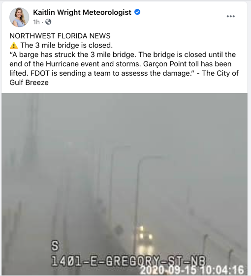
Pensacola’s Three Mile Bridge is closing and there are reports that a barge struck it. No reports on damage.
Category: Alabama's Weather, ALL POSTS, Tropical
About the Author (Author Profile)
Bill Murray is the President of The Weather Factory. He is the site's official weather historian and a weekend forecaster. He also anchors the site's severe weather coverage. Bill Murray is the proud holder of National Weather Association Digital Seal #0001 @wxhistorianSubscribe
If you enjoyed this article, subscribe to receive more just like it.


