Dry Weekend Ahead With A Cooling Trend
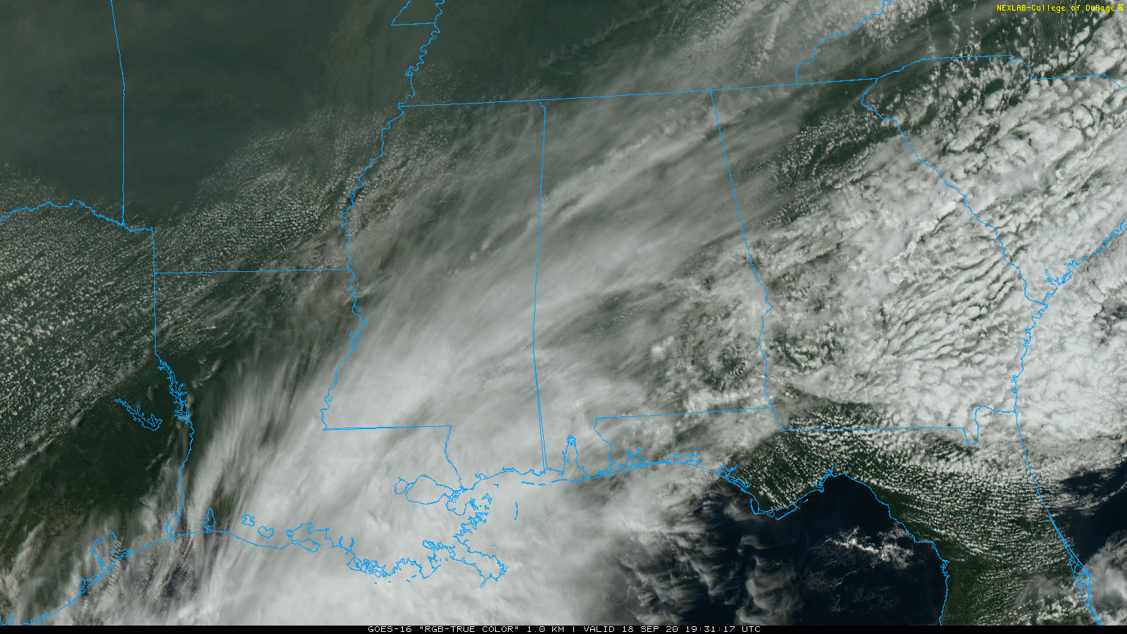
THIS AFTERNOON: A canopy of cirrus clouds is over Alabama this afternoon, streaming into the state from Tropical Depression 22 in the western Gulf of Mexico. We note some patchy light rain over the southwest corner of the state, otherwise it is a dry afternoon with temperatures in the upper 70s and low 80s for most places.
THE ALABAMA WEEKEND: While a little patchy light rain is possible near the coast tomorrow, most of the state will stay dry tomorrow. With a mix of sun and clouds, the high will be in the upper 70s. Then, on Sunday, expect a mostly sunny sky with a high between 77 and 81. Humidity values will lower, and nights will be cooler. We drop to near 60 degrees early Sunday, with 50s for cooler spots.
NEXT WEEK: Fine early fall weather is the story for the first half of the week. Look for sunny pleasant days and clear cool nights Monday through Wednesday; highs will in the 75-80 degree range, with lows mostly in the 50s. Colder valleys have a good chance of seeing upper 40s for the first time season early Tuesday and Wednesday morning. Clouds will increase Wednesday night, and we have amended the forecast to include a chance of rain Thursday and Friday due to a tropical system approaching from the west. How much rain we see is still unknown; there are more questions than answers about the system now. See the Weather Xtreme video for maps, graphics, and more details.
TROPICS: It has been quite a day for our friends at the National Hurricane Center (NHC)… they upgraded Invest 98L to Tropical Storm Wilfred in the eastern Atlantic, and also initiated advisories on Subtropical Storm Beta on the coast of Portugal. Beta is moving inland, and Wilfred is expected to remain weak, and ultimately dissipate early next week far from land.
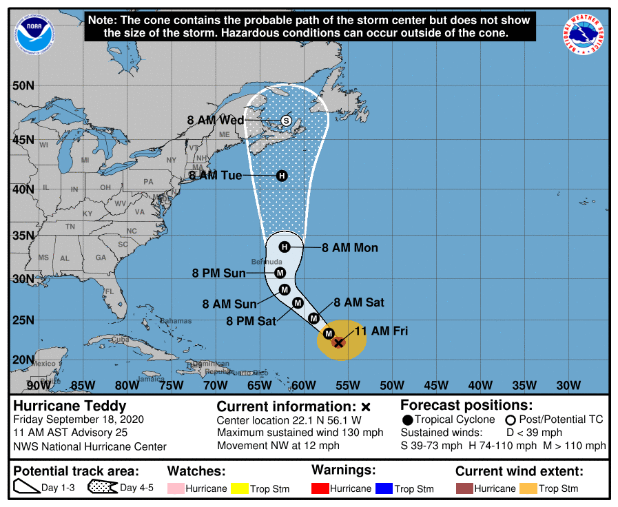
Teddy is a major hurricane in the middle of the Atlantic; the latest forecast track has it passing just east of Bermuda late Sunday night, and then moving into the Canadian Maritimes by Wednesday. It stays well east of the U.S.
Tropical Depression 22, in the Southwest Gulf of Mexico, is expected to be Tropical Storm Beta soon.
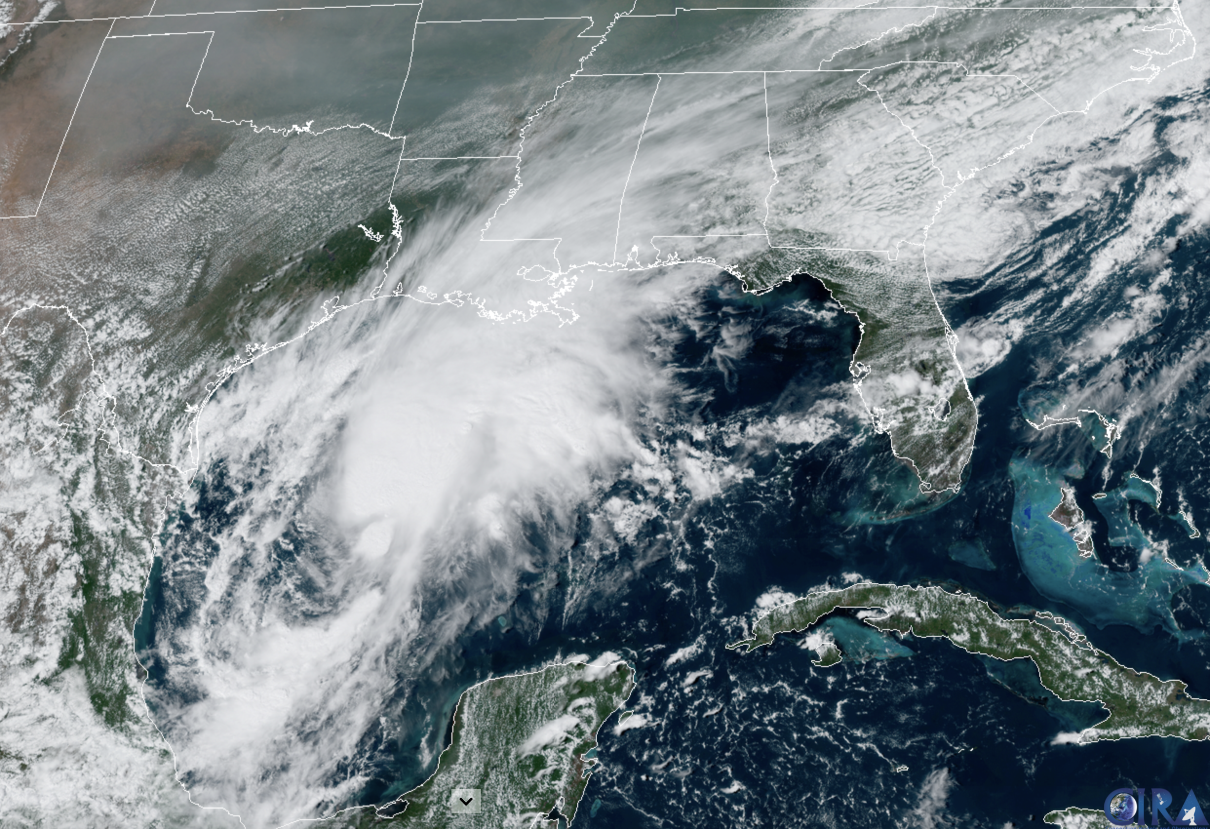
The latest NHC track has the system drifting to the north/northeast, followed by a sharp turn to the west tomorrow night. It briefly becomes a hurricane, before weakening again to a tropical storm as it approaches the Texas coast. And, before moving inland, it is forecast to turn north/northeast again Monday, moving parallel to the Texas coast.
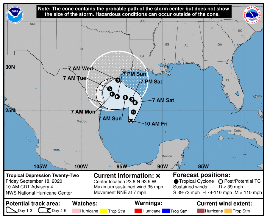
Confidence is increasing that this system will bring rain to much of Southeast Texas, Louisiana, and ultimately Mississippi in coming days. The rain shield could reach Alabama by Thursday and Friday of next week, but of course, there is considerable uncertainty this far out. In terms of intensity and impact, most likely this will just be a big rain-maker as opposed to a dangerous hurricane for places like Houston, Galveston, Port Arthur, and Lake Charles. As always, keep an eye on the forecast for changes. When it comes to tropical systems, if you are using old information, you are using bad information.
ON THIS DATE IN 1926: The great “Miami Hurricane” produced winds of 138 mph that drove ocean waters into the Biscayne Bay drowning 135 persons. The eye of the hurricane passed over Miami, at which time the barometric pressure reached 27.61 inches. Tides up to twelve feet high accompanied the storm, which claimed a total of 372 lives.
BEACH FORECAST: Click here to see the AlabamaWx Beach Forecast Center page.
WEATHER BRAINS: Don’t forget you can listen to our weekly 90 minute show anytime on your favorite podcast app. This is the show all about weather featuring many familiar voices, including our meteorologists here at ABC 33/40.
CONNECT: You can find me on all of the major social networks…
Facebook
Twitter
Instagram
Pinterest
Snapchat: spannwx
Look for my next Weather Xtreme video here by 7:00 a.m. Monday… enjoy the weekend!
Category: Alabama's Weather, ALL POSTS, Weather Xtreme Videos
About the Author (Author Profile)
James Spann is one of the most recognized and trusted television meteorologists in the industry. He holds the AMS CCM designation and television seals from the AMS and NWA. He is a past winner of the Broadcast Meteorologist of the Year from both professional organizations.Subscribe
If you enjoyed this article, subscribe to receive more just like it.


