Gamma Forecast to Strengthen Before Landfall in the Yucatan Peninsula on Saturday
SUMMARY AS OF 10:00 PM
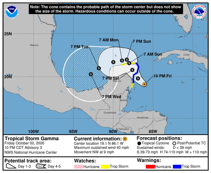
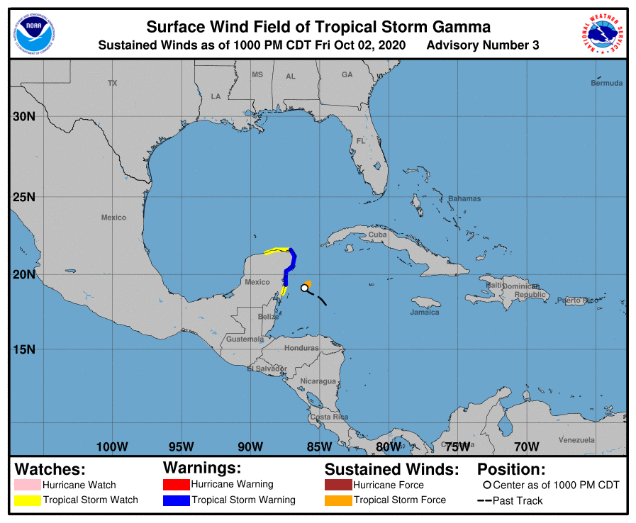
LOCATION…19.1N 86.1W
ABOUT 110 MI…175 KM SSE OF COZUMEL MEXICO
MAXIMUM SUSTAINED WINDS…40 MPH…65 KM/H
PRESENT MOVEMENT…NW OR 315 DEGREES AT 9 MPH…15 KM/H
MINIMUM CENTRAL PRESSURE…998 MB…29.47 INCHES
KEY MESSAGES
Gamma is expected to produce heavy rainfall that could result in life-threatening flash flooding over portions of the Yucatan Peninsula, far western Cuba, and well away from the center in the Mexican states of Campeche, Tabasco, and northern Chiapas.
Gamma is forecast to bring tropical storm conditions to portions of the Yucatan Peninsula on Saturday, where a Tropical Storm Warning is in effect.
WATCHES & WARNINGS
A Tropical Storm Warning is in effect for…
• Punta Herrero to Cabo Catoche
A Tropical Storm Watch is in effect for…
• South of Punta Herrero to Puerto Costa Maya
• West of Cabo Catoche to Dzilam
DISCUSSION & HAZARDS
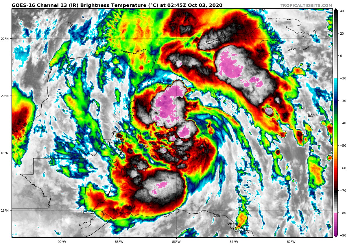
At 1000 PM CDT (0300 UTC), the center of Tropical Storm Gamma was located near latitude 19.1 North, longitude 86.1 West, or about 110 miles south-southeast of Cozumel, Mexico. Gamma is moving toward the northwest near 9 mph (15 km/h). A slower northwestward motion is expected during the next couple of days, followed by a turn to the west or west-southwest. On the forecast track, the center of Gamma should be near the northeastern Yucatan Peninsula on Saturday.
Maximum sustained winds are near 40 mph (65 km/h) with higher gusts. Some strengthening is expected before Gamma moves inland over the northeastern Yucatan Peninsula on Saturday. After landfall, slight weakening or little change in strength is expected. Tropical-storm-force winds extend outward up to 45 miles (75 km) from the center. The estimated minimum central pressure based on data from the Air Force Hurricane Hunters is 998 MB (29.47 inches).
Gamma is expected to produce rainfall of 4 to 8 inches across portions of the Yucatan Peninsula and far western Cuba, with maximum rainfall amounts as high as 10 to 15 inches possible across the northeastern portion of the Mexican state of Quintana Roo. This rainfall may produce life-threatening flash floods. A separate area of significant rain is expected to develop well away from the center in the Mexican states of Campeche, Tabasco, and northern Chiapas with rainfall of 8 to 12 inches and isolated maximum amounts of 20 inches. This rainfall may produce life-threatening flash floods and mudslides. Rainfall of 1 to 3 inches with maximum amounts of 5 inches is expected in the Bay Islands of Honduras and over the Cayman Islands.
Tropical storm conditions are expected within the Tropical Storm Warning area by Saturday morning and are possible within the Tropical Storm Watch area on Saturday and Sunday.
Info from the 10:00 pm update from the National Hurricane Center.
About the Author (Author Profile)
Scott Martin is an operational meteorologist, professional graphic artist, musician, husband, and father. Not only is Scott a member of the National Weather Association, but he is also the Central Alabama Chapter of the NWA president. Scott is also the co-founder of Racecast Weather, which provides forecasts for many racing series across the USA. He also supplies forecasts for the BassMaster Elite Series events including the BassMaster Classic.Subscribe
If you enjoyed this article, subscribe to receive more just like it.


