Just Like Spring This Afternoon
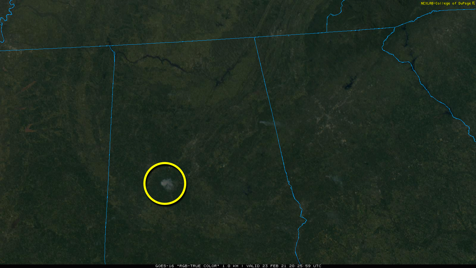
WARM WINTER DAY: One week ago, snow was on the ground across much of North and West Alabama… but today temperatures have exceeded 70 degrees with sunshine in full supply. About the only thing we see on satellite images this afternoon is a large smoke plume south/southeast of Tuscaloosa; most likely a prescribed burn in the Talladega National Forest.
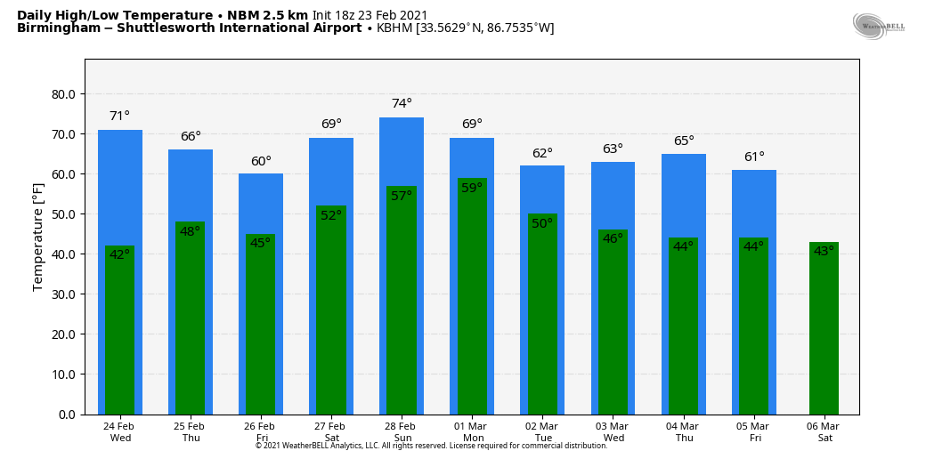
We expect little change tomorrow; lots of sun with a mild afternoon… highs will be mostly in the low 70s.
THURSDAY/FRIDAY: While most of the day Thursday will be dry with only isolated showers… a surface front will drift down into far North Alabama, and periods of rain are likely Thursday night into Friday morning. There could be a rumble of thunder in a few spots, but severe storms are not expected. The high Thursday will be in the mid to upper 60s, followed by mid to upper 50s Friday as the front sags southward.
THE ALABAMA WEEKEND: The front moves northward as a warm front, and will be near the Tennessee state line Saturday. The most widespread rain Saturday will be over Tennessee and Kentucky, with only isolated showers over Alabama. It will be a mostly cloudy day with a high in the low 70s. Sunday’s high will be in the mid 70s… the sky will be mostly cloudy with scattered showers possible. But again, the most widespread rain should be just north of Alabama.
NEXT WEEK: That surface front will meander around Alabama through much of the week, so there will be periods of showery weather, but on the positive side temperatures will remain mild with highs mostly in the 60s and lows in the 40s. Still no sign of any severe thunderstorm threat, or high impact weather event for Alabama for the next seven to ten days. See the Weather Xtreme video for maps, graphics, and more details.
ON THIS DATE IN 1975: The F4 tornado that struck Tuscaloosa on February 23, 1975 just before 2 p.m. CST was not only the strongest tornado that struck the State of Alabama that year, it was the deadliest. The tornado first touched down in the Taylorville community and then skipped northeastward before hitting the Skyland Park area and moving on to the McFarland Blvd. exit area of I-59/20. It went on to affect parts of the Alberta City-Leland Park area and then touched down in Holt.
The official path length was 14.4 miles. Along it, 289 homes were destroyed or heavily damaged, along with 20 businesses and 21 mobile homes. The tornado nearly destroyed the new Scottish Inn motel on I-59 at McFarland. The fatality was a 23 year old housekeeper named Thelma Hill, killed when most of the second floor of the motel was sheared away by the tornado causing a wall to fall on her.
BEACH FORECAST: Click here to see the AlabamaWx Beach Forecast Center page.
WEATHER BRAINS: Don’t forget you can listen to our weekly 90 minute show anytime on your favorite podcast app. This is the show all about weather featuring many familiar voices, including our meteorologists here at ABC 33/40.
CONNECT: You can find me on all of the major social networks…
Look for the next Weather Xtreme video here by 6:00 a.m. tomorrow…
Category: Alabama's Weather, ALL POSTS, Weather Xtreme Videos
About the Author (Author Profile)
James Spann is one of the most recognized and trusted television meteorologists in the industry. He holds the AMS CCM designation and television seals from the AMS and NWA. He is a past winner of the Broadcast Meteorologist of the Year from both professional organizations.Subscribe
If you enjoyed this article, subscribe to receive more just like it.


