CANCELED – Flash Flood Warning Extended Until 1:45 pm for Blount, Walker, & Winston Co.
The National Weather Service in Birmingham has extended the
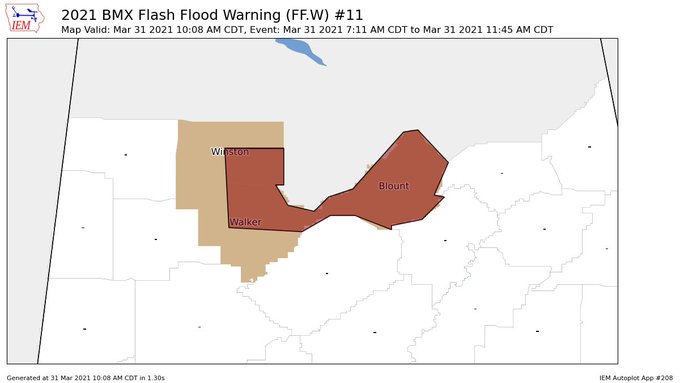
* Flash Flood Warning for…
Blount County in central Alabama…
Northeastern Walker County in central Alabama…
Southeastern Winston County in northwestern Alabama…
* Until 145 PM CDT.
* At 1008 AM CDT, Continuous rainfall across the area has caused
many streams and creeks to overflow. Flash flooding is ongoing or
expected to begin shortly.
HAZARD…Flash flooding caused by thunderstorms.
SOURCE…Doppler radar and automated gauges.
IMPACT…Flooding of small creeks and streams, urban areas,
highways, streets and underpasses as well as other
drainage and low lying areas.
* Some locations that will experience flash flooding include…
Jasper, Oneonta, Springville, Sumiton, Cordova, Blountsville,
Cleveland, Arley, Dallas, Warrior, Locust Fork, Double Springs,
Altoona, Snead, Susan Moore, Walnut Grove, Trafford, Allgood,
Fairview and Hayden.
PRECAUTIONARY/PREPAREDNESS ACTIONS…
Turn around, don’t drown when encountering flooded roads. Most flood
deaths occur in vehicles.
Please report flooding to your local law enforcement agency when you
can do so safely.
A Flash Flood Warning means that flooding is imminent or occurring.
If you are in the warned area move to higher ground immediately.
Residents living along streams and creeks should take immediate
precautions to protect life and property.
Category: Alabama's Weather, ALL POSTS, Severe Weather
About the Author (Author Profile)
Scott Martin is an operational meteorologist, professional graphic artist, musician, husband, and father. Not only is Scott a member of the National Weather Association, but he is also the Central Alabama Chapter of the NWA president. Scott is also the co-founder of Racecast Weather, which provides forecasts for many racing series across the USA. He also supplies forecasts for the BassMaster Elite Series events including the BassMaster Classic.Subscribe
If you enjoyed this article, subscribe to receive more just like it.


