Strong Storms Affecting Blount, Etowah, Jefferson, & St. Clair Counties
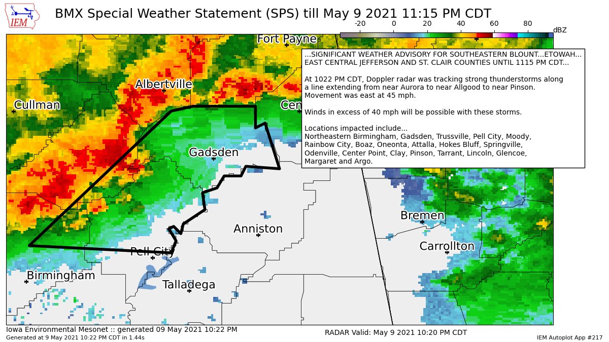
…SIGNIFICANT WEATHER ADVISORY FOR SOUTHEASTERN BLOUNT…ETOWAH…EAST CENTRAL JEFFERSON AND ST. CLAIR COUNTIES UNTIL 1115 PM CDT…
At 1022 PM CDT, Doppler radar was tracking strong thunderstorms along a line extending from near Aurora to near Allgood to near Pinson. Movement was east at 45 mph.
Winds in excess of 40 mph will be possible with these storms.
Locations impacted include…
Northeastern Birmingham, Gadsden, Trussville, Pell City, Moody, Rainbow City, Boaz, Oneonta, Attalla, Hokes Bluff, Springville, Odenville, Center Point, Clay, Pinson, Tarrant, Lincoln, Glencoe, Margaret and Argo.
Category: Alabama's Weather, ALL POSTS, Severe Weather
About the Author (Author Profile)
Scott Martin is an operational meteorologist, professional graphic artist, musician, husband, and father. Not only is Scott a member of the National Weather Association, but he is also the Central Alabama Chapter of the NWA president. Scott is also the co-founder of Racecast Weather, which provides forecasts for many racing series across the USA. He also supplies forecasts for the BassMaster Elite Series events including the BassMaster Classic.Subscribe
If you enjoyed this article, subscribe to receive more just like it.


