Midday Nowcast: Comfortable June Weather; Watching the Gulf
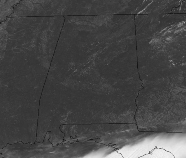
Not too bad outside with the lower dew points in place across the state. The dry air is allowing for sunshine in full supply today and we are seeing temperatures head into the mid and upper 80s this afternoon. Tonight, another clear and comfortable one with widespread 60s and some 50s. Not much change in the weather for Thursday and Friday with generally sunny and dry conditions, highs should return to the low 90s.
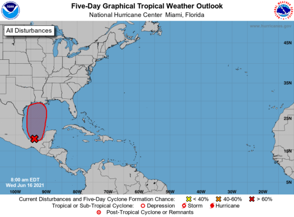
LATEST ON INVEST 92-L: It is only a matter of time before we get a depression and likely Claudette to form in the Gulf…Disorganized showers and thunderstorms continue over the Bay of Campeche and southern Mexico in association with a broad low pressure area.
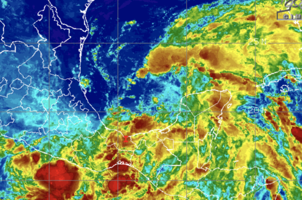
This system will move little today and tonight, and little if any development is expected during that time due to interaction with land. However, the broad disturbance should begin to move northward on Thursday, and a tropical depression is likely to form by late Thursday or on Friday when the low moves across the western Gulf of Mexico. Regardless of development, heavy rainfall will continue over portions of Central America and southern Mexico during the next several days. Heavy rains should also begin to affect portions of the northern Gulf Coast on Friday. Formation chance through 5 days…high…90 percent.
This feature will track north through the western Gulf of Mexico, and looks to make landfall along the Louisiana Coast, then track northeast through the Deep South. New model data out late this morning shows the center of circulation moving faster and farther south than previous runs, with the track right through Central Alabama. This would mean the band of heaviest rain would move right through the area, and could cause some flash flooding issues, but also, being east of the center, could lead to quick, spin-up tornadoes especial Sunday across Alabama.
WET WEEKEND WEATHER: For now with the current forecast model outputs, expect a rather wet weekend across Alabama as rain overspreads the state Saturday and will continue into Saturday night and through the day Sunday. Rainfall could be heavy at times, with some areas receiving over six inches of rain, especially where the heaviest rain band tracks.
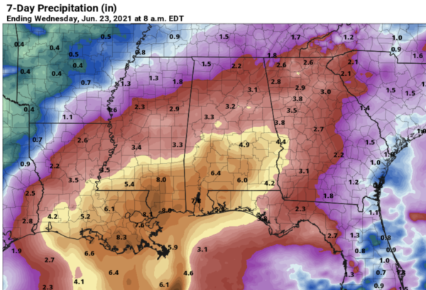
It will be a cloudy and very muggy weekend with temperatures around the 80 degree mark. Again, this forecast will change in the coming days as the system finally develops and gets better organized, once it does, we will have a better handle on the track, timing, and potential impacts.
BEACH FORECAST CENTER: Get the latest weather and rip current forecasts for the beaches from Fort Morgan to Panama City on our Beach Forecast Center page. There, you can select the forecast of the region that you are interested in visiting.
WORLD TEMPERATURE EXTREMES: Over the last 24 hours, the highest observation outside the U.S. was 124.0F at Joba, Oman. The lowest observation was -102.8F at University Dome, Antarctica.
CONTIGUOUS TEMPERATURE EXTREMES: Over the last 24 hours, the highest observation was 124F at Death Valley, CA. The lowest observation was 25F at Sand Creek, OR.
WEATHER ON THIS DATE IN 1944: A tornado in Sioux City, IA, traveled an odd course. It spun in one place for about twenty minutes, made a U-turn, traveled southeast for about three miles, then traveled south, east, north, and finally east again.
Category: Alabama's Weather, ALL POSTS
About the Author (Author Profile)
Macon, Georgia Television Chief Meteorologist, Birmingham native, and long time Contributor on AlabamaWX. Stormchaser. I did not choose Weather, it chose Me. College Football Fanatic. @Ryan_StinnetSubscribe
If you enjoyed this article, subscribe to receive more just like it.


