Tropical Rains Arrive Over The Weekend
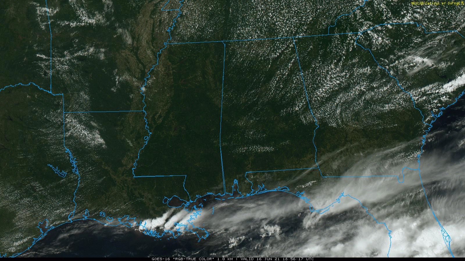
DRY JUNE DAY: The entire state of Alabama is rain-free this afternoon, very unusual for June. A dry airmass covers the state, and with a sunny sky temperatures are mostly in the mid 80s. Dewpoints are in the 50s, and tonight will be clear and pleasant with a low between 58 and 64 degrees for most communities.
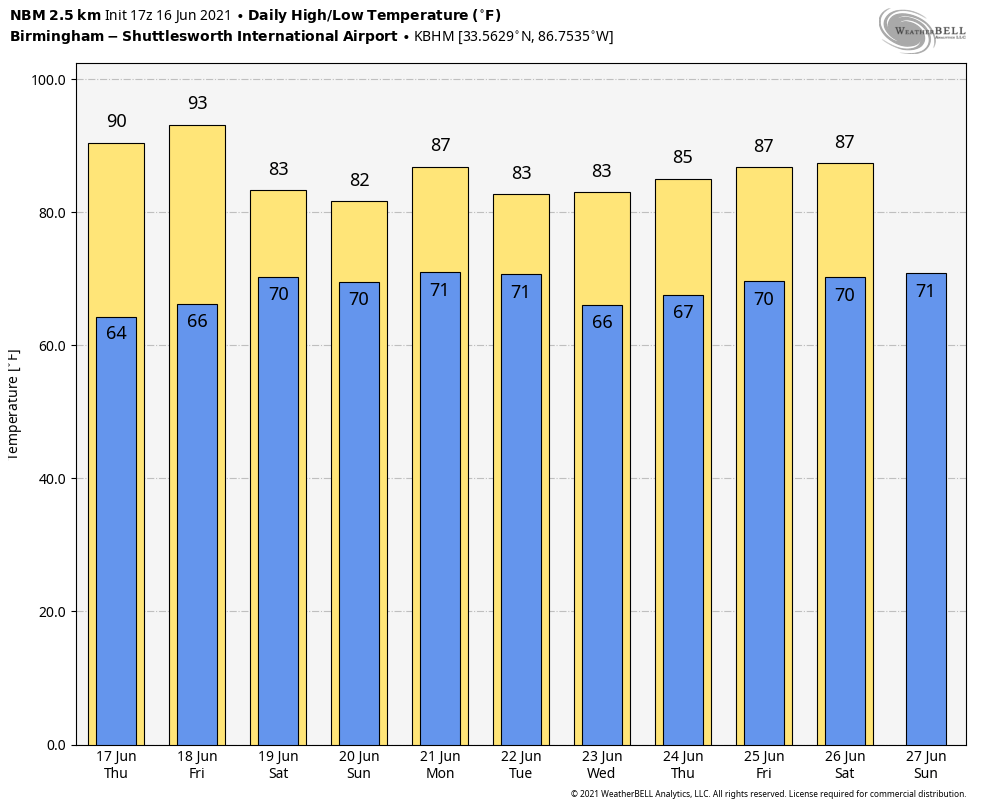
Tomorrow will be another sunny day with a high around 90 degrees. Then, on Friday, moisture begins to increase, and showers are possible over the southern quarter of the state. North/Central Alabama will stay dry Friday with a high in the low 90s.
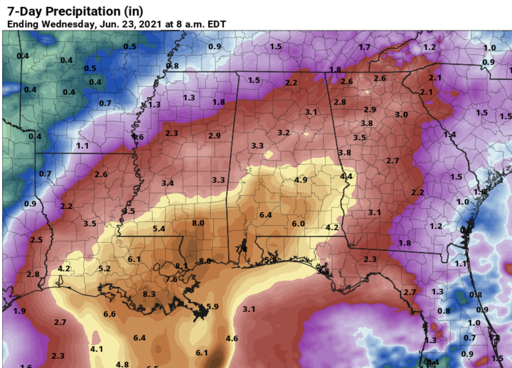
SATURDAY THROUGH MONDAY: A tropical system (most likely a depression) will bring widespread rain to Alabama and the Gulf Coast region over the weekend. Rain over South Alabama will move into the northern half of the state Saturday morning, and rain is likely through Monday as the tropical system moves through. The rain could be heavy at times, and a brief, isolated tornado can’t be ruled out Sunday, especially over the southern counties.
Rain amounts of 4-7 inches are likely over South Alabama, with totals in the 2-4 inch range over the northern half of the state. Some flooding issues are very possible. Highs over the weekend will be in the 78-82 degree range, well below average due to the clouds and rain.
REST OF NEXT WEEK: Drier air begins to move into North Alabama Tuesday, and it looks like any showers over the latter half of the week will be few and far between as an upper ridge begins to build. See the Weather Xtreme video for maps, graphics, and more details.
TROPICS: Disorganized showers and thunderstorms continue over the Bay of Campeche and southern Mexico in association with a broad low pressure area. This system will move little today and tonight, and little if any development is expected during that time due to interaction with land. However, the system should begin to move northward tomorrow, and a tropical depression is likely to form by late tomorrow or on Friday when the low moves across the western Gulf of Mexico. An Air Force Reserve Unit reconnaissance aircraft is scheduled to investigate the area tomorrow.
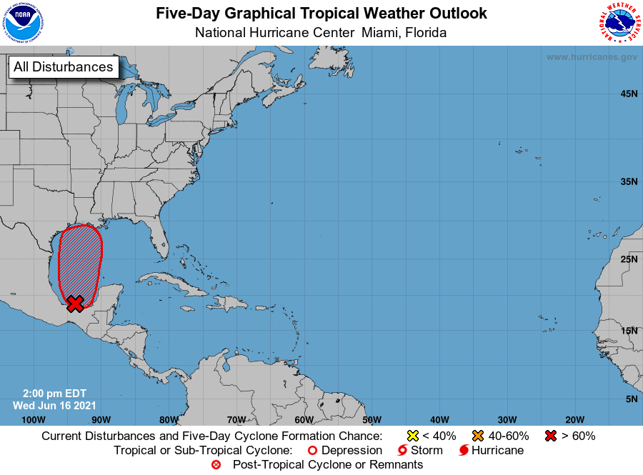
This system will bring widespread rain, heavy at times, to the Louisiana, Mississippi, Alabama, and Northwest Florida Gulf Coast Friday, Saturday, and part of the day Sunday. Also, the rip current danger along the coast will be high as well; expect double red flags in many areas. A few brief, isolated tornadoes or waterspouts are also possible.
Rain amounts could exceed 6 inches along the coast Friday through Sunday. Weather conditions will improve early next week as the tropical low moves away from the region.
ON THIS DATE IN 1896: A tsunami ravages the coast of Japan killing between 22,000 and 27,000 people.
BEACH FORECAST: Click here to see the AlabamaWx Beach Forecast Center page.
WEATHER BRAINS: Don’t forget you can listen to our weekly 90 minute show anytime on your favorite podcast app. This is the show all about weather featuring many familiar voices, including our meteorologists here at ABC 33/40.
CONNECT: You can find me on all of the major social networks…
Look for the next Weather Xtreme video here by 6:00 a.m. tomorrow…
Category: Alabama's Weather, ALL POSTS, Weather Xtreme Videos
About the Author (Author Profile)
James Spann is one of the most recognized and trusted television meteorologists in the industry. He holds the AMS CCM designation and television seals from the AMS and NWA. He is a past winner of the Broadcast Meteorologist of the Year from both professional organizations.Subscribe
If you enjoyed this article, subscribe to receive more just like it.


