Midday Nowcast: Watching the Radar Starting to Get Active
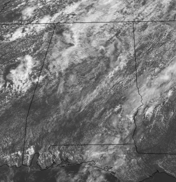
An upper trough remains in place across the region today, and again will produce numerous showers and storms across the Alabama landscape this afternoon and evening. Some of the stronger storms will produce heavy rain, gusty winds, lots of lightning, and small hail. Where it is not raining, we are seeing a mix of sun and clouds with temperatures mostly in the 80s.
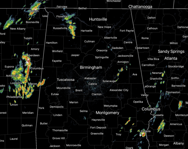
At the midday hour, the radar is starting to get busy as we are watching a cluster of showers and storms in East Mississippi heading towards Alabama. These will move into the state shortly, likely crossing through much of the area this afternoon. Additional showers and storms will also develop across Alabama.
REST OF THE WEEK: The trough pulls out of the area tomorrow and our Wednesday will feature lower rain chances with only isolated storms in the forecast for now. Tomorrow will be hot and humid with highs closer to 90°. Humidity levels stay high Thursday and Friday, and showers and storms will continue to develop on these days, and they should be a bit more scattered in nature as an upper ridge replaces the departing trough. Highs for the second half of the week will be in the upper 80s; chance of any one spot getting wet Thursday/Friday will be in the 40-50 percent range.
TROPICAL UPDATE: All is quiet across the Atlantic basin thanks to dry air and sinking air, and tropical storm formation is not expected at least for the next five days.
BEACH FORECAST CENTER: Get the latest weather and rip current forecasts for the beaches from Fort Morgan to Panama City on our Beach Forecast Center page. There, you can select the forecast of the region that you are interested in visiting.
WORLD TEMPERATURE EXTREMES: Over the last 24 hours, the highest observation outside the U.S. was 124.2F at Jahra, Kuwait. The lowest observation was -99.6F at Concordia, Antarctica.
CONTIGUOUS TEMPERATURE EXTREMES: Over the last 24 hours, the highest observation was 127F at Death Valley and Stovepipe Wells, CA. The lowest observation was 30F at Peter Sinks, UT and Stanley, ID.
WEATHER ON THIS DATE IN 1977: Lightning struck a key electrical transmission line in Westchester County of southeastern New York State plunging New York City into darkness.
Category: Alabama's Weather, ALL POSTS
About the Author (Author Profile)
Macon, Georgia Television Chief Meteorologist, Birmingham native, and long time Contributor on AlabamaWX. Stormchaser. I did not choose Weather, it chose Me. College Football Fanatic. @Ryan_StinnetSubscribe
If you enjoyed this article, subscribe to receive more just like it.


