

Midday Nowcast: Heat, Humidity, Scattered Storms
Looks and feels like August in Alabama as the forecast will not be changing much day to day this week. Each day will feature a mix of sun and clouds while afternoon temperatures climb into the low and mid 90s. Heat index values will be near or just over 100° at times, but for now should remain below the 105° advisory criteria for Central Alabama.
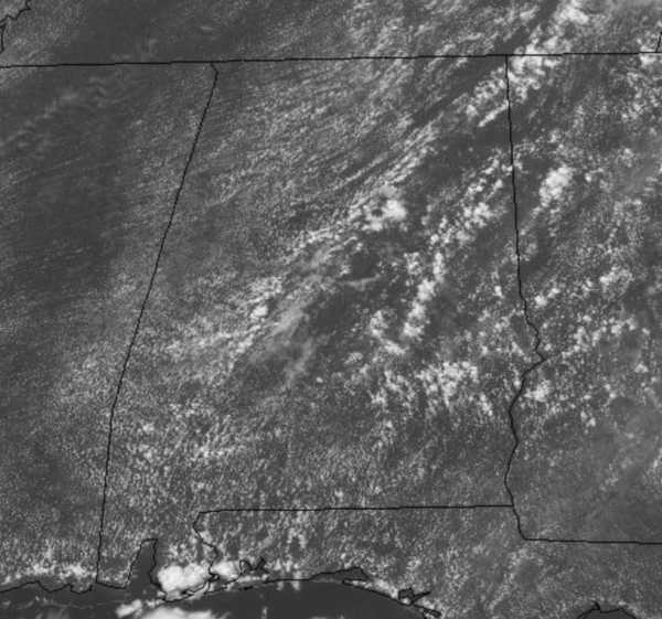
Showers and storms will pop-up on the radar by the afternoon hours, and these will be randomly scattered about the Alabama landscape. Most of the showers and storms will come from 1PM-11PM daily with the odds of any one spot getting wet reach day are in the 35-45 percent range. A quick look at the radar at the midday hours shows some of these already ongoing across Central and East Alabama.
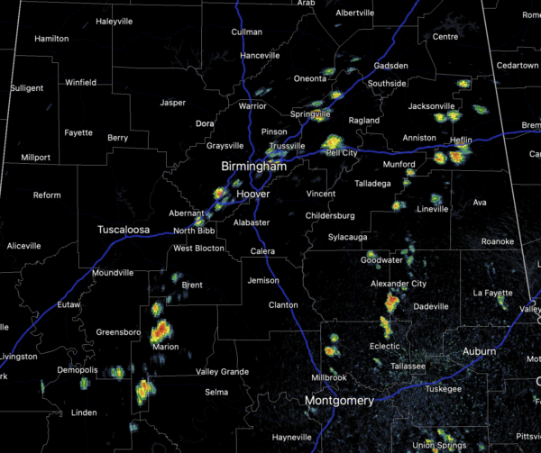
As we have seen at times this summer, some storms could be strong at times with gusty winds, tremendous amounts of lightning. Also, some locations will see a soaking, which could cause some isolated flash flooding, but just down the road it will be dry. Again, these storms are completely random, and you just have to watch radar trends when they start developing.
IN THE TROPICS: We are still watching two tropical waves in the Atlantic the first which could be come a depression soon and then Fred later this week.
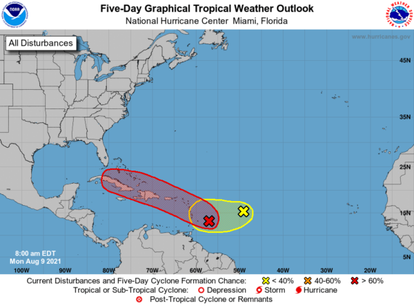
1. Showers and thunderstorms have become more concentrated this morning in association with a low pressure system located about 150 miles east of Barbados. Environmental conditions are expected to be conducive for additional development, and a tropical depression is likely to form later today or tonight while the low moves west-northwestward at 10 to 15 mph. The disturbance is forecast to reach portions of the Lesser Antilles tonight, then move near the Virgin Islands and Puerto Rico on Tuesday, and be near Hispaniola around the middle of this week. Tropical storm watches or warnings could be required today with shorter-than-normal lead times for portions of the Lesser Antilles, the Virgin Islands, and Puerto Rico. In addition, heavy rains and flooding are likely for the Leeward Islands, Virgin Islands, and Puerto Rico. Interests in those areas should monitor the progress of this system. Formation chance through 48 hours…high…70 percent.
2. Disorganized showers and thunderstorms have changed little in association with an elongated low pressure area located several hundred miles east of the Lesser Antilles. Development of this system is becoming less likely during the next few days while it moves toward the west or west-southwest at around 10 mph. Formation chance through 48 hours…low…10 percent.
BEACH FORECAST CENTER: Get the latest weather and rip current forecasts for the beaches from Fort Morgan to Panama City on our Beach Forecast Center page. There, you can select the forecast of the region that you are interested in visiting.
WORLD TEMPERATURE EXTREMES: Over the last 24 hours, the highest observation outside the U.S. was 130.8F at Colinas Do Tocantins, Brazil. The lowest observation was -103.4F at University Dome, Antarctica.
CONTIGUOUS TEMPERATURE EXTREMES: Over the last 24 hours, the highest observation was 119F at Death Valley, CA. The lowest observation was 29F at Peter Sinks, UT.
Category: Alabama's Weather, ALL POSTS
About the Author (Author Profile)
Macon, Georgia Television Chief Meteorologist, Birmingham native, and long time Contributor on AlabamaWX. Stormchaser. I did not choose Weather, it chose Me. College Football Fanatic. @Ryan_StinnetSubscribe
If you enjoyed this article, subscribe to receive more just like it.


