Midday Nowcast: Hot, Humid, Some Storms; Grace Now a Hurricane
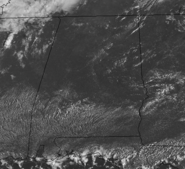
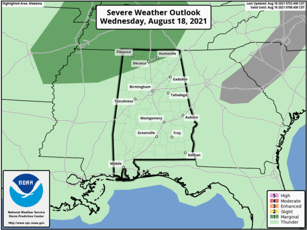
Plenty of sunshine and heat for Alabama today as temperatures this afternoon will be around the 90 degree mark. With dew points in the 70s, heat index values will be near the 100° mark as well. We will be watching the radar as scattered storms are expected through the afternoon and evening hours. However, the better chance of thunderstorms today is across the Tennessee Valley of North Alabama, and the SPC has a “marginal risk” (level 1/5) of severe storms defined for areas north of a line from Hamilton to Decatur to Huntsville. Up that way, a few thunderstorms will likely produce strong gusty winds.
For tomorrow and Friday, rain and storm chances will increases as a colder pocket of air move into the mid-levels which means a more unstable air mass, which will be promoting scattered, to numerous showers and thunderstorms, most active during the afternoon and evening hours. Rainfall could be heavy at times and some areas of flash flooding will be possible under the more intense tropical downpours; also, a some strong storms will be possible. Highs for North/Central Alabama will likely be in the upper 80s.
IN THE TROPICS: Three tropical systems, but thankfully none of them a concern for Alabama. Fred has become post-tropical and is bringing heavy rain and severe weather to the Mid-Atlantic and Northeast the next 24 hours.
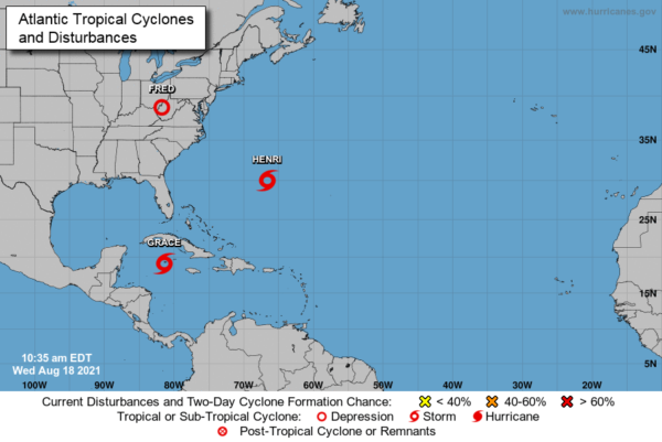
GRACE: Is now a hurricane…the center of Hurricane Grace was located by Air Force Reserve and NOAA Hurricane Hunter aircraft near latitude 19.4 North, longitude 82.2 West. Grace is moving toward the west-northwest near 15 mph. A general west-northwestward to westward motion is expected for the next several days.
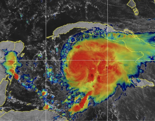
On the forecast track, the center of Grace will continue to move away from Grand Cayman today. Grace is expected to make landfall in the Yucatan Peninsula Thursday morning, and move over the southwest Gulf of Mexico early Friday.
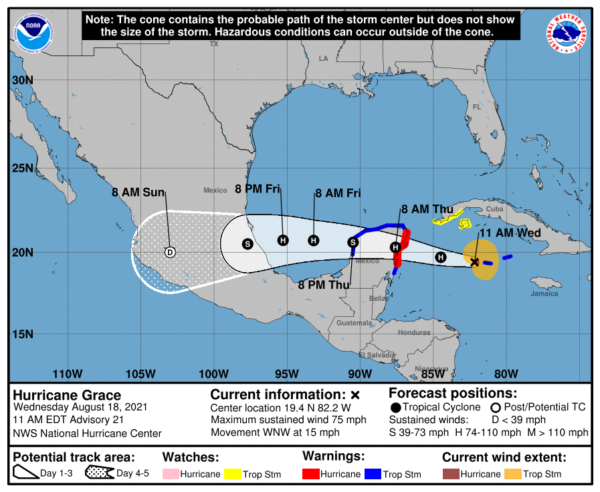
Aircraft data indicate that maximum sustained winds are near 75 mph with higher gusts. Some additional strengthening is forecast before the center of Grace reaches the eastern Yucatan Peninsula. Weakening will occur while the center moves over the Yucatan Peninsula on Thursday, with restrengthening expected when Grace moves over the southwest Gulf of Mexico on Friday. Hurricane-force winds extend outward up to 25 miles from the center and tropical-storm-force winds extend outward up to 115 miles. The estimated minimum central pressure is 992 mb (29.30 inches).
HENRI: Also this will become a hurricane…the center of Tropical Storm Henri was located near latitude 30.0 North, longitude 66.6 West. Henri is moving toward the west near 8 mph and this motion is expected to continue for another day or so. A turn to the north is expected on Friday with that motion continuing into the weekend.
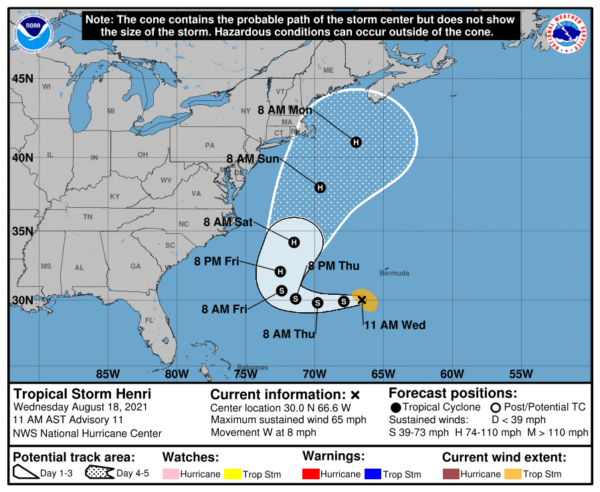
Maximum sustained winds are near 65 mph with higher gusts. Little change in strength is forecast during the next couple of days, but Henri is expected to become a hurricane by the weekend. Tropical-storm-force winds extend outward up to 80 miles from the center. The estimated minimum central pressure is 998 mb (29.47 inches).
BEACH FORECAST CENTER: Get the latest weather and rip current forecasts for the beaches from Fort Morgan to Panama City on our Beach Forecast Center page. There, you can select the forecast of the region that you are interested in visiting.
CONTIGUOUS TEMPERATURE EXTREMES: Over the last 24 hours, the highest observation was 118F at Stovepipe Wells, CA. The lowest observation was 34F at Bodie, CA.
WEATHER ON THIS DATE IN 1925: During the late morning hours a severe hailstorm struck southeastern Iowa completely destroying crops along a path six to ten miles wide and 75 miles long. The hail also injured and killed poultry and livestock, and caused a total of 2.5 million dollars damage. The hailstorm flattened fields of corn to such an extent that many had to leave their farms in search of other work. It was one of the worst hailstorms of record for the nation.
Category: Alabama's Weather, ALL POSTS
About the Author (Author Profile)
Macon, Georgia Television Chief Meteorologist, Birmingham native, and long time Contributor on AlabamaWX. Stormchaser. I did not choose Weather, it chose Me. College Football Fanatic. @Ryan_StinnetSubscribe
If you enjoyed this article, subscribe to receive more just like it.


