Midday Nowcast: Another Wet and Stormy Day
The pesky upper-level low continues to spin just west of the state and is keeping our weather wet and unsettled again today. We are seeing more clouds than sun with occasional showers and storms across the area the rest of today and tonight.
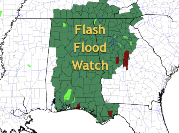
Like the past few days, the rain will be heavy at times and flash flooding remains a concern. The flash flood watch remains in effect for much of the state through this evening and we could certainly see a flash flood warning at anytime.
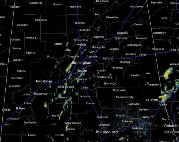
The radar is pretty quiet as we approach the midday hour, but as we have see each day this week, showers and storms will increase in coverage and intensity as we head into and through the afternoon hours.
Additionally, the SPC maintains a low end, “marginal risk” (level 1/5) of severe thunderstorms for much of North and Central Alabama and has added the level 2/5 “slight risK” across portions of Northeast Alabama.
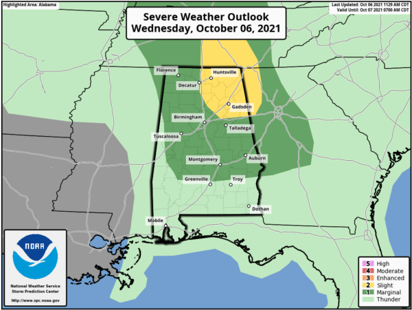
Daytime heating and cold air aloft will allow for higher instability which could allow for a few severe storms this afternoon and we can’t rule out an isolated, brief tornado, gusty winds, or some hail this afternoon.
PATTERN BEGINS CHANGING: Tomorrow, we will maintain the chance for scattered showers and storms, but the upper low will begin to lift out of the area so the coverage will be less. We will continue to see more clouds than sun, with highs in the upper 70s.
FRIDAY AND THE WEEKEND: Dry air returns to the state; the sky will be partly to mostly sunny Friday, and we expect a mostly sunny sky over the weekend. The high Friday and Saturday will be in the low 80s, followed by mid 80s Sunday. Lows will be in the 60s.
INTO NEXT WEEK: A weak front could bring a few sprinkles or isolated showers to the state Monday night or Tuesday, otherwise the week looks generally dry with afternoon highs mostly in the low 80s… a little above average for mid-October in Alabama
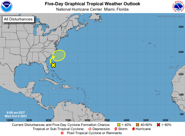
IN THE TROPICS: A surface trough located about 200 miles east of the east coast of Florida continues to produce disorganized showers and thunderstorms well to the east of its axis due to strong upper-level winds. These winds are not expected to be conducive for significant development of this system while it moves slowly northward and then northeastward off the southeastern United States coast during the next few days. By the weekend, the system is forecast to interact with a front near the coast of the southeastern United States, which should also limit tropical development. Formation chance through 5 days…low…10 percent.
BEACH FORECAST CENTER: Get the latest weather and rip current forecasts for the beaches from Fort Morgan to Panama City on our Beach Forecast Center page. There, you can select the forecast of the region that you are interested in visiting.
WORLD TEMPERATURE EXTREMES: Over the last 24 hours, the highest observation outside the U.S. was 110.1F at Bradshaw-Angallary Valley, Australia. The lowest observation was -97.8F at University Dome, Antarctica.
Category: Alabama's Weather, ALL POSTS
About the Author (Author Profile)
Macon, Georgia Television Chief Meteorologist, Birmingham native, and long time Contributor on AlabamaWX. Stormchaser. I did not choose Weather, it chose Me. College Football Fanatic. @Ryan_StinnetSubscribe
If you enjoyed this article, subscribe to receive more just like it.


