Midday Nowcast: Nice Day, Rain/Storms Arrive Tonight
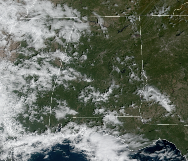
Today will remain dry, but clouds are increasing ahead of the dynamic weather system to our west. Temperatures this afternoon will reach into the lower 70s for most locations. As we head into tonight, rain and storms will return to Alabama. No severe weather for much of the state, but some severe storms are possible are across the southern counties of the state overnight.
The SPC maintains a “slight risk” (level 2/5) for much of Southwest Alabama, with a “marginal risk” (level 1/5) as far north as Meridian, Camden, Greenville, and Troy through 7AM Thursday morning.
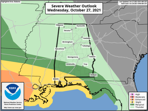
After 7AM tomorrow, and through the midday hours, the SPC has a “marginal risk” (level 1/5) for areas of Southeast Alabama, including Troy, Opp, and Dothan.
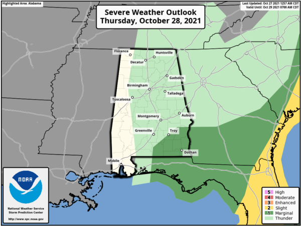
Within the risk areas, there is the potential of damaging winds and a few isolated tornadoes. Not a major threat, but certainly something to watch as the system moves through the state. For the rest of the state, we are just going to be dealing with rain and some rumbles of thunder.
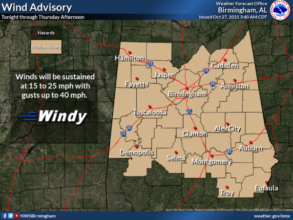
FOR TOMORROW: Behind the front tomorrow, the sky could clear for a few hours with blustery conditions and a wind advisory has been issued for all of North and Central Alabama as winds will be in the 15-25 mph, with higher gusts to 40 mph.
If there is any clearing, the clouds will move back in fast and scattered areas of light rain are expected due to an upper level low spinning over the South. Highs tomorrow will be in the 60s.
RAW, WINTER-LIKE FRIDAY: The deep, upper low will hold over the region Friday and our Friday will remain a cloudy, chilly, and blustery day with temperatures only in the low to mid 50s, a good twenty degrees below average for late October. Add in gusty northwesterly winds of 15-25 mph, it will feel much chillier. Light rain is likely at times over portions of Alabama through Friday night.
FRIDAY NIGHT LIGHTS: For the high school games Friday, the sky will be cloudy with some light rain possible; temperatures will hover around 50 degrees at most stadiums.
HALLOWEEN WEEKEND: Clouds and some light rain will linger into Saturday, especially for the northern half of the state. Across South Alabama, we will forecast gradual clearing Saturday afternoon as the upper low lifts away. Saturday will stay cool with a highs struggling to climb out of the 50s. in the 60s. Sunday will be an amazing day of weather with sunshine in full supply along with a highs returning to the upper 60s and low 70s statewide.
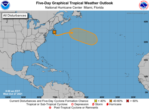
IN THE TROPICS: A deep, non-tropical low pressure system with storm-force winds is centered about 100 miles south of Cape Cod, Massachusetts. The extratropical low is expected to meander off of the mid-Atlantic and northeastern U.S. coasts today, bringing rain and wind impacts to portions of those areas. Thereafter, the low is expected to move eastward away from the United States, and it could acquire some subtropical characteristics while it moves eastward or southeastward over the warmer waters of the central Atlantic through this weekend. Formation chance through 5 days…medium…40 percent.
BEACH FORECAST CENTER: Get the latest weather and rip current forecasts for the beaches from Fort Morgan to Panama City on our Beach Forecast Center page. There, you can select the forecast of the region that you are interested in visiting.
WORLD TEMPERATURE EXTREMES: Over the last 24 hours, the highest observation outside the U.S. was 109.4F at Birdsville Airport, Australia. The lowest observation was -75.3F at University Dome, Antarctica.
CONTIGUOUS TEMPERATURE EXTREMES: Over the last 24 hours, the highest observation was 103F at Rio Grande Village, TX. The lowest observation was 13F at Crestview, CA.
Category: Alabama's Weather, ALL POSTS
About the Author (Author Profile)
Macon, Georgia Television Chief Meteorologist, Birmingham native, and long time Contributor on AlabamaWX. Stormchaser. I did not choose Weather, it chose Me. College Football Fanatic. @Ryan_StinnetSubscribe
If you enjoyed this article, subscribe to receive more just like it.


