Sunday Weather Xtreme Video: Near Record Warmth through Tuesday, Strong Storms Wednesday
Sunday morning, December 26, 2021
Forecaster: Bill Murray
The week ahead will feature warmer than normal readings across Alabama and much of the eastern half of the country. Readings today over Oklahoma and North Texas will approach 30 degrees above normal. The core of the warmest weather will shrink southeastward through midweek, only to balloon again late in the week.
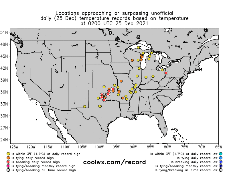
SATURDAY RECORDS: The old record report teletype was busy spitting out little nuggets of warm weather, mainly from Texas up through the Ohio Valley. Hot Springs, Arkansas smashed their record for Christmas Day when the mercury reached 78F. The old record was 70F. That reading was just 2 degrees short of their all-time December high. Beaver Falls, PA, Joe Namath’s hometown, beat their record for the date by 8 degrees as well, with a high of 55F. Junction, TX hit 89F.
HERE IN ALABAMA: We weren’t in record territory, but it was definitely mild yesterday. It was 69F in Birmingham, where cloud cover held back the mercury. Anniston hit 70F and Tuscaloosa hit 73F. The high of 77F at Montgomery was 5 degrees shy of their all-time high for Christmas Day. If we hit our forecast high of 74F at Birmingham today, it will tie the all-time record for December 26th. Monday’s forecast high of 77F would tie that record as well, and Tuesday’s 76F is in danger as well.
WINTRY TROUBLE OUT WEST: On the weather maps this morning, we find a huge upper high over southern Alaska and the Gulf of Alaska. Because it has pushed the upper flow so far to the north, a huge trough has developed downstream over the western United States. A myriad of watches, warnings, and advisories is in effect for wintry weather. Parts of the Sierra Mountains in California are expected to pick up over 6 feet of snow! That’s great news for the seasonal snowpack, but not so good for drivers trying to get over Donner Pass. The NWS in Sacramento put out a tongue-in-cheek Tweet warning people in the Sierra to stock up on food, so there wouldn’t be any modern-day repeats of what happened with those 19th-century pioneers that pass is named for. A winter storm warning is in effect for the Portland OR area where 4-6 inches of snow is expected through Monday evening. Higher elevations, like Mount St. Helens, will get 10-18 inches. Seattle is under a winter weather advisory, where 2-7 inches will fall in snow showers.
CLOSER TO HOME: Alabama is covered by an air mass that is not only warm, but it is also extremely moist as well. Precipitable water values, which is an excellent way of judging the amount of moisture in the atmosphere over any one location, are running some 200-300 percent above normal, which is very high. The result has been fairly extensive cloudiness. That will be the case again today. A cold front is trying to sag into North Alabama, but it won’t get very far with a surface low forming over Colorado that will advance out onto the Plains over the next 24 hours. As the front retreats on Monday, it will take some of the moisture with it, and the result will be more sunshine Monday and Tuesday, helping threaten those record highs. Highs both days will be in the 70s, with lows around 60F.
GOING BOWLING: The Birmingham Bowl will move to its beautiful new home in Protective Stadium Tuesday afternoon. The weather looks like it will be a hit for this big game between the Auburn Tigers and Houston Cougars, with game-time temperatures in the 70s and a good supply of sunshine. Only a small chance of a rogue shower.
MIDWEEK TRANSITION: The big trough will get heavier will time and will try to spread east. The frontal boundary that sets up between the cold airmass over the West and the strong subtropical high over the western Atlantic will set up the battleground just to our north. As southerly winds pile moisture in here late Tuesday, a few showers could show up late in the day and into the overnight. The front will sag south to near the Tennessee/Alabama border on Wednesday. By then, moisture levels will be 300% above normal again across North and Central Alabama. Showers and thunderstorms will be a possibility.
SEVERE WEATHER WEDNESDAY: With the warmth and moisture, instability levels will be on the increase Wednesday. CAPE values could reach 1000-15000 joules/kg, certainly sufficient for strong storms. The low-level jet structure seems to be best after the instability wanes during the overnight, but there is enough of a signal for a marginal severe threat. Damaging winds and hail look to be the main threats. Rain and some thunder will be likely Thursday morning as the front drifts down to I-59. Rain should end over North and Central Alabama Thursday afternoon.
DALLAS BOUND: For any Alabama fans heading to Big D for the Cotton Bowl, the weather should be very nice. Temperatures will be comparable to ours here. The only chance of rain will come late Friday night into early Saturday when a few showers may creep into the forecast. Highs will be in the 60s to near 70F at the end of the year, with lows in the 50s.
NEW YEAR’S EVE: Friday looks dry, but only a tad cooler. That’s good news for any New Year’s Eve events. Friday evening lows will be in the middle and upper 50s.
NEW YEAR’S DAY: Even as the ball drops, moisture will be surging northward. Saturday will start off dry, cloudy, and warm, and humid. A few showers and storms will affect northwestern sections during the day, but the main rain event will hold off until Saturday evening and Sunday morning.
SUNDAY AND BEYOND: January 2nd looks like it will be colder and wet, with rain and some thunder Highs should retreat back to around 60s, with lows in the 40s to lower 50s.
BEACHCAST: Nice weather along the beautiful beaches of Alabama and Northwest Florida. It will be sunny today and Monday, with partly cloudy skies for Tuesday. An increasing southerly flow will lead to showers and a few storms by Wednesday. Rain and storms will be likely Thursday, diminishing on Friday. But they will be increasing again by Saturday and especially Sunday. The best rain chances will be Sunday night along the coast, with cooler weather to start the first full week of the New Year. Water temperatures are running about 60F. Rip currents will be increasing by midweek.
Click here to see the Beach Forecast Center page.
ADVERTISE WITH US: Deliver your message to a highly engaged audience by advertising on the AlabamaWX.com website. The site enjoyed over 22 MILLION page views in the past 12 months. Don’t miss out! We can customize a creative, flexible, and affordable package that will suit your organization’s needs. Contact me, Bill Murray, at (205) 687-0782, and let’s talk.
WEATHERBRAINS: This week, we have a special Christmas story for you. Author Janet L. Chestnut penned a story called Christmas Eve with the Weather Lady that Ken Osbourn narrated for us. It is a heartwarming story of the power of community and small market radio. Check out the show at www.WeatherBrains.com. You can also subscribe on iTunes. You can watch the show live at live.bigbrainsmedia.com or on James’ YouTube Channel You will be able to see the show on the James Spann 24×7 weather channel on cable or directly over the air on the dot 2 feed.
ON THIS DATE IN 1996: Cold temperature gripped Italy, with ice on the famous canals of Venice and freezing temperatures in Rome. A week of snow and cold weather in central and eastern Europe left 29 people dead. Follow my weather history tweets on Twitter. I am @wxhistorian at Twitter.com.
Category: Alabama's Weather, ALL POSTS, Severe Weather, Weather Xtreme Videos
About the Author (Author Profile)
Bill Murray is the President of The Weather Factory. He is the site's official weather historian and a weekend forecaster. He also anchors the site's severe weather coverage. Bill Murray is the proud holder of National Weather Association Digital Seal #0001 @wxhistorianSubscribe
If you enjoyed this article, subscribe to receive more just like it.


