

Monday Weather Xtreme — Severe Storm Potential on Wednesday & This Weekend
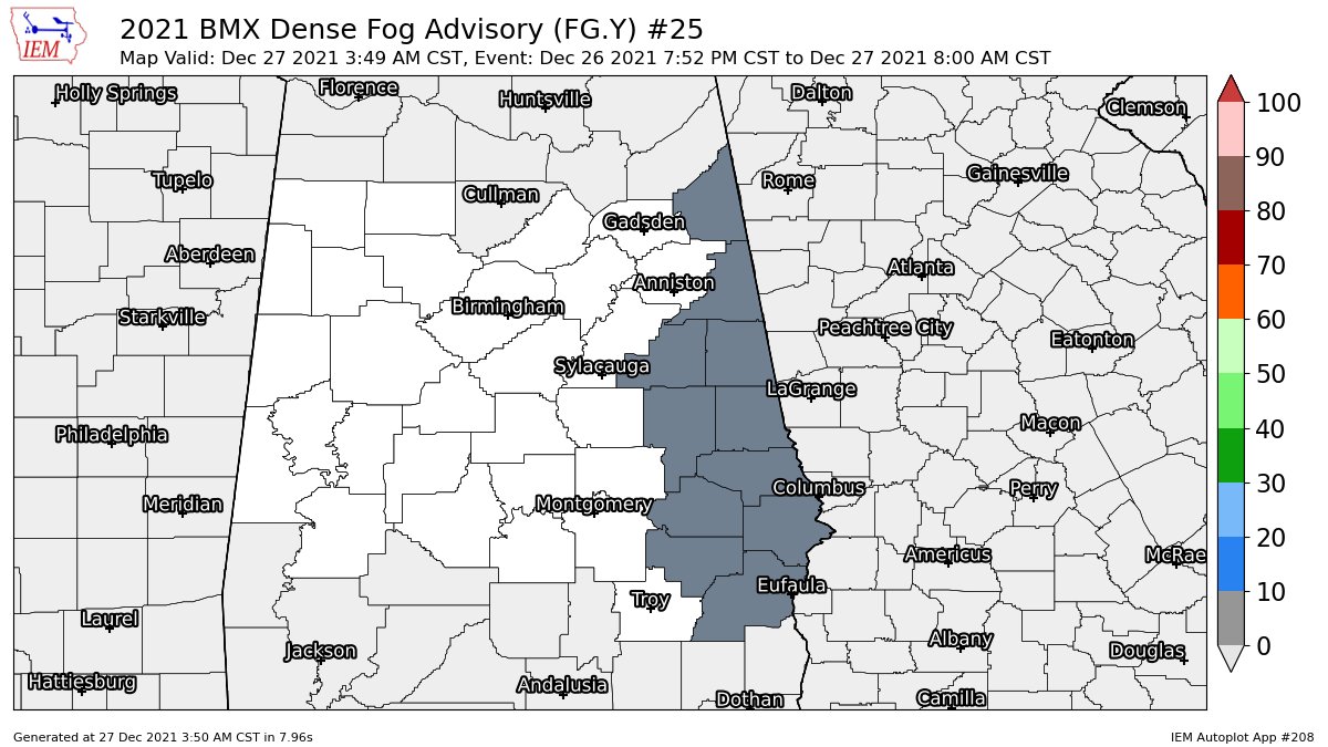
DENSE FOG ADVISORY: We have a Dense Fog Advisory in effect for the far eastern counties in Central Alabama until 8 am this morning. Those counties in the advisory are Barbour, Bullock, Chambers, Cherokee, Clay, Cleburne, Lee, Macon, Randolph, Russell, and Tallapoosa.
TODAY’S WEATHER: After the fog lifts for those eastern counties, we’ll have variable cloudiness across Central Alabama with some light drizzle possible, but with drier air aloft, most locations will stay dry. There will be some breaks in the clouds and some locations may have a decent period of sunshine. Highs will be in the lower 70s to close to 80 degrees from northwest to southeast.
TUESDAY’S WEATHER: We’ll have a shift in our pattern on Tuesday that will have warm, moist air begin to flow up into the area from the south and southwest. This will bring a chance of isolated to scattered showers to mainly the north and northwestern parts of the area, roughly along and west of the I-59 corridor. Skies will be mostly cloudy otherwise, with highs reaching the mid-70s to the lower 80s.
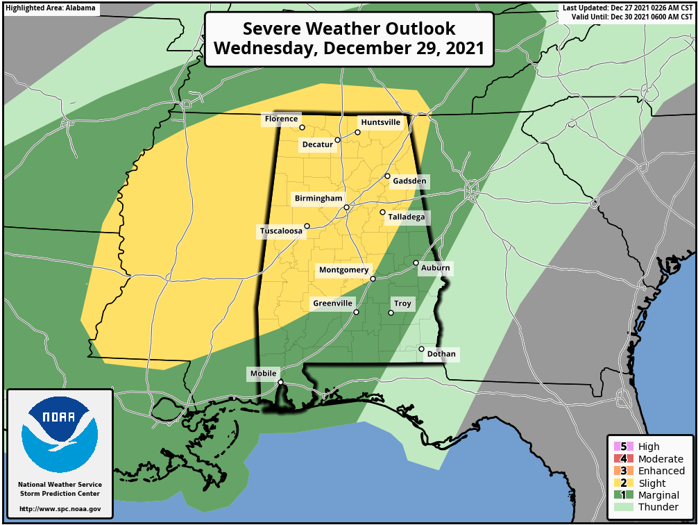
STRONG TO SEVERE STORMS POSSIBLE ON WEDNESDAY: A cold front will be approaching the area on Wednesday, and Central Alabama will be in the very moist and warm sector out ahead of the front. We’ll have a decent amount of instability and shear in place and a few stronger to severe storms will be possible with damaging winds being the main threat. A brief tornado is possible, but the good news is that the better dynamics will be a little too far to the north for this to be a large threat of tornadoes.
For now, the SPC has a Slight Risk up for locations along and west of a line from roughly Selma to Montgomery to Heflin, with nearly the rest of Central Alabama in a Marginal Risk. Timing at this point for the threat of severe storms will be from Wednesday afternoon through Wednesday night.
Most of the activity looks to be scattered out ahead of the front, as the front does not move into the area until Thursday morning. Wednesday’s highs will be in the 70s throughout Central Alabama.
THURSDAY & FRIDAY’S WEATHER: The front will move through Central Alabama on Thursday that will keep showers and thunderstorms likely until the front passes by. No severe weather threats at this time, but I couldn’t rule out a strong storm or two. Highs will be in the upper 60s to the upper 70s. Moisture does stick around, and we could see the front move back northward as a warm front on Friday, which will keep a chance of showers and thunderstorms in the forecast. Highs will be in the lower to mid-70s.
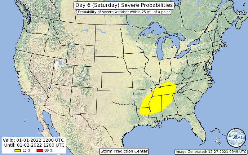
MORE STRONG TO SEVERE STORMS POSSIBLE FOR THE WEEKEND: Another system will get its act together on Saturday and will begin to move into the area on Saturday. Signals are already pointing to the potential for strong to severe storms for late Saturday through early Sunday morning. SPC already has the equivalent of a Slight Risk issued for the northern half of the state on Saturday. We’ll have to get through Wednesday’s event before we can focus on the weekend at this point and what the main risks will be. Stronger storms may continue through the day on Sunday, as a surface low will form and move through the area during the afternoon and evening. Saturday’s highs will be in the 70s, while we’ll see much cooler air start to move in on Sunday, with highs reaching the mid-50s to the lower 70s from northwest to southeast.
Category: Alabama's Weather, ALL POSTS, Severe Weather, Weather Xtreme Videos
About the Author (Author Profile)
Scott Martin is an operational meteorologist, professional graphic artist, musician, husband, and father. Not only is Scott a member of the National Weather Association, but he is also the Central Alabama Chapter of the NWA president. Scott is also the co-founder of Racecast Weather, which provides forecasts for many racing series across the USA. He also supplies forecasts for the BassMaster Elite Series events including the BassMaster Classic.Subscribe
If you enjoyed this article, subscribe to receive more just like it.


