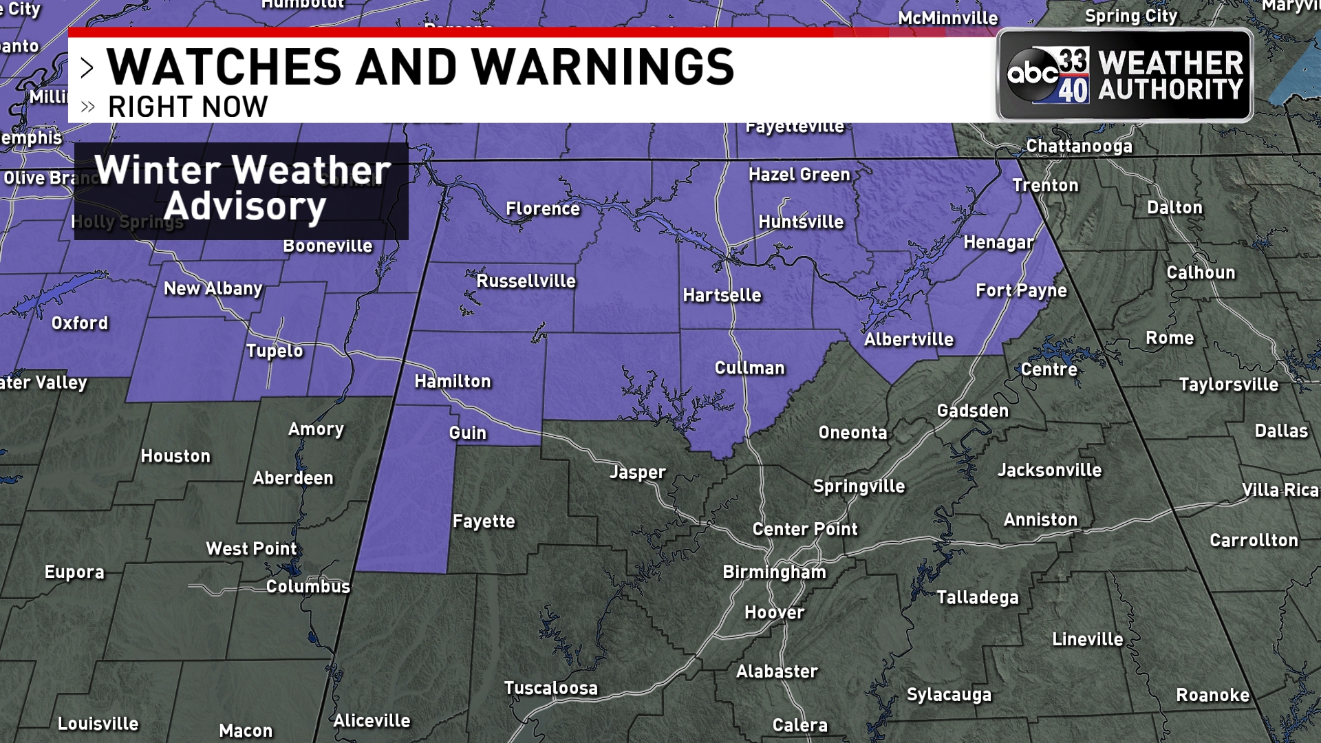
Winter Weather Advisory For Parts Of North Alabama Tomorrow
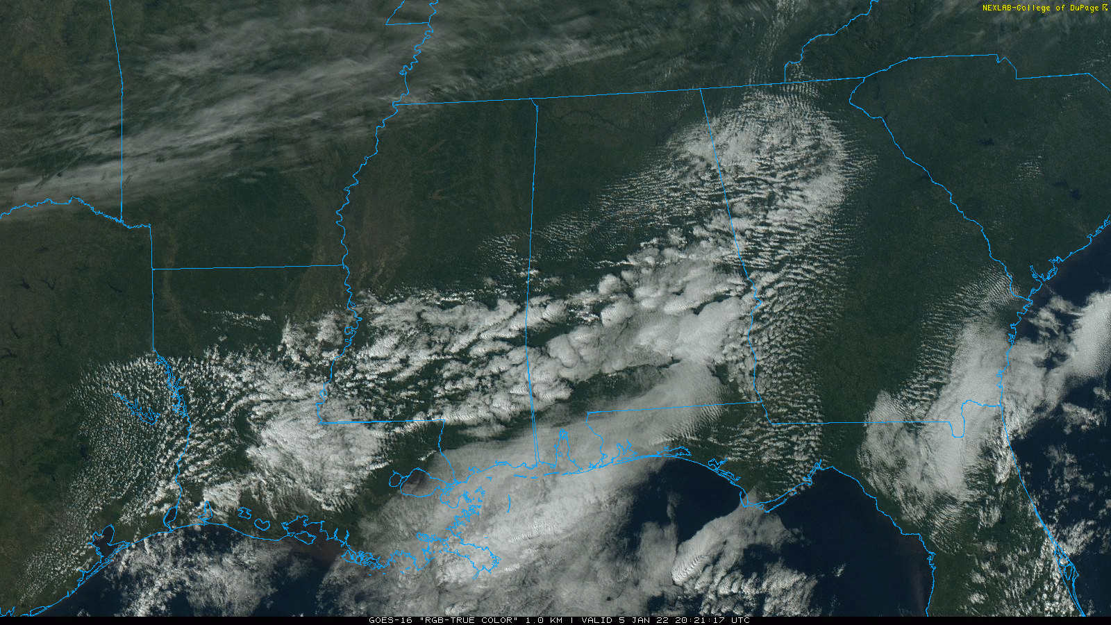
THIS AFTERNOON: The sky is partly sunny across most of Alabama this afternoon… temperatures are mostly in the 57-62 degree range. Clouds will thicken tonight ahead of an approaching cold front.
TOMORROW: A winter weather advisory is in effect for parts of North Alabama tomorrow… generally for areas north of a line from Millport to Cullman to Fort Payne. The advisory does not include Birmingham, Tuscaloosa, Anniston, or Gadsden.
A “wintry mix” of light sleet and freezing rain will likely begin over Northwest Alabama tomorrow morning, which will spread eastward during the day. There is potential for some bridge icing in the advisory area tomorrow morning… and possibly tomorrow afternoon as well. Black ice could form tomorrow night over North Alabama where water is still standing on roads. This isn’t a “major” winter weather event for Alabama, but again we stress bridge icing is very possible, so be very careful if you are in the advisory area and are driving.
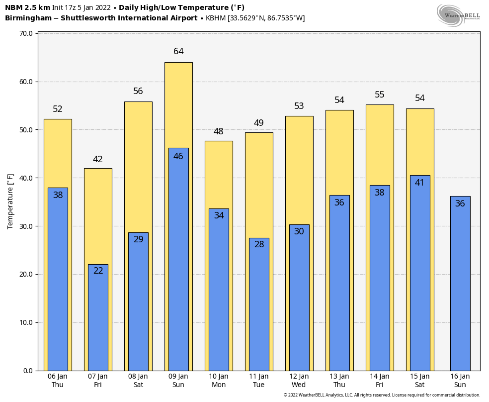
The best chance of accumulating snow will be across Tennessee, where Nashville and Knoxville could see several inches. For that part of Alabama south of the winer weather advisory, tomorrow will just feature periods of rain. Temperatures will fall during the day, reaching the 30s by afternoon as the coldest air so this season moves into the state. By Friday morning, we project temperatures in the 18-24 degree range with a wind chill index near 10 degrees.
Friday will be a sunny but cold day with a high in the upper 30s.
THE ALABAMA WEEKEND: Saturday will be a sunny day… after a low in the 20s temperatures rise into the mid 50s by afternoon. Then rain returns Sunday ahead of the next cold front. The high Sunday will be in the upper 50s with rain likely through the day. Maybe some thunder, but no risk of severe storms.
NEXT WEEK: Monday will be mostly sunny and colder with a high in the 40s. Dry weather continues through mid-week, then rain returns late Thursday and Thursday night. See the Weather Xtreme video for maps, graphics, and more details.
ON THIS DATE IN 1892: From the History of Fayetteville, Georgia, “Another traumatic event occurred in Fayetteville on the evening of January 5, 1892, about six o’clock in the evening. A terrible tornado or cyclone struck the town of Fayetteville just as many had sat down for dinner. The storm killed three people and injured many more as its raging force destroyed numerous residences, outbuildings, and structures, including the academy, as well as killing abundant livestock. The event was written about as far away as Savannah.”
ON THIS DATE IN 1962: Two tornadoes, about 100 yards apart and each making paths about 100 yards wide, followed parallel paths from southeast to northwest through the edge of the Crestview, Florida’s residential area. These tornadoes killed one and injured 30 others.
BEACH FORECAST: Click here to see the AlabamaWx Beach Forecast Center page.
WEATHER BRAINS: Don’t forget you can listen to our weekly 90 minute show anytime on your favorite podcast app. This is the show all about weather featuring many familiar voices, including our meteorologists here at ABC 33/40.
CONNECT: You can find me on all of the major social networks…
Look for the next Weather Xtreme video here by 6:00 a.m. tomorrow…
Category: Alabama's Weather, ALL POSTS, Weather Xtreme Videos
About the Author (Author Profile)
James Spann is one of the most recognized and trusted television meteorologists in the industry. He holds the AMS CCM designation and television seals from the AMS and NWA. He is a past winner of the Broadcast Meteorologist of the Year from both professional organizations.Subscribe
If you enjoyed this article, subscribe to receive more just like it.


