Late Morning Update on Today’s Severe Weather Threat
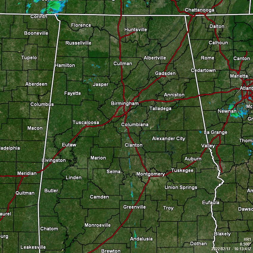
As of 10:15 am this morning, it now looks like all of the shower activity that was moving through the east and southeastern parts of the area has moved on over into Georgia, and all of Central Alabama is quiet at this juncture. However, you will definitely need to hold on to your hats and to those doors when you head out and come back from your lunch break. As far as the severe weather threat, the forecast still looks to be on track.
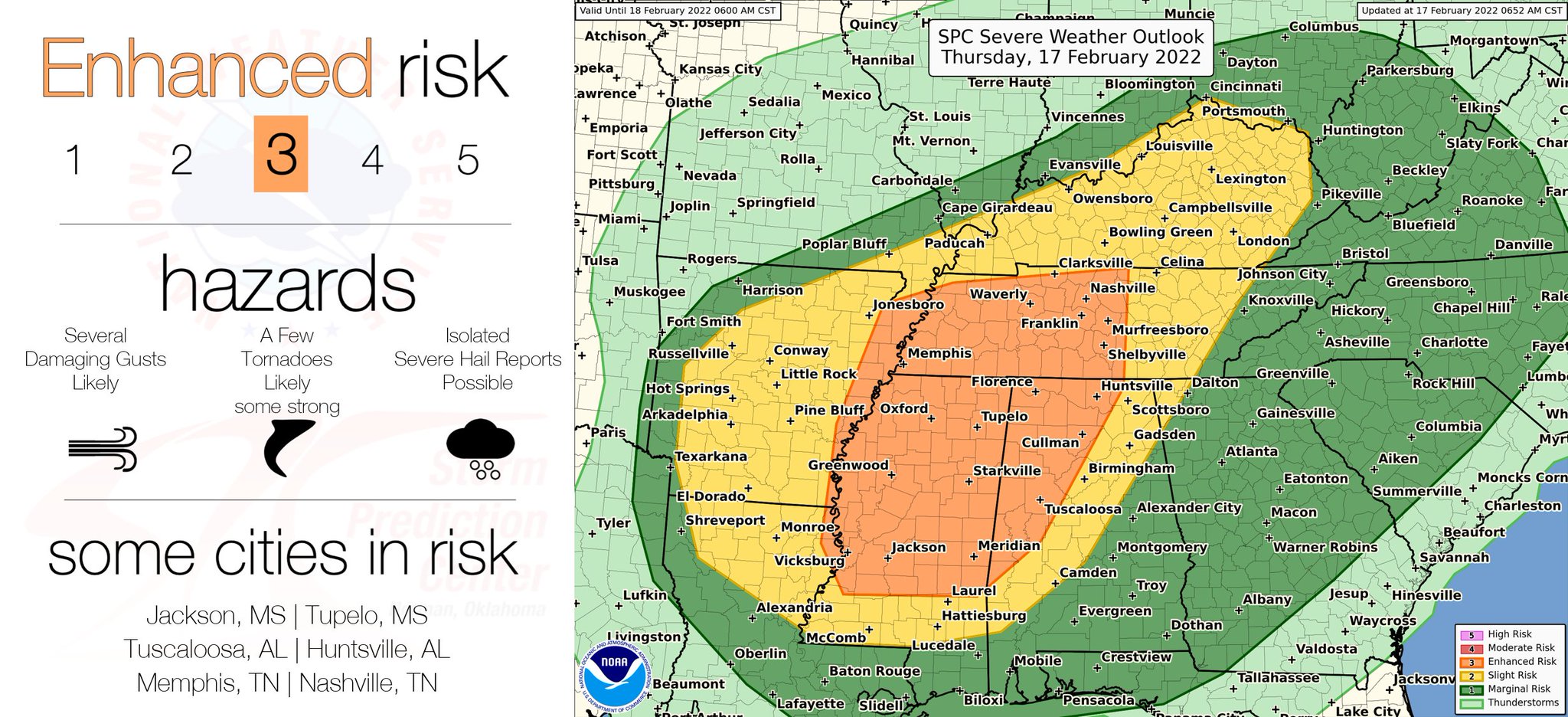
The SPC continues to keep the risk areas the same as with the previous update, but another one will be out before midday. All modes of severe weather will be possible… damaging wind gusts up to 60-70 mph, tornadoes, and hail up to quarter size in diameter. In that enhanced risk area, there is the potential for significant, long-track tornadoes of EF-2 or greater. Also, we’ll have strong wind gusts outside of the thunderstorm activity that may reach as high as 45 mph. Here is a breakdown of timing for the threat of severe storms:
• 2 pm to 8 pm: Western parts of the area west of a line from Demopolis to Brookwood to Cullman.
• 4 pm to 12 am: Central parts of the area east of the previous line to a line from just east of Montgomery to Alexander City to just east of Centre.
• 6 pm to 4 am: Eastern parts of the area east of the previous line to the Alabama/Georgia state line.
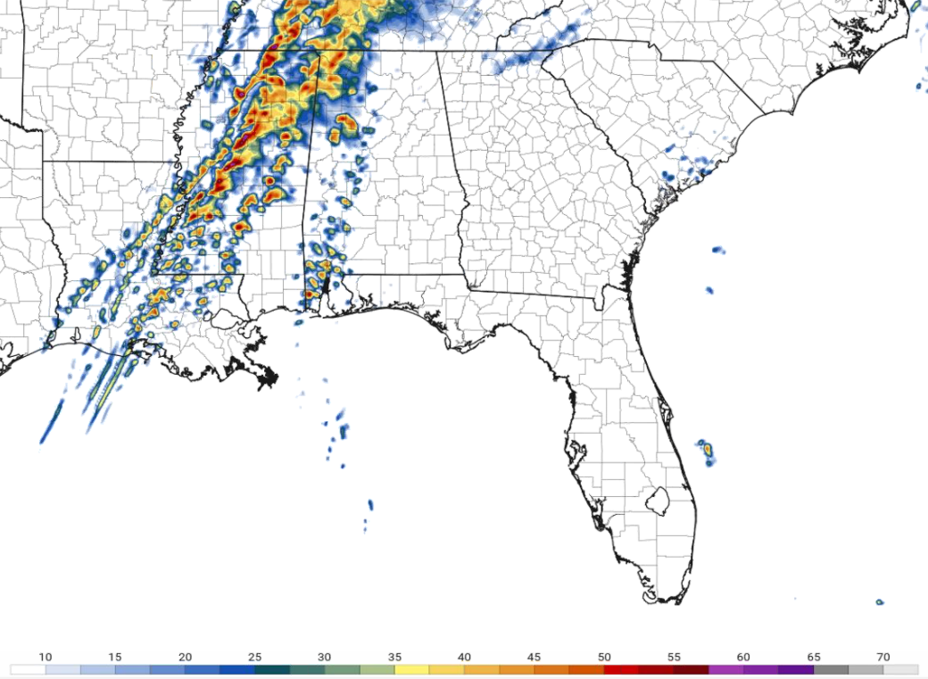
What is a little worrisome about the forecast models is that some of these cells have that kidney bean shape to them, which means the potential for rotating updrafts. This also means that we’ll most likely see supercellular thunderstorms. The good news is that just three hours later around 6 pm, the simulated radar image does not look as intense, so the line will begin a weakening phase. Even with that being said, damaging winds and a couple tornadoes will remain possible… so don’t let your guard down.
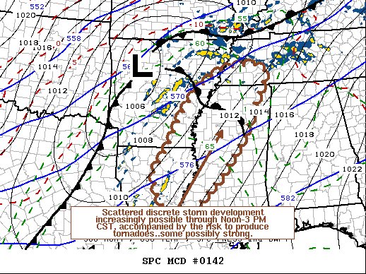
A tornado watch is likely to be issued shortly for the area highlighted in the latest mesoscale discussion from the SPC. It is likely that a tornado watch will be issued for the western half of Central Alabama and up into North Alabama this afternoon before the threat moves into the area.
Category: Alabama's Weather, ALL POSTS, Severe Weather
About the Author (Author Profile)
Scott Martin is an operational meteorologist, professional graphic artist, musician, husband, and father. Not only is Scott a member of the National Weather Association, but he is also the Central Alabama Chapter of the NWA president. Scott is also the co-founder of Racecast Weather, which provides forecasts for many racing series across the USA. He also supplies forecasts for the BassMaster Elite Series events including the BassMaster Classic.Subscribe
If you enjoyed this article, subscribe to receive more just like it.


