Nice Warm-Up Today; Storms Return Tomorrow
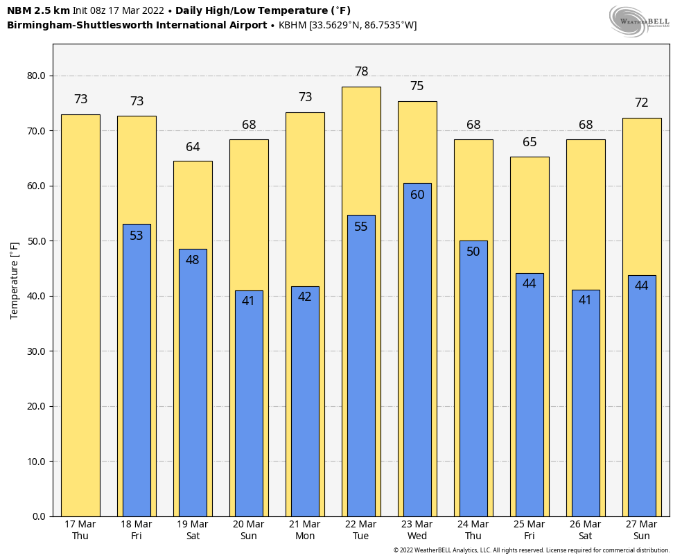
FOGGY START: A dense fog advisory is in effect for the northern 2/3 of Alabama early this morning, but once that fog dissipates we expect a very nice springy, with ample sunshine along with a high in the mid 70s this afternoon. It will be the warmest day of the week. Clouds return tonight ahead of the next storm system.
ACTIVE DAY TOMORROW: SPC has defined a “slight risk” (level 2/5) of severe thunderstorms tomorrow for areas south of a line from Demopolis to Calera to Wedowee, and a “marginal risk” (level 1/5) north of that line for the rest of the state.
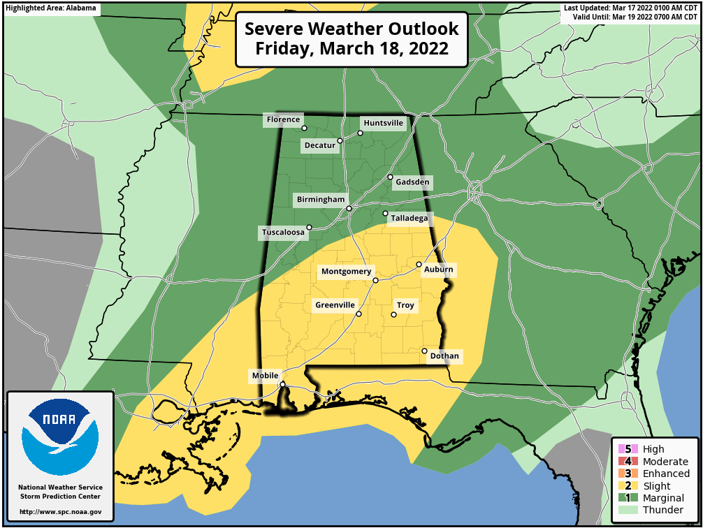
There will be two rounds of thunderstorms tomorrow… round one will come during the morning hours (mostly between 5am and 12 noon), and these storms will be elevated due to the lack of surface based instability. The main threat with the morning round will come from heavy rain and gusty winds, but an isolated tornado is possible over the southwest corner of the state, where some instability will be available.
Round two will come during the late afternoon and evening hours (mostly between 3 and 8pm); this activity will be more scattered in nature, and the severe weather threat is somewhat conditional. If the air can recover from the morning storms, these thunderstorms will be capable of producing large hail, strong winds, and a few tornadoes. The bottom line is that Alabamians need to be weather aware tomorrow, and in a position to hear severe weather warnings if they are needed. The high tomorrow will be in the low 70s, maybe mid 70s if we can get some sun during the early afternoon lull in thunderstorm activity.
THE ALABAMA WEEKEND: We are forecasting dry weather over the weekend with mostly sunny pleasant days and fair cool nights. The high Saturday will be in the mid 60s, followed by low 70s Sunday. We should note the low early Sunday morning will be in the 35-40 degree range, and some of the colder spots could see frost, and maybe even a light freeze.
NEXT WEEK: Monday will be dry and mild with a high in the mid 70s. Then, a robust weather system will bring a round of rain and storms to the state Tuesday night and Wednesday. There will most likely be a risk of severe thunderstorms, and SPC has most of the state in a severe weather risk. But, it is still too early to know the magnitude of the event, the threats, and the timing. Once we get the system Friday out of here we can be much more specific. Dry weather will return Thursday and Friday… See the Weather Xtreme video for maps, graphics, and more details.
THURSDAY’S FLOODING: A slow moving thunderstorm brought flash flooding to parts of Birmingham yesterday afternoon; our Skywatcher in the Oxmoor Valley reported 4.02″, and the total at Crestwood was 3.16″. There were eight water rescues, and one man is in critical condition after bring pulled from flood waters.
ON THIS DATE IN 1990: Showers and thunderstorms associated with a slow-moving cold front produced torrential rains across parts of the southeastern U.S. over two days. Flooding claimed the lives of at least 22 persons, including thirteen in Alabama. Up to 16 inches of rain deluged southern Alabama with 10.63 inches reported at Mobile in 24 hours. The town of Elba was flooded with 6 to 12 feet of water causing more than 25 million dollars damage, and total flood damage across Alabama exceeded 100 million dollars. Twenty-six counties in the state were declared disaster areas.
ON THIS DATE IN 2021: A total of 25 tornadoes touched down in Alabama; this included 3 rated EF-2. The longest-track tornado was 36.5 miles, associated with a tornado from Wayne County, Mississippi to southern Marengo County, Alabama. There were no fatalities; two were injured in an EF-2 tornado at Burnsville in Dallas County (near Selma), and there was one minor injury in an EF-0 tornado north of Birmingham near Mount Olive.
BEACH FORECAST: Click here to see the AlabamaWx Beach Forecast Center page.
WEATHER BRAINS: Don’t forget you can listen to our weekly 90 minute show anytime on your favorite podcast app. This is the show all about weather featuring many familiar voices, including our meteorologists here at ABC 33/40.
CONNECT: You can find me on all of the major social networks…
Look for the next Weather Xtreme video here by 3:00 this afternoon… enjoy the day!
Category: Alabama's Weather, ALL POSTS, Weather Xtreme Videos
About the Author (Author Profile)
James Spann is one of the most recognized and trusted television meteorologists in the industry. He holds the AMS CCM designation and television seals from the AMS and NWA. He is a past winner of the Broadcast Meteorologist of the Year from both professional organizations.Subscribe
If you enjoyed this article, subscribe to receive more just like it.


