

Warm, Humid Days; Strong/Severe Storms Possible Friday
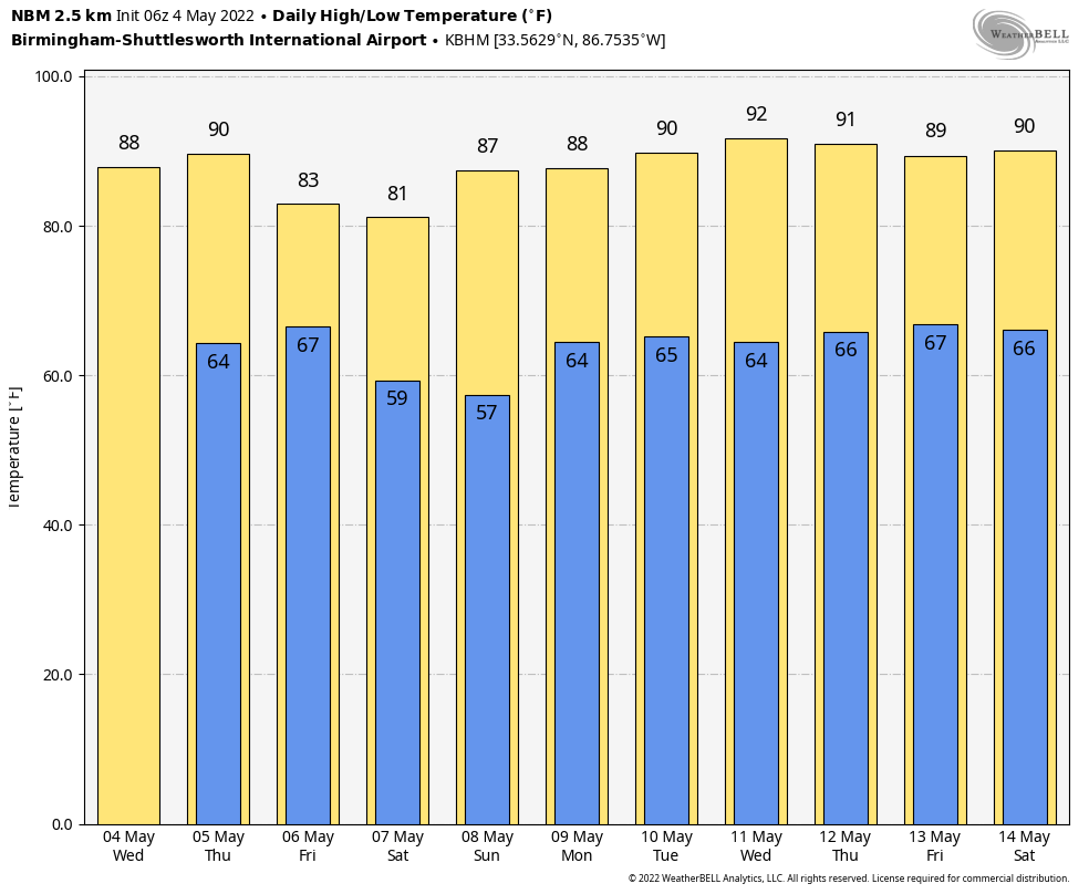
SUMMER-LIKE WEATHER CONTINUES: Alabama’s weather won’t change much through tomorrow. Partly sunny, warm, humid days with a handful of widely scattered showers and storms around, mostly during the afternoon and evening hours. The high will be in the mid 80s both days, and odds of any one spot getting wet are in the 15-25 percent range.
FRIDAY: A cold front will bring an organized batch of showers and thunderstorms into Alabama Friday. SPC has now defined a “slight risk” (level 2/5) for much of the state.
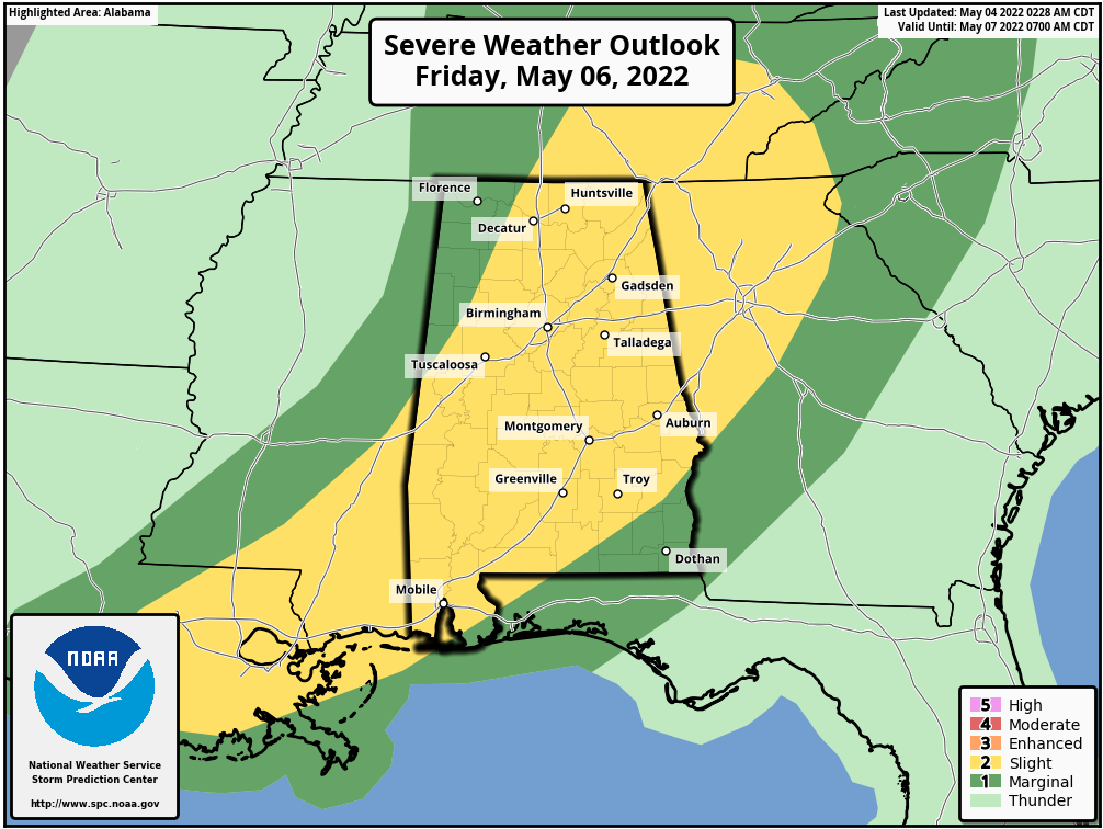
The air becomes very unstable Friday, with surface based CAPE values in the 2000-3000 j/kg range for much of the state. Storms that move through will be capable of producing large hail and strong, potentially damaging wind. A brief isolated tornado or two can’t be ruled out, but that is not the primary threat. We could very well have two rounds of storms, one during the early morning hours, and another with the cold front during the afternoon… it won’t rain all day, but just understand that when thunderstorms do pass through they could be strong to severe. Rain amounts of around 1/2 inch are likely, and the high will be around 80 degrees.
MOTHERS DAY WEEKEND: Dry air returns Friday night, and the weekend will feature sunny days… the high Saturday will be close to 80, followed by mid 80s Sunday.
NEXT WEEK: Most of the week will be dry, with potential for the hottest weather so far this year by mid-week as temperatures climb toward the 90 degree mark. Global models suggest a few showers could show up by Friday (May 13)… See the Weather Xtreme video for maps, graphics, and more details.
ON THIS DATE IN 2007: A devastating EF5 twister demolishes nearly every structure in Greensburg, Kansas around 9:30p CT and kills ten. The mammoth wedge tornado cuts a swath 1.7 miles wide and 22 miles long across the Kansas landscape. It is the worst single tornado to touch down in the U.S. in eight years.
ON THIS DATE IN 2021: Rain totals reached five to seven inches in and surrounding Shelby/Jefferson counties. A rare Flash Flood Emergency was issued to highlight the life-threatening nature of the flooding in the Birmingham metro. Many roads were closed, some structures were flooded, and water rescues were performed.
BEACH FORECAST: Click here to see the AlabamaWx Beach Forecast Center page.
WEATHER BRAINS: Don’t forget you can listen to our weekly 90 minute show anytime on your favorite podcast app. This is the show all about weather featuring many familiar voices, including our meteorologists here at ABC 33/40.
CONNECT: You can find me on all of the major social networks…
Look for the next Weather Xtreme video here by 3:00 this afternoon… enjoy the day!
Category: Alabama's Weather, ALL POSTS, Weather Xtreme Videos
About the Author (Author Profile)
James Spann is one of the most recognized and trusted television meteorologists in the industry. He holds the AMS CCM designation and television seals from the AMS and NWA. He is a past winner of the Broadcast Meteorologist of the Year from both professional organizations.Subscribe
If you enjoyed this article, subscribe to receive more just like it.


