Scattered Storms Mainly Over South Alabama Through Tomorrow
RADAR CHECK: Scattered showers and thunderstorms are in progress today mainly south of U.S. 80… south of a line from Demopolis to Selma to Montgomery to Opelika. The more concentrated storms are across Southeast Alabama, where some spots have seen heavy amounts of rain. The northern half of the state is enjoying a partly to mostly sunny sky.
Temperatures are in the mid 80s over the eastern counties of the state… it is hotter over West Alabama where some spots have reached the low 90s. Scattered storms over South Alabama will fade after sunset.
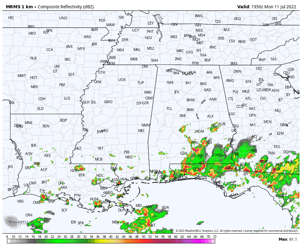
The weather won’t change much tomorrow; mostly dry conditions for the northern half of the state; scattered showers and storms remain possible over the southern counties where moisture levels are higher. Highs tomorrow will be generally in the 89-95 degree range.
WEDNESDAY THROUGH THE WEEKEND: Moisture levels will rise Wednesday, and scattered showers and storms are possible statewide with a mix sun and clouds; the high will be close to 90 degrees. Then, with tropical moisture in place, we expect scattered to numerous showers and storms on a daily basis Thursday through Sunday. Understand this doesn’t mean “washout” conditions, but some rain is likely occasionally, mostly during the afternoon and evening hours. Storms that form on these days will be very efficient rain producers due to the high precipitable water values. Highs will be mostly in the mid to upper 80s Thursday through the weekend, which is below average for mid-July in Alabama.
NEXT WEEK: For now it looks like a fairly routine summer week, with partly sunny days and a few showers and storms around in random spots during the afternoon and evening hours. See the daily Weather Briefing video for maps, graphics, and more details.
TROPICS: A broad trough of low pressure currently located over the northern Gulf of Mexico is producing a large area of disorganized showers and thunderstorms. Gradual development of this system is possible if it can remain offshore while it meanders near the northern Gulf of Mexico coast through the end of the week. Regardless of development, heavy rains will be possible along portions of the northern Gulf coast from Louisiana to the Florida Panhandle over the next several days.
If you have a trip planned to the Central Gulf Coast (Gulf Shores to Panama City Beach), understand you will see some sun at times, but the coverage of daily showers and storms will be higher than usual for the next several days due to this tropical feature.
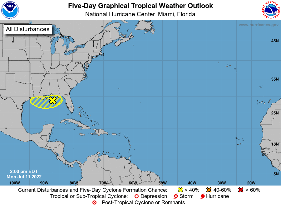
The rest of the Atlantic basin remains very quiet.
ON THIS DATE IN 1936: From July 5-17 in Canada, temperatures exceeding 111 degrees in Manitoba and Ontario claimed 1,180 lives (mostly the elderly and infants) during the most prolonged, deadliest heat wave on record there. Four hundred of these deaths were caused by people who drowned seeking refuge from the heat. In fact, the heat was so intense that steel rail lines and bridge girders twisted, sidewalks buckled, crops wilted and fruit baked on trees. Some record temperatures include; 112 degrees at St. Albans and Emerson, Manitoba, 111 at Brandon, Manitoba, 108 at Atikokan, Ontario, and Winnipeg, Manitoba.
BEACH FORECAST: Click here to see the AlabamaWx Beach Forecast Center page.
Look for the next Weather Briefing video here by 6:00 a.m. tomorrow…
Category: Alabama's Weather, ALL POSTS, Weather Xtreme Videos
About the Author (Author Profile)
James Spann is one of the most recognized and trusted television meteorologists in the industry. He holds the AMS CCM designation and television seals from the AMS and NWA. He is a past winner of the Broadcast Meteorologist of the Year from both professional organizations.Subscribe
If you enjoyed this article, subscribe to receive more just like it.


