Hot Through Thursday; Cooler Air Arrives Friday
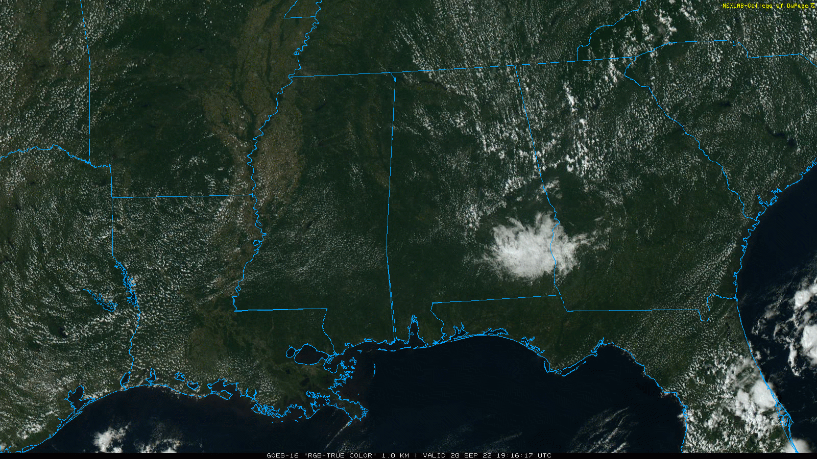
RADAR CHECK: We have a few small, isolated showers over East Alabama this afternoon, otherwise the sky is partly to mostly sunny with temperatures in the 90-94 degree range for most places. The isolated showers will end this evening, and the sky will be fair tonight with a low in the low 70s.
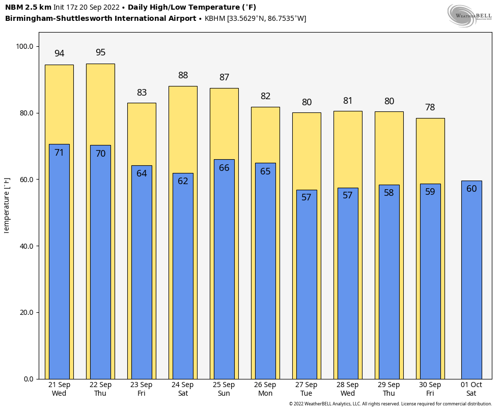
The weather will stay hot and dry tomorrow and Thursday with highs in the 91-95 degree range, about ten degrees above average. Then, a cold front will pass through the state in dry fashion late Thursday, followed by a cool change Friday. The high Friday will be at or just over 80 degrees with a good supply of sunshine.
THE ALABAMA WEEKEND: Saturday morning will be cool with a low in the 50s in most spots as the “fall feel” returns to Alabama. Saturday will feature a sunny sky with a high in the mid 80s. Then, on Sunday, clouds will increase ahead of a cold front which will bring some risk of showers to the northern half of the state by afternoon and into Sunday night. This won’t be a big rain producer, but some spots could see 1/4 to 1/2 inch by early Monday morning.
NEXT WEEK: Showers on Monday will be confined to East and South Alabama, otherwise the sky will clear with a high only in the mid to upper 70s. The rest of the week looks mostly dry and pleasant at this point with highs at or just over 80 degrees on most days. See the daily Weather Briefing video for maps, graphics, and more details.
FALL ALMOST HERE: The autumnal equinox is tomorrow night at 8:03p CT. The sun will illuminate the northern and southern hemispheres equally tomorrow, and we will have approximately 12 hours of daylight and 12 hours of darkness.
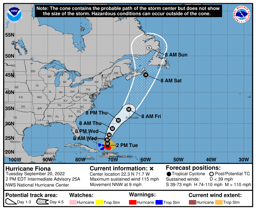
TROPICS: Fiona remains a major, category three hurricane with winds of 115 mph. It is just northeast of North Caicos Island this afternoon; the hurricane could reach category four strength tonight as it moves north… and it could be very close to Bermuda by late Thursday night or early Friday morning.
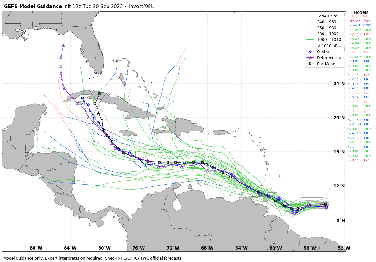
Elsewhere… a tropical wave located a few hundred miles east of the Windward Islands continues to show signs of organization. Additional development is expected, and a tropical depression is likely to form within the next few days as the system moves westward to west-northwestward at 15 to 20 mph across the eastern and central Caribbean Sea.
This tropical wave has a very real chance of entering the southern Gulf of Mexico in about 8-10 days, potentially as a significant system. It is important to note there is zero skill in forecasting the placement and intensity of a tropical cyclone more than 7 days in advance, but the pattern does suggest there could very well be a hurricane in the Gulf by the end of next week. If that happens, we just don’t know the final destination. Simply something to watch for now, and we will continue to do just that.
ON THIS DATE IN 1909: A large and deadly Category 3 hurricane made landfall near Grand Isle, Louisiana during the late evening hours. The states of Louisiana and Mississippi showed catastrophic damage resulting in 371 deaths
BEACH FORECAST: Click here to see the AlabamaWx Beach Forecast Center page.
Look for the next Weather Briefing video here by 6:00 a.m. tomorrow…
Category: Alabama's Weather, ALL POSTS, Weather Xtreme Videos
About the Author (Author Profile)
James Spann is one of the most recognized and trusted television meteorologists in the industry. He holds the AMS CCM designation and television seals from the AMS and NWA. He is a past winner of the Broadcast Meteorologist of the Year from both professional organizations.Subscribe
If you enjoyed this article, subscribe to receive more just like it.


