No Rain For At Least The Next Ten Days
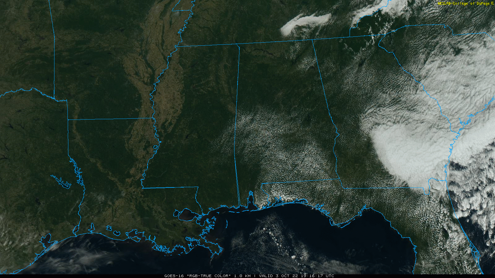
SEVERE CLEAR: With sunshine in full supply temperatures are in the 77-81 degree range this afternoon across Alabama. Tonight will be clear with a low in the 50s.
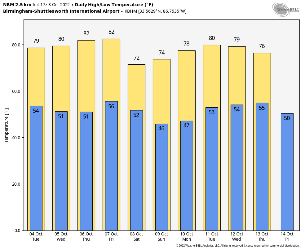
Dry weather will continue through the weekend with sunny days and fair nights. Highs will be in the low 80s through Friday, but a nice surge of cooler air arrives Saturday with the high dropping to near 70 degrees over the northern half of the state. Colder spots over North Alabama could see lows in the 30s early Sunday morning for the first time this season… Sunday will be another sunny day with a high in the low 70s.
NEXT WEEK: No change; expect sunny days and clear nights. Highs mostly in the 70s, lows in the 40s and 50s. Still no sign of any big rain event through mid-October… See the daily Weather Briefing video for maps, graphics, and more details.
Some notes on the dry conditions (based on data at Birmingham)…
*Today is the 8th consecutive day with no measurable rain.
*Our last measurable rain was on September 25, but the amount was only 0.03”.
*We have gone without measurable rain on 22 of the last 23 days.
*The last day with over one tenth of an inch of rain came on September 4, when the total was 1.55”
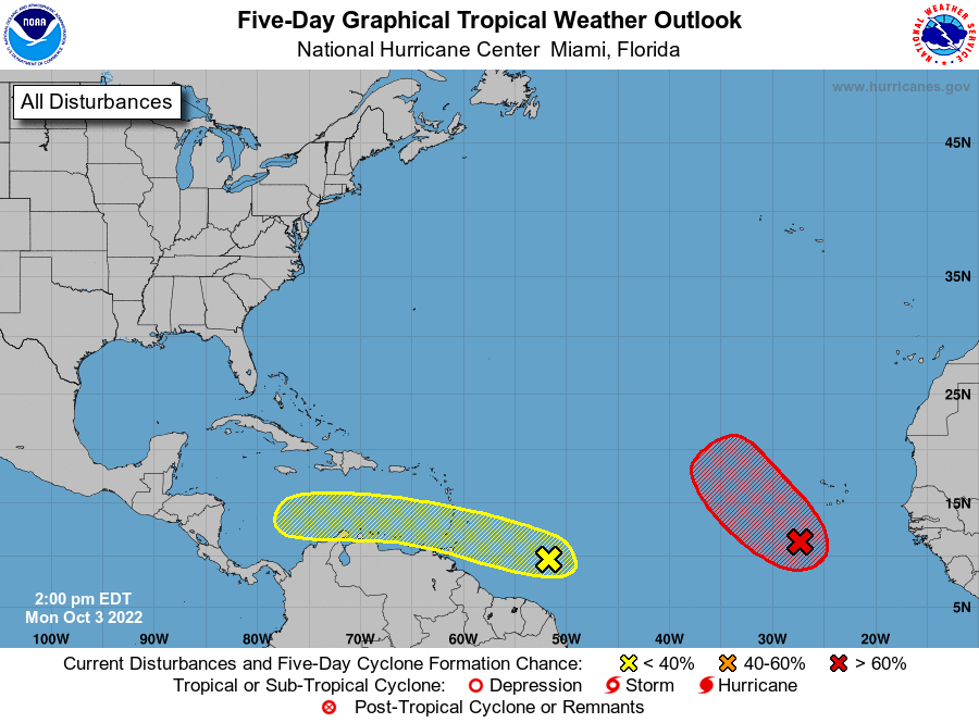
TROPICS: A tropical wave in the eastern Atlantic has a high chance of development over the next five days, but it will turn northward, and encounter unfavorable conditions by the weekend far from land.
Showers and thunderstorms associated with a tropical wave located several hundred miles east of the southern Windward Islands have changed little in organization during the last several hours. Slow development is possible during the next several days while the wavemoves generally westward at 15 to 20 mph, reaching the Windward Islands and the eastern Caribbean Sea by midweek. NHC has actually dropped the chance of development over the next five days is 30 percent; far too early to know the final destination or intensity… just something to watch for now.
ON THIS DATE IN 1964: Hurricane Hilda made landfall just southeast of Burns Point, Louisiana around 5 PM CT as a Category 2 hurricane with winds of 105 mph. The majority of deaths associated with Hilda in Louisiana were a result of tornadoes spawned by the hurricane in its outer peripheral rainbands and squall lines. Six tornadoes and two waterspouts occurred in Louisiana due to the hurricane. Despite tracking for only 1–1.5 mi near Larose, Louisiana, a violent F4 tornado killed 22 people and injured 165 others, destroying 35 homes in the process.
ON THIS DATE IN 1979: An F4 tornado struck the towns of Windsor, Windsor Locks, and Suffield in Connecticut, causing an estimated $400 million in property damage, on this day. The New England Air Museum, which housed more than 20 vintage aircraft, was destroyed. This tornado also caused a United Airlines flight to abort a landing at the Bradley International Airport because the pilot saw the tornado
BEACH FORECAST: Click here to see the AlabamaWx Beach Forecast Center page.
Look for the next Weather Briefing video here by 6:00 a.m. tomorrow…
Category: Alabama's Weather, ALL POSTS, Weather Xtreme Videos
About the Author (Author Profile)
James Spann is one of the most recognized and trusted television meteorologists in the industry. He holds the AMS CCM designation and television seals from the AMS and NWA. He is a past winner of the Broadcast Meteorologist of the Year from both professional organizations.Subscribe
If you enjoyed this article, subscribe to receive more just like it.


