Sunday Afternoon Update
Most parts of Alabama are cool and dreary on this Sunday afternoon.
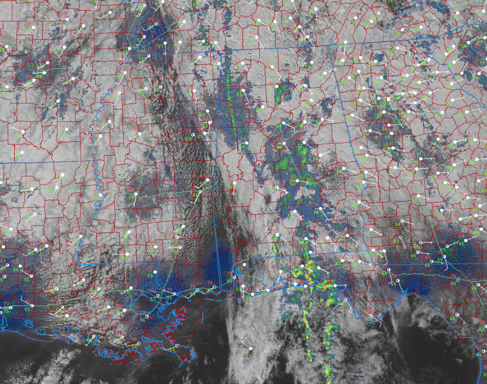
Patches of light rain are occurring in the I-65/US-331 Corridor between Birmingham, Montgomery, and Florala. Other patches are over western Alabama with a thin line of showers from Franklin and Colbert Counties south into Pickens and Tuscaloosa Counties.
Storms continue along the Gulf Coast, with the heaviest activity just passing through Sandestin, now crossing Choctawhatchee Bay and approaching the US-331 Bridge, extending out into the Gulf. Other cells are offshore off Laguna Beach and Panama City Beach. This activity is capable of waterspouts as it moves into the nearshore waters.
A dry slow is working into Southwest Alabama with some clearing now across Eastern Mississippi at Starkville and Meridiana and into Southwest Alabama at Mobile and Bay Minette. Some sunshine will reach Tuscaloosa, Demopolis, and Evergreen by sunset.
Temperatures are in the 60s areawide except in Southwest Alabama, where it is 76F in Mobile and 71F in Gulf Shores.
The clouds may hold pretty steady through the night and into tomorrow morning. Places that do clear late will probably cloud up again overnight. Clearing will slowly occur on Monday with clouds possibly continuing in spots through Tuesday. Highs on Monday will remain mostly in the 60s with a few 70s down south. 70s should return on Tuesday for the remainder of the week into the weekend. 50s will be the rule for lows all week.
Only 0.42 inches of rain has fallen from this system at the BHM airport. We will end the month behind in rainfall for October.
Category: ALL POSTS
About the Author (Author Profile)
Bill Murray is the President of The Weather Factory. He is the site's official weather historian and a weekend forecaster. He also anchors the site's severe weather coverage. Bill Murray is the proud holder of National Weather Association Digital Seal #0001 @wxhistorianSubscribe
If you enjoyed this article, subscribe to receive more just like it.


