Midday Nowcast: Warm Start to November
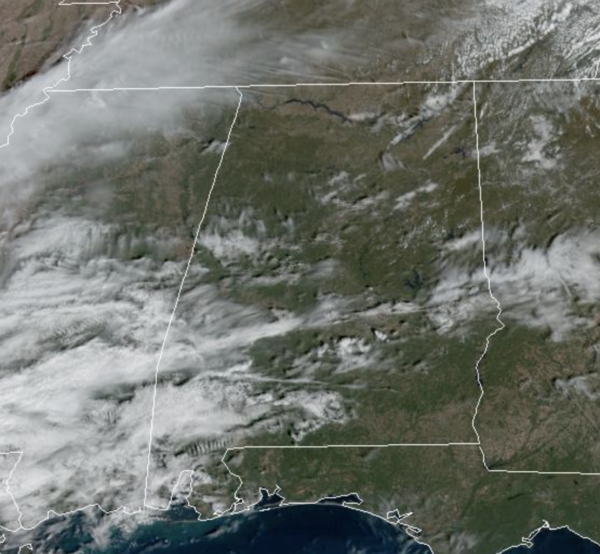
It was another foggy morning across North and Central Alabama, but this afternoon we are seeing more sun than clouds, with temperatures in the mid 70s. Tonight, a weak disturbance will swing through the state, it will bring more clouds, and it could squeeze out a few showers, but the air simply looks too dry for any meaningful rain.
REST OF WEEK: An upper ridge will build in, keeping us dry, and producing above average temperatures for early November. Highs again tomorrow will be in the mid 70s, followed by upper 70s Thursday and Friday. Nights will be fair and cool with 40s and 50s.
WARM WEEKEND WEATHER: The main storm track remains west of Alabama this weekend, meaning we stay dry and warm as the upper ridge remains in places. Expect a mainly sunny and dry day Saturday with highs near 80° both days. A few showers could reach the northwest corner of the state Sunday afternoon/night ahead of a cold front.
FALL BACK: Time changes this weekend as we fall back onto standard time. That will give us an extra hour of sleep Saturday night, but also mean sunset Sunday in Birmingham will be 4:50 PM CST.
NEXT WEEK: The upper ridge is expected to stay in place, which will deflect the main rain producers north and west of Alabama. Showers will be hard to find, and the weather stays mild with highs mostly in the 70s.
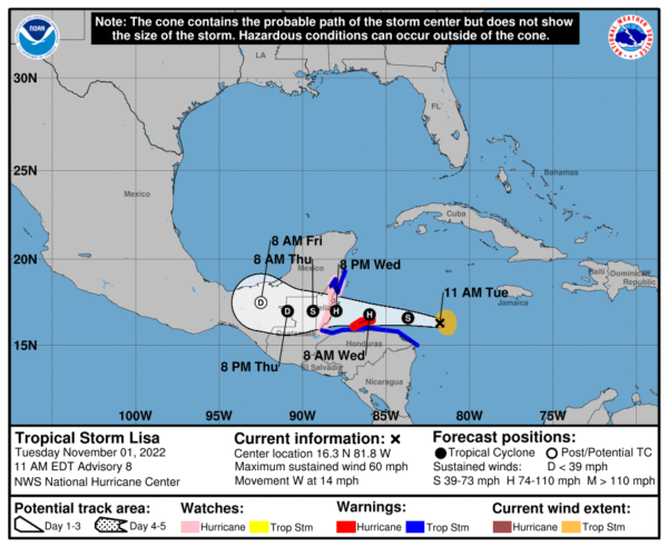
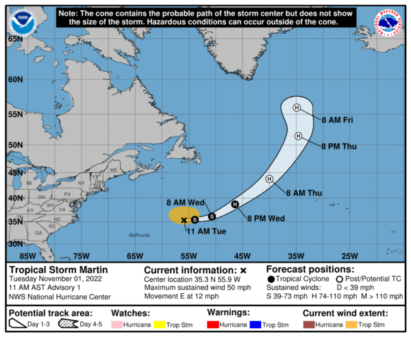
TROPICS: Lisa is gaining strength and will make landfall as hurricane in Belize late tomorrow night. While we now have Tropical Storm Martin which is in the North Atlantic and is no threat to land. Hurricane season ends November 30th.
BEACH FORECAST CENTER: Get the latest weather and rip current forecasts for the beaches from Fort Morgan to Panama City on our Beach Forecast Center page. There, you can select the forecast of the region that you are interested in visiting.
WORLD TEMPERATURE EXTREMES: Over the last 24 hours, the highest observation outside the U.S. was 111.4F at Ngukurr, Australia. The lowest observation was -70.2F at Vostok, Antarctica.
CONTIGUOUS TEMPERATURE EXTREMES: Over the last 24 hours, the highest observation was 94F at Sebring, FL. The lowest observation was 13F at Angle Fire, NM.
Category: Alabama's Weather, ALL POSTS
About the Author (Author Profile)
Macon, Georgia Television Chief Meteorologist, Birmingham native, and long time Contributor on AlabamaWX. Stormchaser. I did not choose Weather, it chose Me. College Football Fanatic. @Ryan_StinnetSubscribe
If you enjoyed this article, subscribe to receive more just like it.


