Windy, Wet Weather For East Alabama Tomorrow Night/Friday Morning
FINE FALL DAY: With a good supply of sunshine, temperatures are in the 70-75 degree range across most of Alabama this afternoon… tonight will be mostly fair with a low in the 50s.
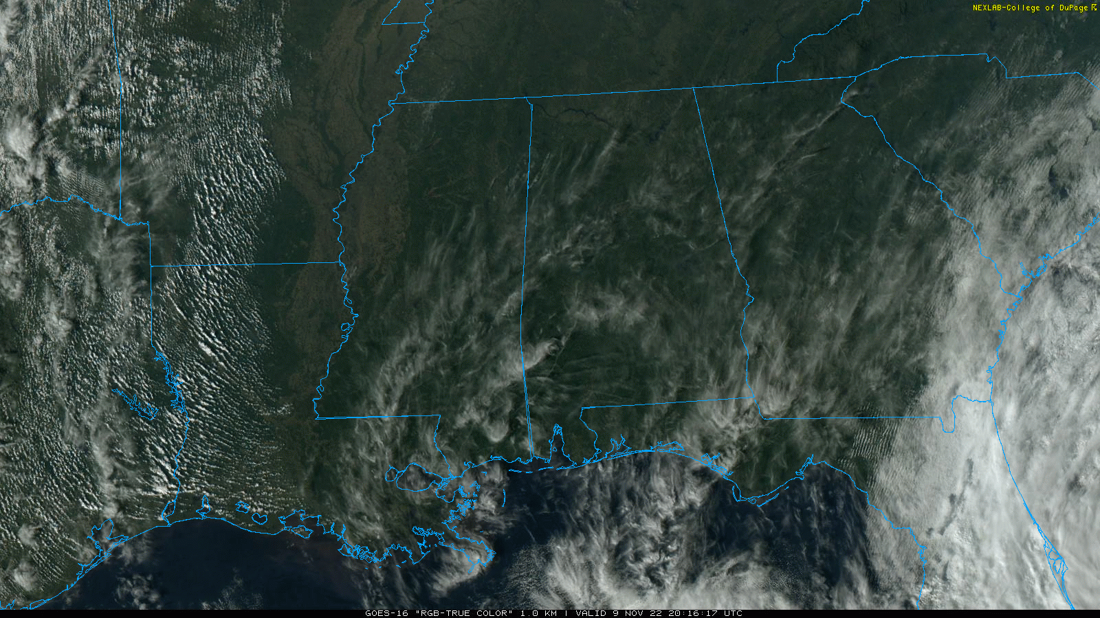
Clouds will increase during the day tomorrow, and rain will move into the eastern half of the state tomorrow night as Tropical Storm Nicole passes through Georgia. The best chance of rain will be along and east of I-65, and the heavier rain totals (1-2″) will be along and east of U.S. 431 (the far eastern part of the state). West Alabama will see little rain from the system.
Winds could gust to 40/50 mph over the southeast corner of the state tomorrow evening (places like Dothan and Ozark)… for the rest of East Alabama gusts of 30/40 mph are possible tomorrow night into early Friday. Winds will be much lighter over the western half of Alabama.
Rain over East Alabama will end from the south Friday morning, and most of the state will be dry by afternoon with lingering clouds. Otherwise, Friday will be a breezy, cool day with a high in the mid to upper 60s.
COLD WEEKEND: The coldest air so far this season will roll into the state over the weekend, with highs dropping into the 50s. Temperatures go into the sub-freezing range early Sunday, with a low in the 26-32 degree range over the northern half of the state. Saturday will feature a partly sunny sky with a gusty north wind, and Sunday will be a sunny day.
NEXT WEEK: Another freeze is likely early Monday morning.. the day will be dry with a high in the 50s Monday afternoon. Clouds increase late in the day, and rain is likely at times late Monday night into Tuesday. Then, the weather looks dry Wednesday through Friday with temperatures remaining below average.. highs in the 50s and lows in the 30s and 40s. See the daily Weather Briefing video for maps, graphics, and more details.

EYES ON NICOLE: Tropical Storm Nicole, with winds of 70 mph, is about 135 miles east of West Palm Beach, Florida early this morning. This system is moving through the northern Bahamas now, and, landfall comes late tonight along the Atlantic coast of Florida, either as an upper end tropical storm or minimal hurricane. A hurricane warning remains in effect from Boca Raton to the Flagler/Volusia County line.
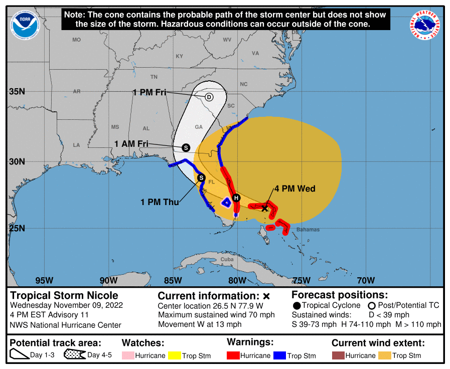
Hurricane conditions are expected across portions of the coast of southeast and east-central Florida beginning this evening or tonight, where the Hurricane Warning is in effect. Tropical storm conditions will continue along the east coast of Florida, Georgia, and South Carolina within the warning areas into Thursday. Tropical storm conditions are expected to begin along the west coast of Florida within the warning area this evening or tonight.
A dangerous storm surge is expected along much of the east coast of Florida, portions of coastal Georgia, and the Florida Big Bend along the Gulf coast. The storm surge will be accompanied by large and damaging waves along the Atlantic coast. Residents in the warning area should listen to advice given by local officials. Do not focus on the exact track of Nicole since it is a large storm with hazards extending well to the north of the center, outside of the forecast cone. These hazards will affect much of the Florida peninsula and portions of the southeast United States.
Nicole will produce heavy rainfall today into Thursday across the Florida Peninsula. Flash and urban flooding will be possible across portions of the Florida Peninsula along with renewed river rises on the St. Johns River. Isolated flash, urban, and small stream flooding will also be possible on Friday in the Southeast through the southern and central Appalachians, including the Blue Ridge Mountains, and extending northward through west central Pennsylvania into western New York by Friday night.
FOOTBALL WEATHER: The weather will be dry for the high school playoff games Friday night across Alabama, but it will be mostly cloudy and breezy with temperatures falling into the 50s.
Saturday, Alabama travels to Oxford to take on Ole Miss (2:30p CT kickoff)… the sky will be mostly sunny with temperatures in the mid to upper 40s along with a brisk, chilly north wind.
UAB will host North Texas at Protective Stadium in downtown Birmingham Saturday (2:30p CT kickoff)… the sky will be partly sunny with a kickoff temperature around 52 degrees, falling into the 40s by the final whistle.
Auburn hosts Texas A&M Saturday evening at Jordan-hare Stadium (6:30p CT kickoff). The sky will be clear with temperatures falling from near 47 at kickoff, into the low 40s by the final whistle.
ON THIS DATE IN 1926: An estimated F3 to F4 tornado tore through La Plata, Maryland, killing 14 individuals at a small school. This storm caused 17 deaths and injured 65 others.
BEACH FORECAST: Click here to see the AlabamaWx Beach Forecast Center page.
Look for the next Weather Briefing video here by 6:00 a.m. tomorrow…
Category: Alabama's Weather, ALL POSTS, Weather Xtreme Videos
About the Author (Author Profile)
James Spann is one of the most recognized and trusted television meteorologists in the industry. He holds the AMS CCM designation and television seals from the AMS and NWA. He is a past winner of the Broadcast Meteorologist of the Year from both professional organizations.Subscribe
If you enjoyed this article, subscribe to receive more just like it.


