Warmer Pattern; Showers Over North Alabama This Morning
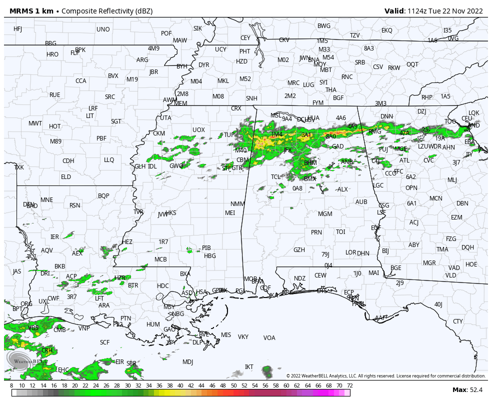
RADAR CHECK: A band of showers is moving across North Alabama early this morning; this rain should be out of the state by mid-morning. Then, the sky becomes partly sunny this afternoon with a high in the 58-62 degree range. The average high for Birmingham on November 22 is 63.
REST OF THE WEEK: Tomorrow will be a dry and mild day with a high in the mid to upper 60s as the warming trend continues. Then, on Thanksgiving Day, clouds will increase, and some rain could move into the western counties of the state by mid to late afternoon. Rain is more likely statewide Thursday night. Expect a high Thursday in the 67-72 degree range, 5-10 degrees above average.
Friday looks like a fairly wet day with periods of rain and possibly a thunderstorm. No risk of severe storms, and it won’t rain all day. Friday’s high will be in the mid 60s.
THE WEEKEND: Forecast confidence Saturday remains low due to model madness (inconsistency). An upper low to the west in the southern branch of the jet stream will keep rain over the state for at least a part of the day. The reliable European model continues to trend slower, suggesting rain could linger much of the day Saturday. Like Friday, some thunder is possible, but for now we don’t expect any severe storms. Saturday’s high will be in the mid 60s, and the rain will end Saturday night.
Sunday will be dry and pleasant with a high in the 63-67 degree range.
NEXT WEEK: An upper ridge will build across the Gulf Coast, meaning much of the week will be mild and dry with highs in the 60s. We do note the European global model continues to hint at a round of rain Wednesday. No sign of freezing temperatures for at least the next 10 days… See the daily Weather Briefing video for maps, graphics, and more details.
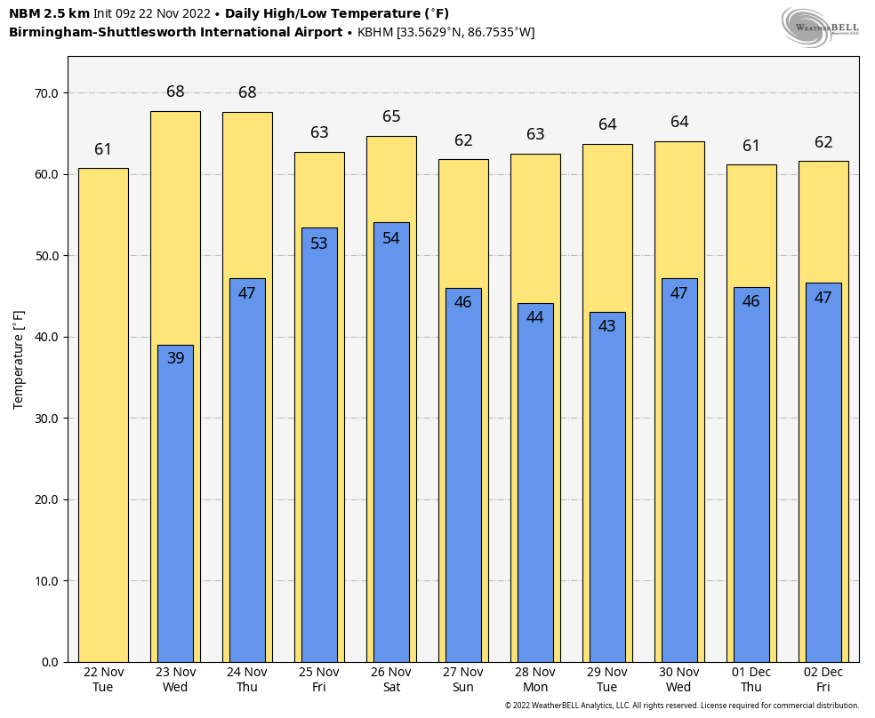
IRON BOWL: For Saturday’s big game (Auburn at Alabama, 2:30p CT kickoff in Tuscaloosa), we are going to need to introduce a chance of rain during the game with temperatures generally in the low 60s. This remains a low confidence forecast; we will have much better clarity as we get closer to the weekend. But, for now plan on taking the rain gear. Rain is also likely Saturday morning in Tuscaloosa.
TROPICS: All remains quiet, and tropical storm formation is very unlikely for the rest of the month. The hurricane season ends in 8 days.
ON THIS DATE IN 1992: A total of 45 tornadoes touched down in the Tennessee and Ohio Valleys. Georgia was hard hit with two F4, one F3 and three F2 tornadoes that killed six people and injured 144. Indiana had a total of 15 tornadoes on this day to set a record for an outbreak in November and for the month of November. One, an F4 multiple-vortex type, cut a 22-mile path through extreme southeastern Indiana and northern Kentucky. This tornado debunked the myth that twisters don’t cross rivers, as this devastating tornado crossed the Ohio River twice. Indiana had a total of 15 tornadoes on this day to set two state records, the largest November tornado outbreak, and the most tornadoes in November. This tornado outbreak made a significant contribution to what was to become the biggest November ever for the U.S. concerning the number of tornadoes.
Alabama had a total of 13 tornadoes touch down ranging in strength from F0 to F2, with no deaths and 53 injuries. The tornado with the most injuries occurred just outside of Sardis City where multiple structures were damaged and twelve people were injured.
BEACH FORECAST: Click here to see the AlabamaWx Beach Forecast Center page.
Look for the next Weather Briefing video here by 3:00 this afternoon… enjoy the day!
Category: Alabama's Weather, ALL POSTS, Weather Xtreme Videos
About the Author (Author Profile)
James Spann is one of the most recognized and trusted television meteorologists in the industry. He holds the AMS CCM designation and television seals from the AMS and NWA. He is a past winner of the Broadcast Meteorologist of the Year from both professional organizations.Subscribe
If you enjoyed this article, subscribe to receive more just like it.


