Tornado Watch Issued for Several Counties in the Western Part of Central Alabama Until 11 pm
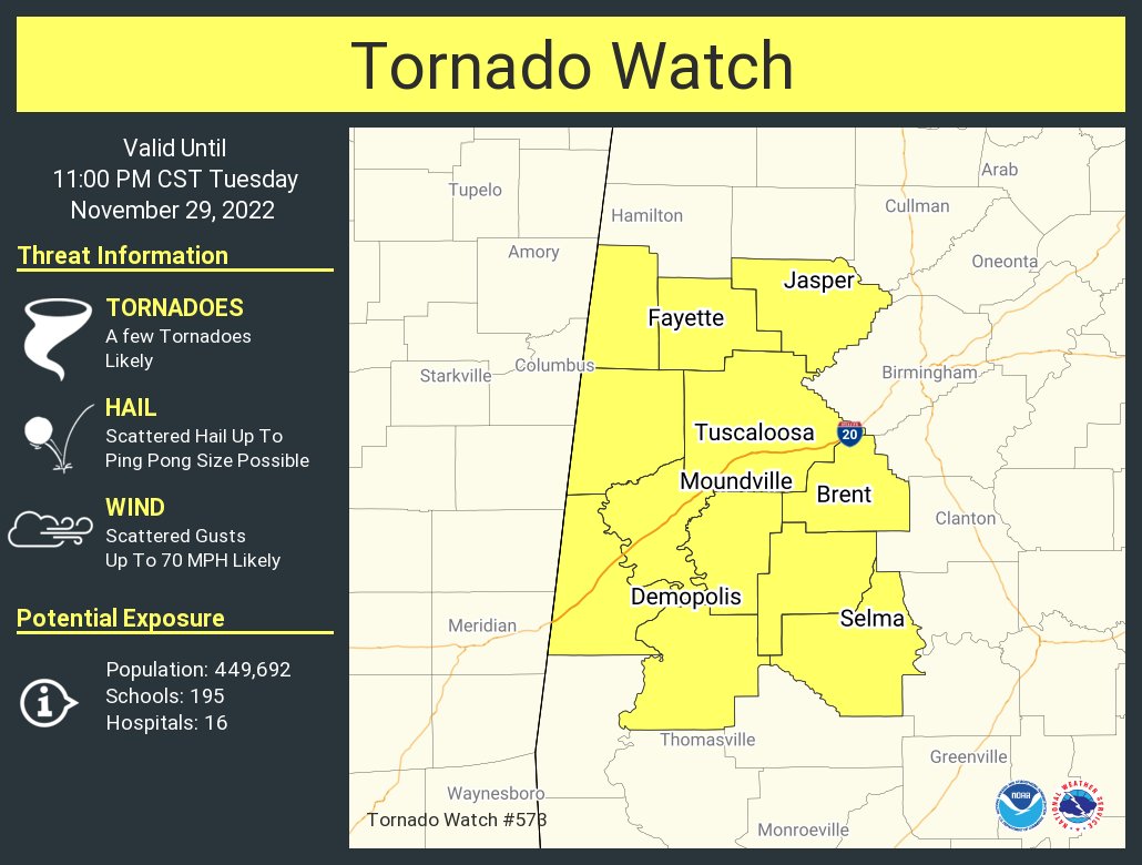
The Storm Prediction Center and NWS Birmingham have issued a TORNADO WATCH effective immediately for the following counties in Central Alabama: Bibb, Dallas, Fayette, Greene, Hale, Lamar, Marengo, Perry, Pickens, Sumter, Tuscaloosa, and Walker. The Tornado Watch is set to expire at 11 pm tonight.
In the watch area, a few tornadoes are likely, along with scattered hail up to ping pong size possible, and scattered damaging wind gusts up to 70 mph likely.
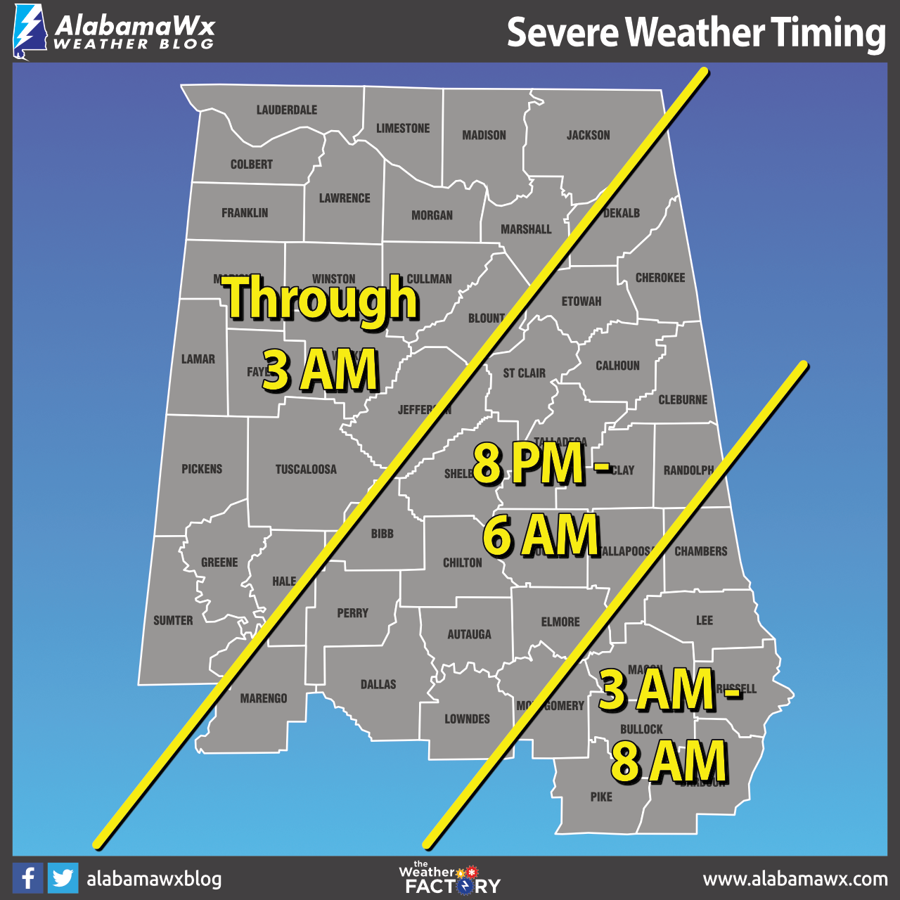
Here is the updated timing graphic on the threat of severe storms. For the western section (from roughly Demopolis to Birmingham to Henagar), timing will be from now through 3 am Wednesday morning. For the middle section (east of the first section to a line from roughly Fort Deposit to roughly Roanoke), timing will be from 8 pm tonight through 6 am Wednesday. For the southeastern section, timing will be from 3 am through 8 am Wednesday morning.
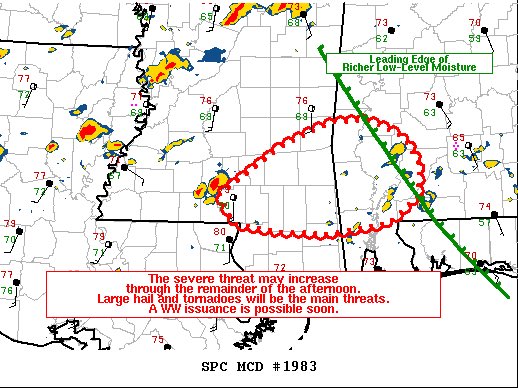
The latest Mesoscale Discussion just released mentions that a Tornado Watch will be issued shortly for the southwestern parts of Alabama. However, NWS Huntsville is not ready to issue a watch at this point, even though earlier rain and storms over North Alabama is not keeping the higher dewpoints for moving into their area.
Category: Alabama's Weather, ALL POSTS, Severe Weather
About the Author (Author Profile)
Scott Martin is an operational meteorologist, professional graphic artist, musician, husband, and father. Not only is Scott a member of the National Weather Association, but he is also the Central Alabama Chapter of the NWA president. Scott is also the co-founder of Racecast Weather, which provides forecasts for many racing series across the USA. He also supplies forecasts for the BassMaster Elite Series events including the BassMaster Classic.Subscribe
If you enjoyed this article, subscribe to receive more just like it.


