Christmas Cold Wave – Sunday Morning Update
CHRISTMAS COLD WAVE: A bitterly cold, Arctic airmass will invade the Deep South Thursday night, and will persist through the Christmas weekend. Here are some important points as of Sunday morning:
*Ahead of the Arctic front, some light rain is possible late Thursday afternoon. As cold air rushes into the state, the rain will likely change to light snow or snow flurries over North Alabama Thursday night and very early Friday morning.
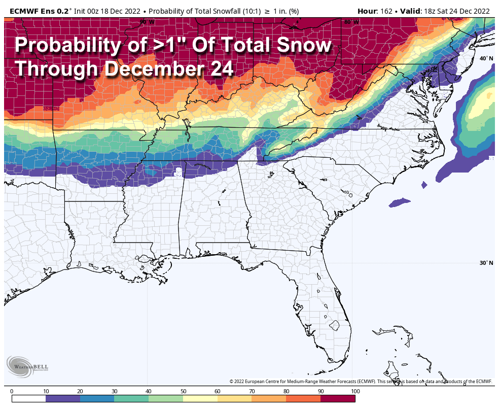
*This is a “cold air chasing the moisture” setup, which rarely produces meaningful snow accumulation here. Using the reliable European global model ensemble mean, the probability of getting 1 inch of snow across North Alabama Thursday night for now is only 10-20 percent for areas along and north of the Tennessee River.
*The chance of seeing a few snow flakes over the northern third of the state late Thursday night and Friday morning is fairly high, but the chance of accumulation is pretty low.
*The focus needs to be on the cold air. Temperatures could reach the single digits across parts of North Alabama by Friday morning, and temperatures will remain below freezing all day across much of the state. The wind chill index will be below zero most of the day Friday over the northern counties.
*Many places will go at least 48 consecutive hours below freezing… some over 72 hours. The high Saturday will be in the 25-32 degree range, and between 30 and 36 degrees on Christmas Day.
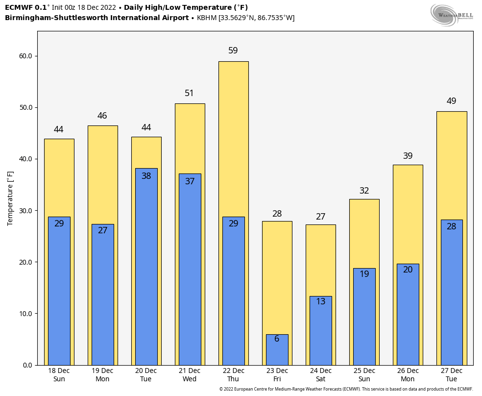
*The Arctic airmass Saturday and Sunday will be very dry; the sky will be mostly sunny on Christmas Day.
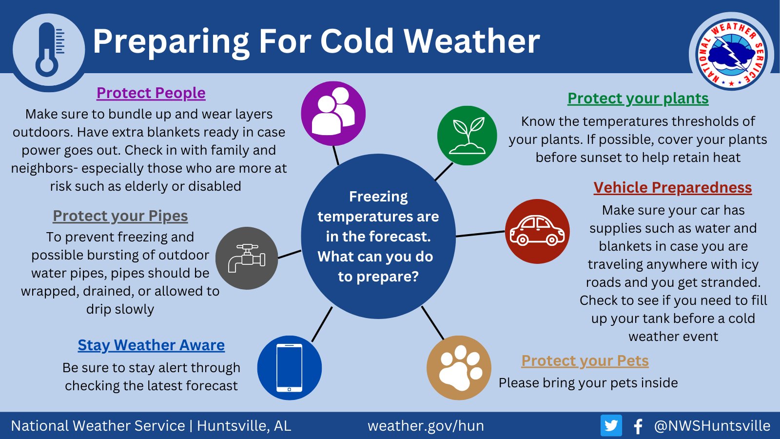
*Cold waves like this are a serious threat to people with no adequate heating source. Be very, very careful with space heaters. Plan on bringing your pets indoors. Exposed pipes will need to be wrapped with insulation. Learn how to shut off water valves for potential pipe bursts.
*Please don’t share the outrageous ”model snow maps” from rogue Facebook accounts like “Uncle Joe’s Tot Locker and Weather Page”. While some do it for fun, others do it maliciously, knowing we will have to spend lots of time we don’t have answering the “Is is true” questions. Think before you share!
*From a historical perspective, the last time temperatures reached the single digits in Birmingham during the month of December was in 1989… we dropped to 1 degree on December 23 during the peak of the cold wave. We have achieved single lows during the month of December in eight years since 1900; in 1901, 1917, 1925, 1926, 1962, 1981, 1983, and 1989.
We might not reach the single digits this year, but it will be a very close call.
Category: Alabama's Weather, ALL POSTS
About the Author (Author Profile)
James Spann is one of the most recognized and trusted television meteorologists in the industry. He holds the AMS CCM designation and television seals from the AMS and NWA. He is a past winner of the Broadcast Meteorologist of the Year from both professional organizations.Subscribe
If you enjoyed this article, subscribe to receive more just like it.


